The US Voted Against the New World Map: What Does Africa’s True Size Have to Do With Power?
The US voted against the UN’s new Equal Earth map. What does Africa’s true size and centuries of map distortion have to do with global power?
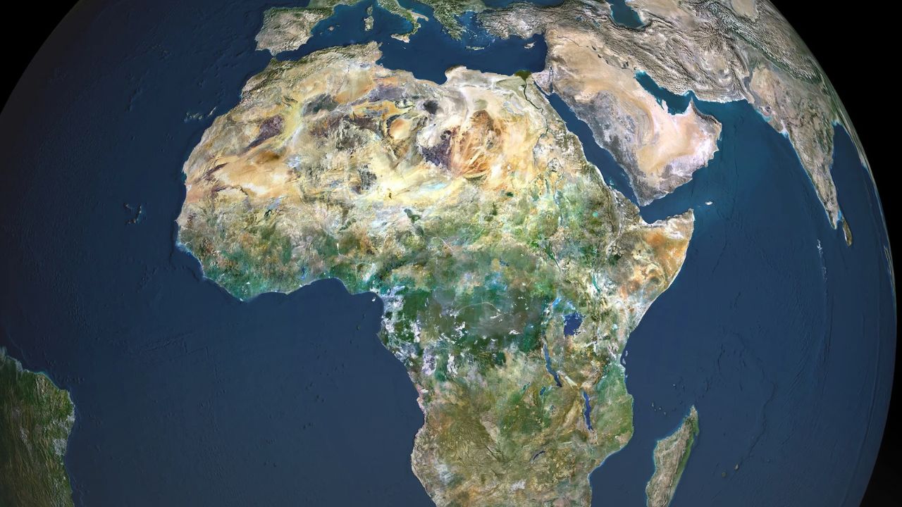
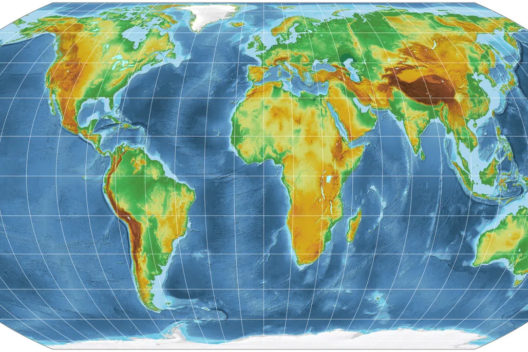
The United Nations General Assembly has voted 164 to 1 to endorse the Equal Earth map projection, a cartographic model that finally shows Africa at its real size. Only the United States rejected the resolution, calling it a "radical ideological project." Six countries were absent and the rest said yes.
That single American vote against a map might sound trivial but it is not. It sits at the center of an older argument about who gets to look big on paper, who gets to look small, and what that has quietly done to global power for five centuries.
What the Equal Earth Map Resolution Actually Changed
The resolution, titled "Correct the Map" and sponsored by Togo with the backing from the African Union, does not outrightly ban Mercator. It encourages governments, schools, media houses, and tech platforms to replace it with the Equal Earth projection.
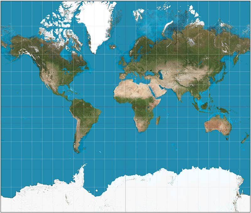
The Equal Earth projection is a 2018 model built to represent every landmass in true proportion to its actual area.
Under Mercator, the 16th-century projection still hanging in most classrooms today, Africa appears roughly the same size as Greenland. In reality, Africa is about 14 times larger.
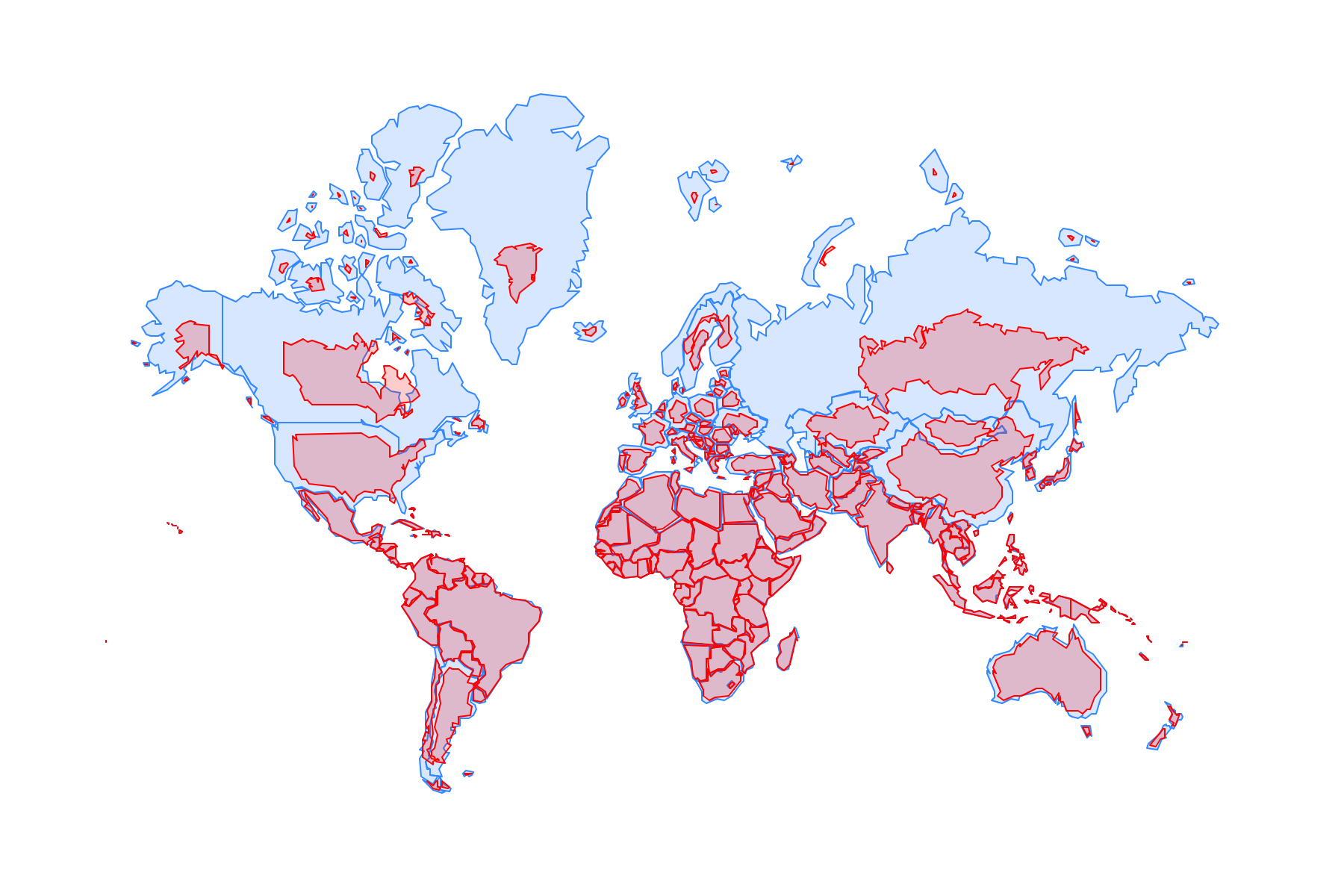
Africa is large enough to contain the United States, China, India, most of Europe, and Japan combined, with room left. None of that lass mass has ever been visible on the map billions of people grew up trusting.
France has already announced it will drop Mercator for its government maps, thereby aligning with the broader push led by the African Union. Advocacy groups like Africa No Filter and Speak Up Africa, who led the "Correct the Map" campaign, want Equal Earth adopted in classrooms, newsrooms, and digital platforms worldwide, not just inside UN buildings.
They are simply saying that if the map used to teach geography is wrong, everything built on that lesson inherits the same distortion.
Why the US Voted Against the Africa Map Resolution
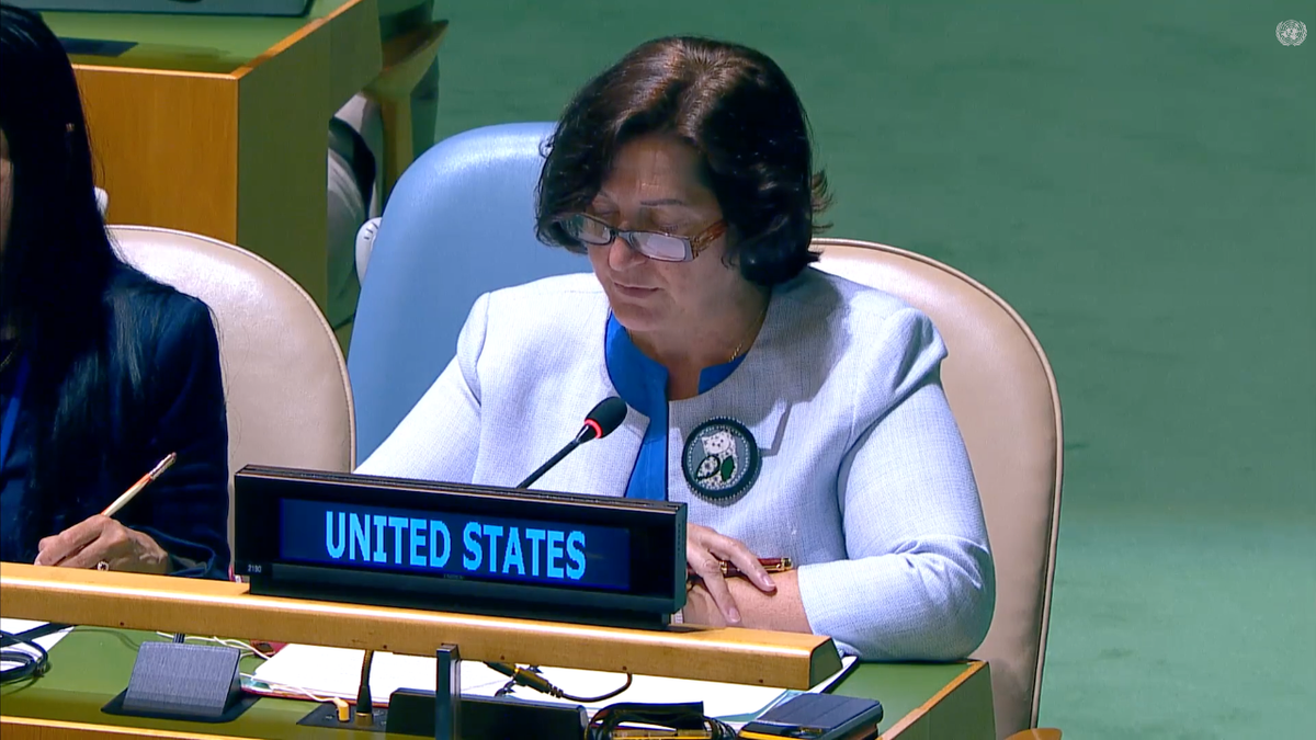
Deputy US representative, Yaryna Ferencevych, argued that what was framed as a technical correction was part of a larger ideological project tied to reparations and "cognitive justice" language embedded in the resolution's text. She called it a distraction that undermines the UN's credibility.
Stripping away the diplomatic jargon, a pattern emerges. The US was comfortable admitting the map is inaccurate. It was not comfortable admitting why that inaccuracy survived for 500 years, or what correcting it might symbolically hand back to the countries it shrank.
Every map is a political document before it becomes a geographic one. Mercator built his projection for European sailors navigating colonial trade routes and for continents to be represented fairly.
That is the choice that trained generations to see Europe and North America as dominant and the equatorial world as marginal.
Not the First Time: The US and the Slave Trade Resolution
Months earlier, the US was one of three countries, alongside Israel and Argentina, to vote against a separate UN resolution calling the transatlantic slave trade the "gravest crime against humanity."
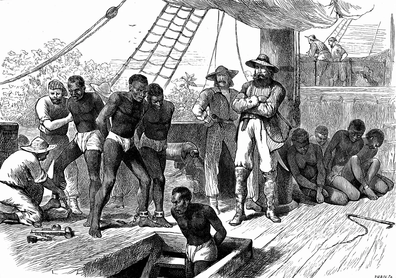
The resolution, introduced by the Ghanaian President, John Mahama, passed with 123 to 3. 52 countries, including the UK and every EU member state, chose to abstain rather than oppose it.
The US objection centered on the resolution's call for reparations and its restitution demands for cultural artifacts taken from African nations.
A deputy US ambassador argued that ranking crimes against humanity diminished other atrocities, and that reparations could not apply to acts not illegal under international law when they occurred.

Placed side by side, the two votes now form a pattern. One resolution asked the US to acknowledge historical harm in words. The other asked it to accept an accurate picture of the continent that harm was inflicted on. And both times, it said no.
How Map Size Shapes Perceptions of Power
Cartography has always doubled as propaganda. A map is the first geography lesson most people ever get, often before they can read about the countries it depicts.
When a child opens an atlas and sees Africa squeezed into the same visual footprint as Greenland, a population of roughly 1.5 billion people gets pushed into the "small" category before a single fact about the continent is taught.
That visual hierarchy has consequences that go beyond the classroom and into the real-world. Investors read scale as significance, policymakers read scale as relevance, and media coverage mirrors the same pattern of treating a continent of 54 nations as one undifferentiated land cut-out while covering individual European countries with far more context.
Greenland's outsized appearance on Mercator maps is not neutral either. An autonomous Danish territory with roughly 56,000 residents has spent centuries looking cartographically comparable to a continent it could fit into 14 times over.
This has continually flattered the global north and diminished the global south before any policy debate or trade agreement even begins.
The Politics Behind Africa's True Size on World Maps
The African Union's push for the Equal Earth map is framed as reclaiming narrative control. AU Commission deputy chairperson, Selma Malika Haddadi, has pointed out that the Mercator distortion helped foster a false impression that Africa was marginal, despite the continent's actual scale and population.
That impression has shaped how the world negotiates with African nations, funds them, and reports on them.
This is why the US vote reads as more than administrative caution. A country that has benefited from appearing large on the world's dominant map projection is now the lone holdout against a correction that makes it look smaller relative to the equator.
This is touching the same instinct that built empires on cartography in the first place.
What Comes Next for the Correct the Map Campaign
The resolution is not binding. No government is forced to review its textbooks overnight. Its power lies in the platforms it may eventually influence.
The real test is whether Equal Earth reaches the places Mercator has occupied unchallenged for centuries: classrooms, atlases, weather graphics, and tech company map defaults. Search engines, navigation apps, and news broadcasts still lean on Mercator-style proportions, which means the correction has to spread far beyond one resolution to matter.
A single accurate line on a map cannot undo five hundred years of skewed perception, but it removes one more excuse for keeping that perception alive.
The US vote against it confirmed how much some are still invested in the old picture, and how uncomfortable an honest map can be for anyone who benefited from the inaccurate one.