Today will be a great day to take a dip in the pool for people in the Pittsburgh area - CBS Pittsburgh
/ CBS Pittsburgh
KDKA-TV Morning Forecast (7/15)
If you live in the Pittsburgh area and are wondering when the best days to jump into the pool are, today and Saturday are your best opportunities this week.
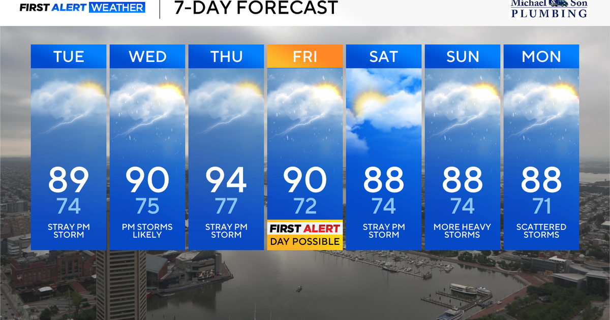
There are some potential First Alert Weather Days over the next 7 days. I can't rule out Wednesday due to downpours leading to potential flash flooding. Next Monday also looks like a severe weather set-up
Fueled by warm mornings, our average temperature for the first two weeks of the month are running above normal by 3.5°.
Both today and Saturday will see little to no rain. Highs today should hit the upper 80s with sunny skies through the early afternoon and then high clouds leading to filtered sunshine for the rest of the day.
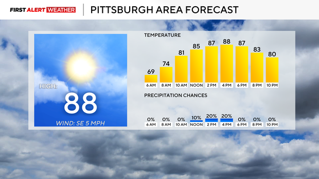
Even with the clouds in place, you're going to want to apply sunblock. I have our noon temperature in the mid-80s. Morning temperatures dipped to the upper 60s in most places. There was some fairly thick fog around this morning too.
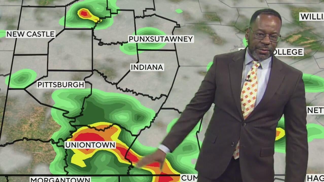
Today's reprieve from the rain won't extend into Wednesday with rain arriving before noon, and the chance for rain and storms with some potential big rain totals sticking around for the rest of the day. As of 4a we are not included under the severe outlook for Wednesday, but I think that will change at some point today. Right now model data has jumped on a mid level low that is on the northern edge of a ridge of high pressure entrenched in the Northern Gulf of Mexico. This low will slide through here tomorrow, and with the heat and humidity in place should set off a series of storms through the late morning, afternoon and early evening. Frequent lightning along with windy conditions will be possible around any storms. Flash flooding will also be possible with any 'training' storms. Training just means one spot sees a series of storms in rapid succession. No one storm dumps enough rain in a spot to set off a flash flood warning, but the sum of all the storms is enough to hit the threshold. Right now, our flash flood criteria for tomorrow will be around 1.25" of rain in an hour or 1.5" of rain in a 3-6 hour time period.
Rain chances will stick around on Thursday and Friday morning. Friday afternoon and Saturday are looking comfy and dry. I have Wednesday highs in the mid-80s. Expect upper 80s for highs ahead of the storms on Thursday before we get some relief from heat and humidity with highs in the low 80s on Friday and the mid 80s on Saturday.
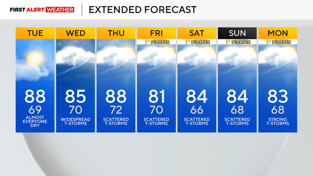
Another round of rain is expected Sunday through Tuesday of next week with a severe weather set-up appearing due to high wind speeds on Tuesday. We are still several days out from that though so we will see if the severe chance remains in place.
Current Conditions | School Closings & Delays | Submit Your Weather Photos
Arriving to KDKA in June 2015, Ron Smiley has been giving a local and hopefully bright outlook on the day in Pittsburgh and Western Pennsylvania.