Warm, muggy weather in Maryland Tuesday - CBS Baltimore
/ CBS Baltimore
CBS News Live
Maryland will experience warm and muggy weather on Tuesday, following powerful storms on Monday evening. More storms are possible Wednesday.
Humidity levels will remain at the top of the scale today, but we're looking at drier weather compared to Monday. Any storms this afternoon should be rather sparse and they won't have the momentum of Monday's storms.
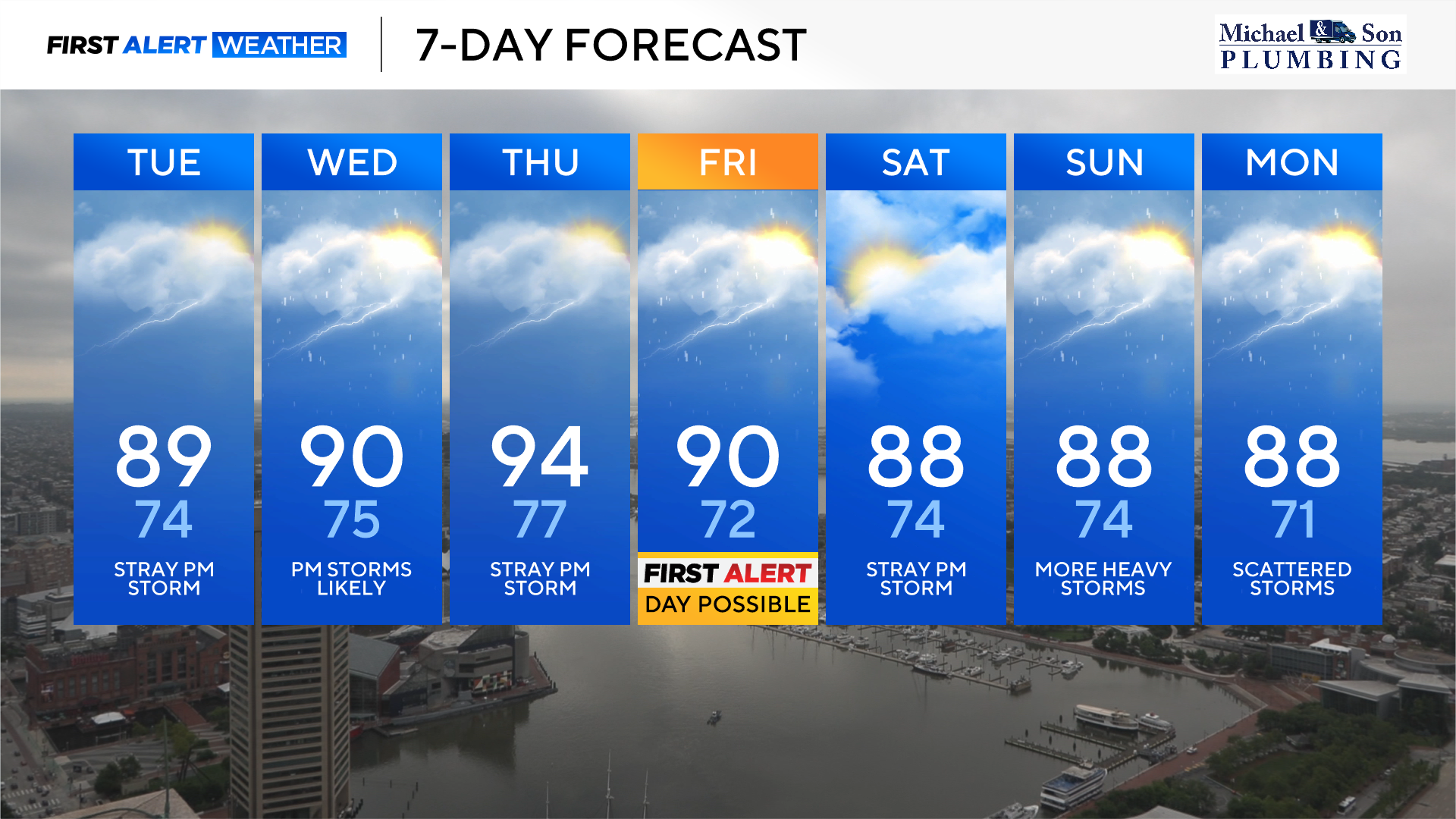
Most of us will see a partly sunny sky along with plenty of heat and humidity. High temperatures will reach the middle to upper 80s, but feels like temperatures will top out in the middle to upper 90s. The UV index today will be 10, so apply sunscreen generously and wear sun protection.
Wednesday will also feature a good deal of heat and humidity. High temperatures will climb close to 90°. Feels like temperatures will climb close to 100°. The weather looks quiet Wednesday morning, so if you have any outdoor work or activities, you'll want to get them done earlier in the day.
Wednesday afternoon and evening could turn busy as clusters of showers and heavy thunderstorms form as a disturbance approaches from the west. Similar to Monday, multiple batches of storms may form along the Bay breeze boundary, combined with the disturbance approaching from the west. Since the air will be so muggy, any storm could bring torrential downpours and pockets of flooding.
Right now, the WJZ First Alert Weather Team has not issued an Alert Day for Wednesday, but if new information trends stormier, we'll potentially need to issue one.
Thursday will be the hottest day of the upcoming week with high temperatures climbing into the mid-90s. Factor in the very high levels of humidity and heat index values will climb to values between 100° and 105°. The city of Baltimore will likely need to open some cooling centers due to this extreme heat.
Unlike Wednesday, thunderstorms will be the exception and not the rule. Thursday looks mainly dry.
Friday will be another hot day with high temperatures climbing close to 90°. A slow-moving cold front will approach Friday afternoon and evening, sparking off clusters of strong to possibly severe storms.
The weather team has tagged Friday as a possible First Alert Weather Day for the potential of severe storms with damaging winds and flooding downpours. The timeline of the strongest storms looks like 2 p.m. until 10 p.m.
Saturday will be the better outdoor weather day this weekend across Maryland. Humidity levels will be slightly lower with dry weather expected. Most of the state should see partly to mostly sunny skies with highs in the upper 80s. The only exception may be southern Maryland with a few isolated storms.
Sunday will also be hot and muggy, but thunderstorms become a concern later in the day into the evening. Given the tropical humidity, we'll need to monitor these storms for the threat of torrential downpours, lightning, and gusty winds.