Thousands without power after tornado warnings issued in Twin Cities overnight - CBS Minnesota
By
Riley Moser
Digital Producer, CBS Minnesota
Riley Moser is a digital producer who covers breaking news and feature stories for CBS Minnesota. Riley started her career at CBS Minnesota in June 2022 and earned an honorable mention for sports writing from the Iowa College Media Association the same year.
/ CBS Minnesota
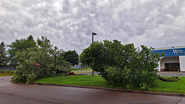
See the damage severe storms left throughout Minnesota overnight
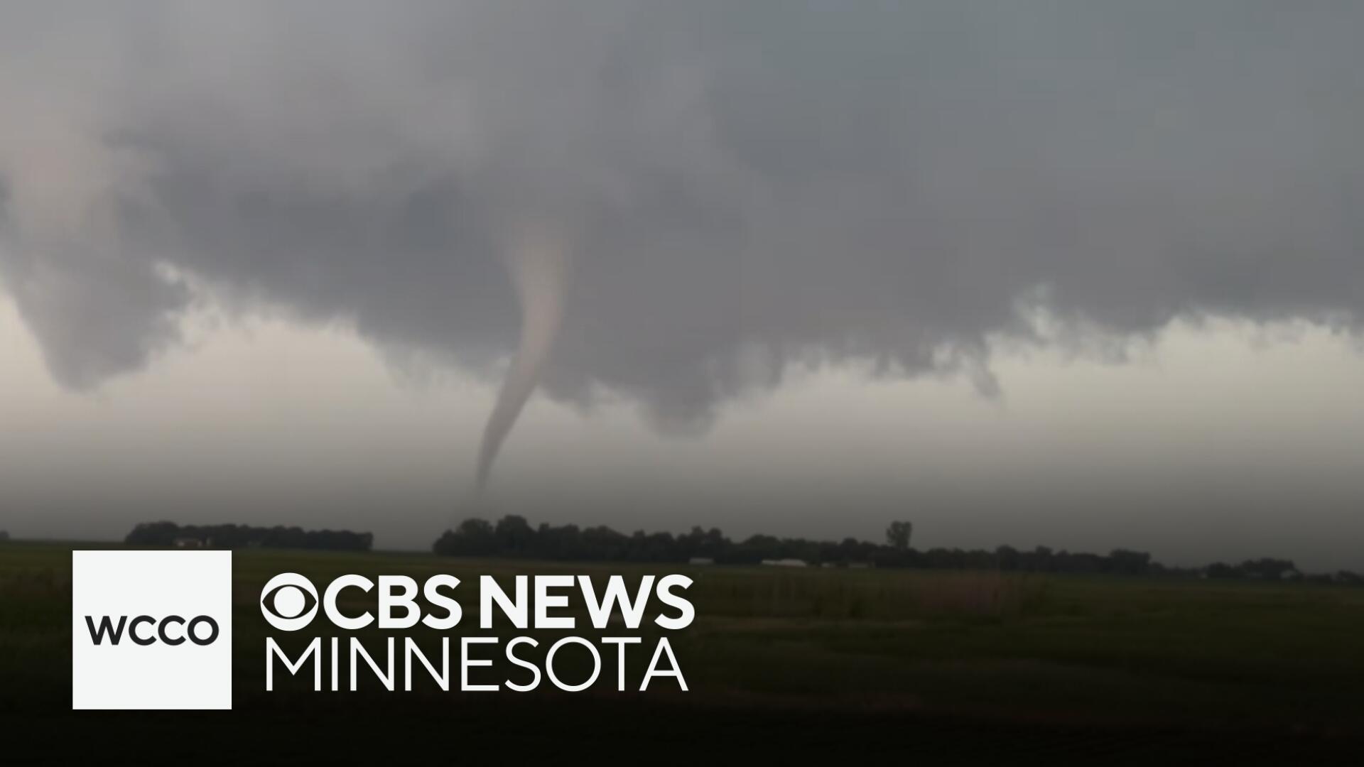
The National Weather Service confirmed at least two tornadoes touched down in the southwestern Twin Cities metro overnight into Sunday.
One tornado was near Lake Zumbra in the northeastern part of Carver County. It has a preliminary rating of EF-1 with winds of 80-90 mph reported, according to the NWS. A second tornado tracked along the north side of Lake Waconia toward Parley Lake, also in Carver County. That tornado also has a preliminary rating of EF-1, with winds between 85 to 95 mph.
The NWS also suspects there were at least one or two tornadoes near Cologne and has sent a team to investigate the area.
Many families across the metro and western Minnesota are spending their Sunday cleaning up after the storms.
Over 14,000 Xcel Energy customers are without power in the Twin Cities as of 12:20 p.m., according to the company's outage map. That's down from about 50,000 customers without power earlier in the morning. Xcel Energy says its crews are working as quickly and safely as possible to restore power.
Several trees came down on Highway 7 in the southwestern metro, blocking traffic in both directions for several hours. Power lines were also downed in the storm. The highway has since reopened.
The Swift County Sheriff's Office in west-central Minnesota reported a tornado touchdown five miles east of Halloway just before 8 p.m. on Saturday.
The Twin Cities National Weather Service issued the first tornado warning for the Twin Cities shortly after midnight Sunday that included cities such as Chanhassen, Waconia and Mound in the western metro.
Another tornado warning was issued for parts of Minneapolis and the south and western metro around 12:30 a.m. The NWS allowed that warning to expire at 1 a.m.
Many metro cities reported nearly an inch or more of rain falling overnight. More than 2 inches of rain fell in Elk River and Minneapolis received nearly 1.5 inches.
There's another chance for severe weather Sunday night, with the Twin Cities under a marginal risk (1 out of 5) and southeastern Minnesota under a slight risk (2 out of 5). Damaging winds and hail are the main threats, but isolated tornadoes are also possible.
Riley Moser is a digital producer who covers breaking news and feature stories for CBS Minnesota. Riley started her career at CBS Minnesota in June 2022 and earned an honorable mention for sports writing from the Iowa College Media Association the same year.