The Mount St. Helens deadly eruption was 45 years ago
Watch a video showing the May 18, 1980, eruption of Mount St. Helens in Washington.
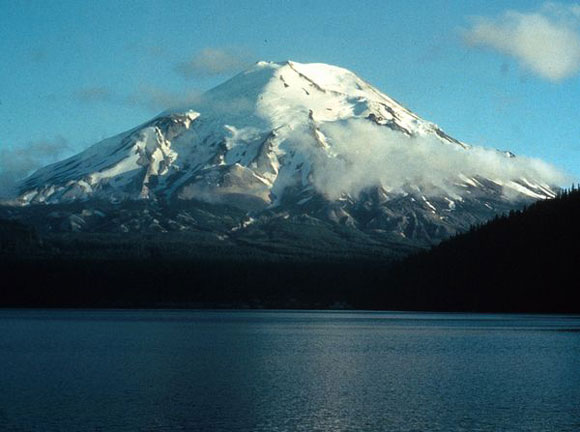
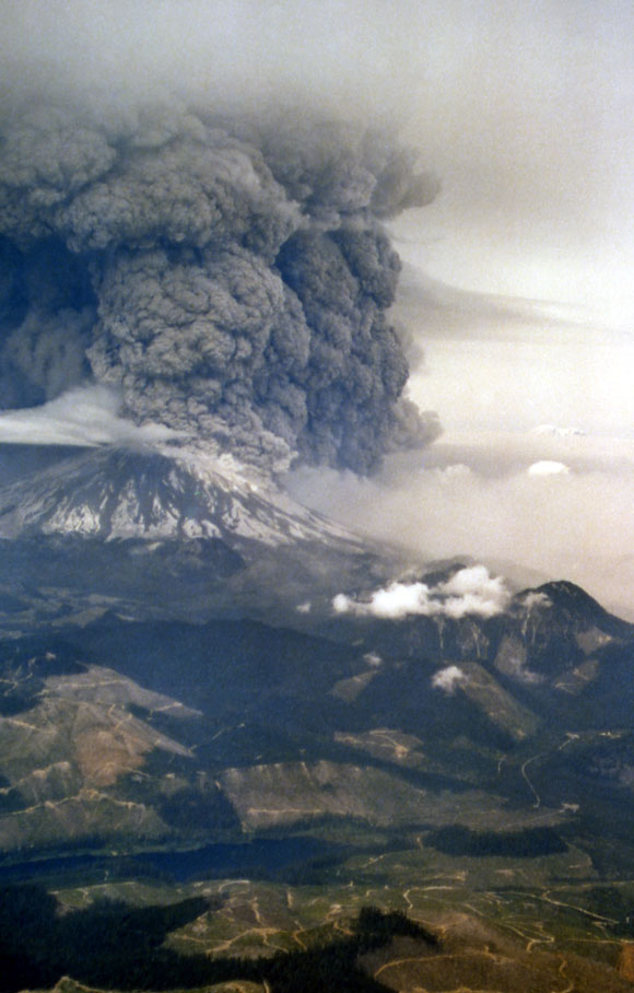
On May 18, 1980, Mount St. Helens underwent a catastrophic and deadly eruption, triggering the largest landslide ever recorded. Earlier in the year, thousands of small earthquakes, venting steam, and a growing bulge protruding 450 feet (137 m) indicated that magma was rising in the volcano. Then, at 8:32 a.m. local time, a 5.1-magnitude earthquake rocked the mountain, triggering the huge landslide and lateral blast that collapsed the volcano’s northern face. Hot pressurized magma erupted, and the ash plume reached a towering height of 80,000 feet (15 miles, 24 km), before blanketing the surrounding region. A United States Geological Survey (USGS) geologist described the destructive blast:
It completely destroyed an area of 230 square miles [595 square kilometers] in a matter of five to nine minutes. It essentially killed everything within that area.
Altogether, 57 people, including volcanologist David A. Johnston and photojournalist Reid Blackburn, were killed during the May 18, 1980, eruption at Mount St. Helens. Later, the Johnston Ridge Observatory in Toutle, Washington, was named for the late volcanologist.
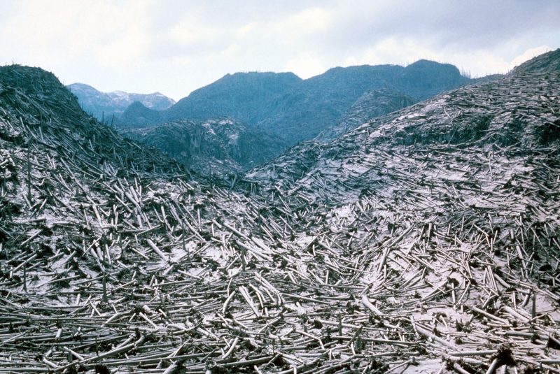
The dense forest that covered the slopes of the volcano was reduced to ash inside an area known as the inner blast zone, which extended about 6.2 miles (10 km) from the summit. Additionally, trees farther away from the inner blast zone were also damaged by the searing heat. The total extent of the devastated forested area is known as the blowdown zone.
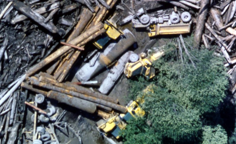
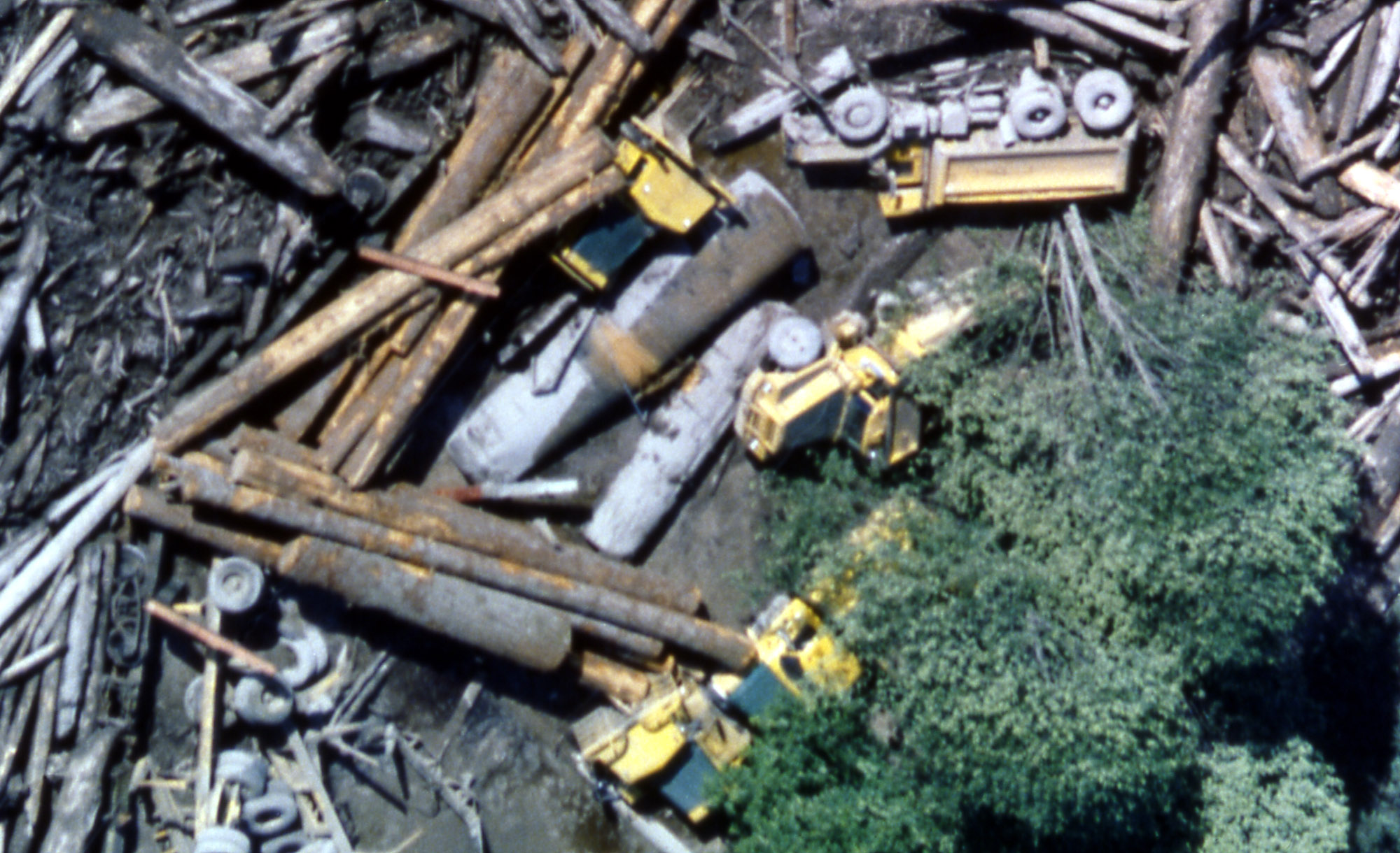
Lahars – mudflows carrying debris from volcanic eruptions – formed rapidly from the melting ice and snow on Mount St. Helens’s flanks. The massive lahars created in the 1980 eruption damaged homes, roads and bridges in nearby communities.
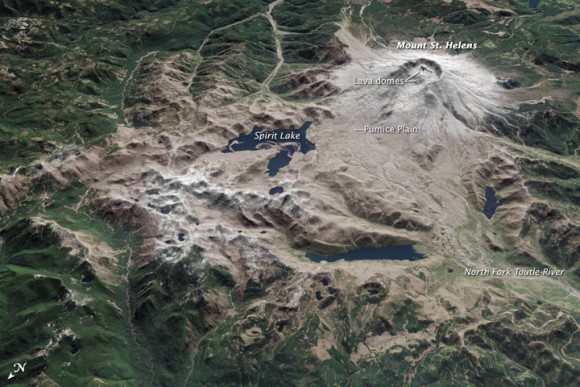
Over the past decades, however, this area has slowly rebounded with life.
#MSH45 | May 15, 1980
Cowlitz County Sheriff and friend Les Nelson tries one last time to coax Harry Truman to leave Spirit Lake.Nelson is so afraid of Mount St. Helens that he keeps his truck running, pointed down two-lane Highway 504, ready to leave if it finally goes.
— Mount St. Helens in 1980 (@mountsthelens1980.bsky.social) May 15, 2025 at 9:48 AM
The volcano is hidden, but its presence is still felt over the lake, the lodge, and the two men. Silence screams.
Nelson, aware of St. Helens's danger, pleads with Truman, but to no avail. Back into the truck, gun the motor back to safety.
KGW cameras later recorded Truman—the last footage of him.
— Mount St. Helens in 1980 (@mountsthelens1980.bsky.social) May 15, 2025 at 9:49 AM
On Sunday it passes 45 years since the 1980 eruption of Mt. Saint Helens. One can see the effects of the eruption also showing up in weather observations at the time.
First observation on the observed phenomena map that hinted something was amiss: weather.us/observations…
TT
— weather.us – Weather Forecasts For Professionals (@weather.us) May 15, 2025 at 1:15 PM
While the loss of power disrupted a major telemetry hub for Mount St. Helens monitoring, @PNSN1 stations on the volcano are still providing plenty of data. There is no volcanic unrest associated with this debris flow. CVO continues to monitor the volcano and its surroundings. 2/3
— USGS Volcanoes? (@USGSVolcanoes) May 15, 2023
On May 14, 2023, warm temperatures released a debris flow that caused more destruction. This flow, made from leftover eruptive material, rushed down South Coldwater Creek and took out a bridge on the lone park road, State Highway 504, aka Spirit Lake Highway. In addition, the destruction cut off access and power to the Johnston Ridge Observatory, located at the end of State Highway 504, in the heart of Mount St. Helens’ blast zone. The USGS assured people online that, while the debris flow was large enough to trigger seismographs, there was:
no volcanic unrest associated with this debris flow.
The local Fox12 news station in Oregon reported that 11 people and a dog had to be rescued by helicopter after the landslide. Cowlitz County officials estimated the landslide at about 200 yards (183 m) wide and 10 feet (3 m) deep, with a foot of water running over the entrance road.
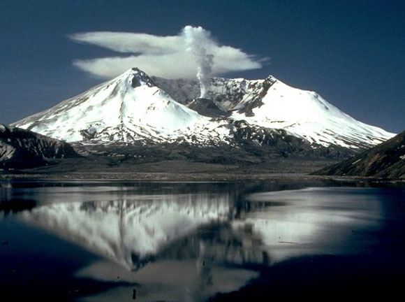
Now, Mount St. Helens stands as an 8,366-foot (2,550-m) high stratovolcano located in Skamania County, Washington, some 1,300 feet (396 m) shorter than before its 1980 eruption. Moreover, it is the most active volcano in the Cascade Range, which runs along the northwestern coast of North America. The Cascade Range is part of the Pacific Ring of Fire. Indeed, Mount St. Helens is still considered one of the most dangerous volcanoes in the United States.
Also, since 1980, Mount St. Helens has continued to experience periodic earthquakes and volcanic eruptions, but not to the same extent of that seen in 1980. The Cascades Volcano Observatory continually monitors activity at Mount St. Helens.
Bottom line: Mount St. Helens volcano exploded in a cataclysmic event on May 18, 1980, killing 57 people and dramatically altering the landscape.
View more Mount St. Helens eruption videos
Deanna Conners
About the Author:
Deanna Conners is an Environmental Scientist who holds a Ph.D. in Toxicology and an M.S. in Environmental Studies. Her interest in toxicology stems from having grown up near the Love Canal Superfund Site in New York. Her current work is to provide high-quality scientific information to the public and decision-makers and to help build cross-disciplinary partnerships that help solve environmental problems. She writes about Earth science and nature conservation for EarthSky.
Kelly Kizer Whitt
About the Author:
Kelly Kizer Whitt - EarthSky’s nature and travel vlogger on YouTube - writes and edits some of the most fascinating stories at EarthSky.org. She's been writing about science, with a focus on astronomy, for decades. She began her career at Astronomy Magazine and made regular contributions to other outlets, including AstronomyToday and the Sierra Club. She has nine published books, including a children's picture book, Solar System Forecast, and a young adult dystopian novel, A Different Sky.


