Tropical downpours Monday afternoon, evening in Philadelphia; flash flooding possible. Here's the forecast. - CBS Philadelphia
/ CBS Philadelphia
Heavy rain, flash flooding possible Monday in Philadelphia area
Monday is a NEXT Weather Alert day in the Philadelphia area for tropical downpours and an elevated flash flood risk.
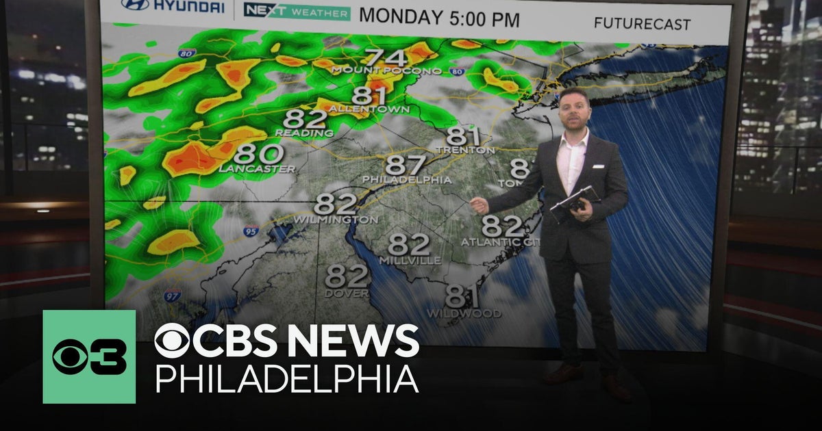
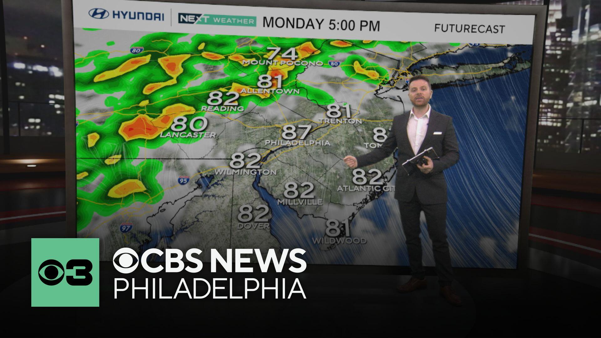
As a cold front approaches the area, widespread showers and storms will develop in the afternoon, evening and overnight hours. Any storm could train over the same areas for an hour or more.
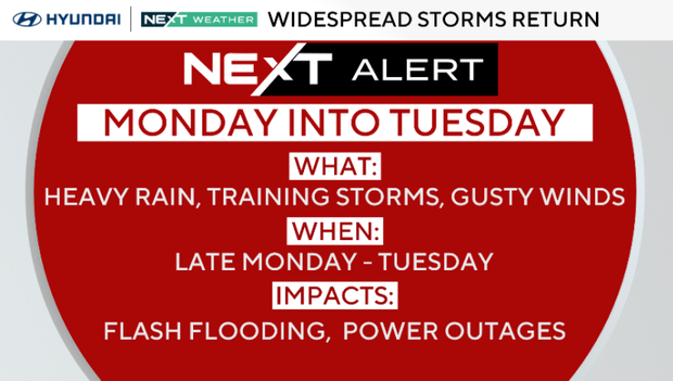
Rainfall rates in some storms will approach 1-2 inches per hour, with rainfall totals between 2-4 inches or more under any storm.
A flash flood watch is in effect across the Philadelphia area Monday from 2 p.m. to 11 p.m. The level 2 threat is along the I-95 corridor, including Philadelphia and nearby areas in Pennsylvania, New Jersey and Delaware.
Because the ground is saturated, much of the rain will run off, leading to flooded streams and roads. Late Monday evening commutes may be affected.
Weakened trees may also fall because of saturated soil, and travel delays are possible.
Severe weather is not expected, but an isolated damaging wind gust is possible.
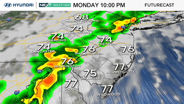
Tuesday may start with isolated storms and localized flooding. Otherwise, skies will be partly sunny, and highs will be in the upper 80s.
We will have a more typical summer pattern Wednesday through Friday with partly sunny skies and isolated storms each afternoon. Temperatures will also soar to either side of 90 during the day and the mid- 70s at night. High humidity will lead to heat indices that feel close to 100 degrees! We will be monitoring for any possible heat alerts.
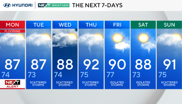
NEXT Weather Alert for flooding. High 87, Low 74.
Scattered storms. High 87, Low 73.
Scattered storms. High 88, Low 74.
Scattered storms. High 92, Low 75.
Isolated storms. High 92, Low 75.
Isolated storms. High 88, Low 73.
Scattered storms. High 91, Low 75.