Storms Possible Tomorrow - Eyes on the Gulf - NewsBreak
A Flood Watch remains in effect for the Hill Country, where yet another stalled-out system brought heavy rain this morning. More storms are possible tonight, continuing the flood threat. Closer to home, we could catch the tail end of a line of storms this evening, with another shot at rain tomorrow before drier and hotter weather settles in. Meanwhile, all eyes are turning toward the tropics as we head deeper into the week. We'll be monitoring closely for any developments that could impact our region.
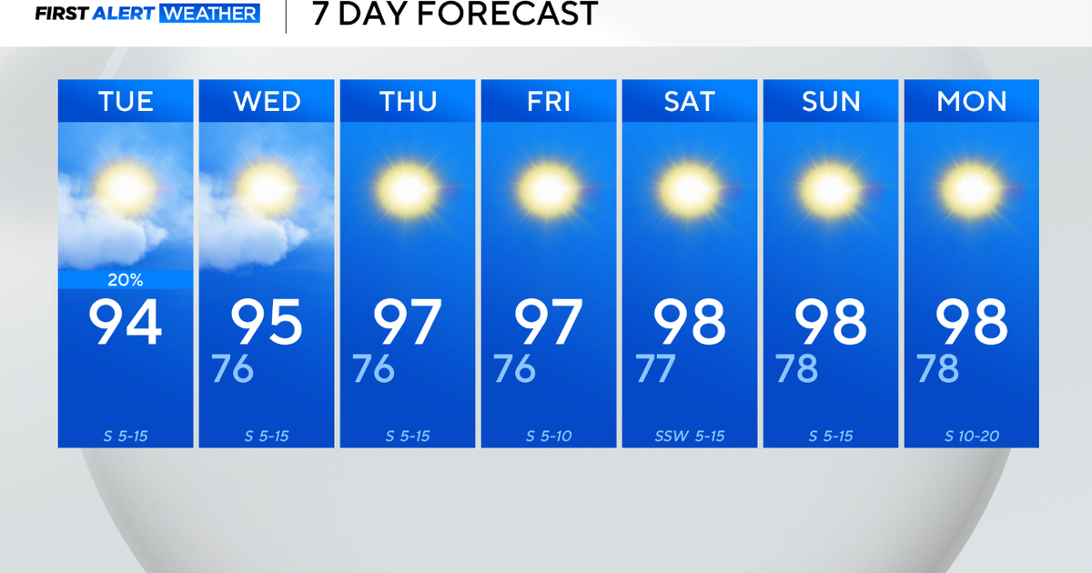
What we are tracking: An area of low pressure is expected to move westward across Florida and enter the Gulf by Tuesday. As it tracks westward, conditions look favorable for gradual strengthening through the week. Current model guidance points to a more northwesterly path, with the system likely approaching Louisiana by Friday. Regardless of development, this system will bring widespread rainfall. As for us in the Crossroads, we could still see some rain, even though the core of the moisture will stay well to our east. At this time, there’s a 20% chance of showers on both Friday and Saturday
We’ll continue to monitor this system closely as it evolves.
Extended Outlook: Rain chances will decrease and temperatures will rise up from some upper level ridging. Windy conditions will be likely as we head to the middle of the week.
COPYRIGHT 2025 BY CROSSROADS TODAY. ALL RIGHTS RESERVED. THIS MATERIAL MAY NOT BE PUBLISHED, BROADCAST, REWRITTEN OR REDISTRIBUTED.
You may also like...
Diddy's Legal Troubles & Racketeering Trial

Music mogul Sean 'Diddy' Combs was acquitted of sex trafficking and racketeering charges but convicted on transportation...
Thomas Partey Faces Rape & Sexual Assault Charges

Former Arsenal midfielder Thomas Partey has been formally charged with multiple counts of rape and sexual assault by UK ...
Nigeria Universities Changes Admission Policies

JAMB has clarified its admission policies, rectifying a student's status, reiterating the necessity of its Central Admis...
Ghana's Economic Reforms & Gold Sector Initiatives

Ghana is undertaking a comprehensive economic overhaul with President John Dramani Mahama's 24-Hour Economy and Accelera...
WAFCON 2024 African Women's Football Tournament

The 2024 Women's Africa Cup of Nations opened with thrilling matches, seeing Nigeria's Super Falcons secure a dominant 3...
Emergence & Dynamics of Nigeria's ADC Coalition

A new opposition coalition, led by the African Democratic Congress (ADC), is emerging to challenge President Bola Ahmed ...
Demise of Olubadan of Ibadanland
Oba Owolabi Olakulehin, the 43rd Olubadan of Ibadanland, has died at 90, concluding a life of distinguished service in t...
Death of Nigerian Goalkeeping Legend Peter Rufai

Nigerian football mourns the death of legendary Super Eagles goalkeeper Peter Rufai, who passed away at 61. Known as 'Do...