Severe storms on Tuesday in Philadelphia region to bring heavy rain, gusty winds. Here's the weather forecast. - CBS Philadelphia
/ CBS Philadelphia
Tracking more severe storms for Tuesday in Philadelphia region
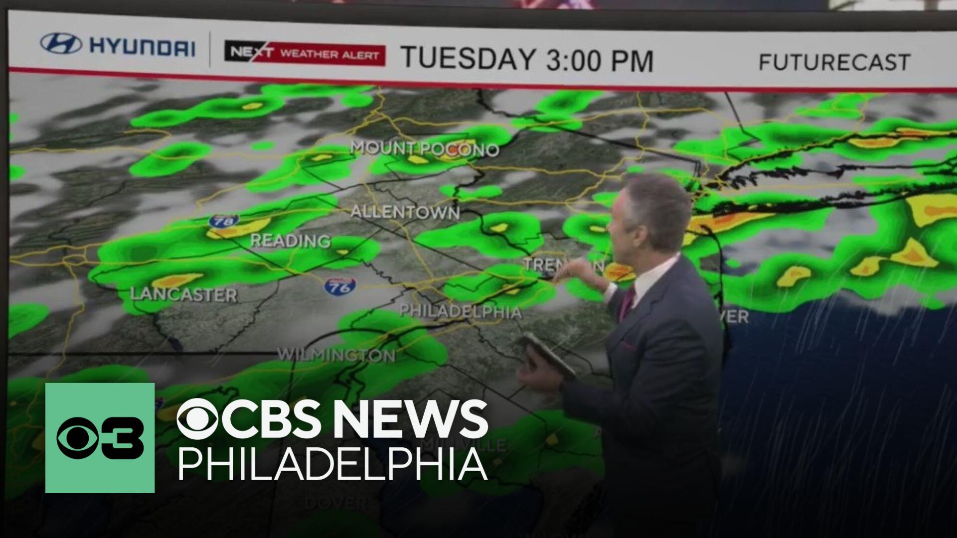
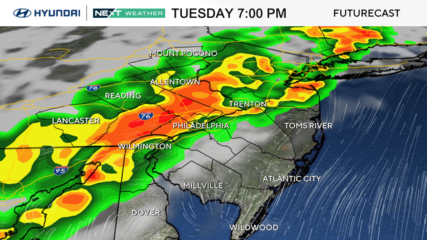
Good Tuesday, everyone! Get your outdoor activities done early as showers and storms are set to arrive in the Philadelphia region by late afternoon and early evening, bringing heavy rain, frequent lightning, and winds gusting to 60 mph-plus as a line of strong storms moves through.
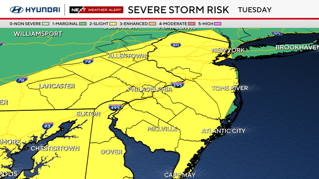
The region will be fully in the warm sector with highs in the low 80s to low 90s and dew points in the 70s — supporting strong instability. A strengthening upper-level trough will push a cold front through the area later in the day. If morning clouds and convection clear in time, conditions will support strong to severe storms. The Storm Prediction Center has placed most of the region in a slight risk (2/5) for severe thunderstorms, with damaging wind gusts as the main threat.
Alongside the severe threat, there's also a risk of localized flash flooding. Potential rainfall values between 2.0 – 2.5 inches and deep warm cloud layers will support heavy rainfall rates, especially if storms train over the same area. Delmarva is under a slight risk (2/4) for excessive rainfall, with a marginal risk (1/4) elsewhere.
There's a good chance the Phillies game may be postponed or adjusted somehow. Stay tuned for updates on that because the weather should be arriving around the time of first pitch.
The cold front slows as it moves through Tuesday night, with lingering showers possible through Wednesday morning, especially near coastal areas. Lows Tuesday night will be in the 60s to low 70s.
An upper-level trough lingers over the Northeast into the weekend. While Wednesday and Thursday will be warm, humidity will drop slightly behind the front. Most of Wednesday looks dry, with only a slight chance for showers Thursday near and northwest of I-78 as a weak front moves through.
Friday and Saturday look pleasant. High pressure will settle over the region with mostly sunny skies, highs in the 80s and comfortable dew points in the low to mid 60s. It's shaping up to be a nice holiday weekend, with no weather issues expected to impact your plans on the Fourth of July!
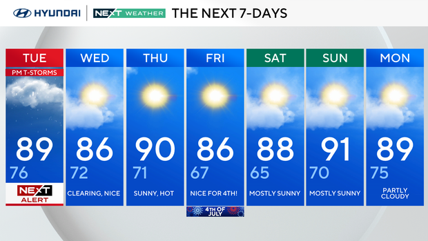
NEXT Weather Alert for p.m. storms. High 89, Low 76.
Clearing nice. High 86, Low 72.
Sunny, hot. High 90, Low 71.
: Nice for the Fourth! High 86, Low 67.
: Mostly sunny. High 88, Low 65.
Mostly sunny. High 91, Low 70.
Partly cloudy. High 89, Low 75.