Powerful 'bomb cyclone' to smash NSW, residents urged to prepare now
Residents in NSW are being urged to prepare now as a powerful “bomb cyclone” bears down on the state.
Bureau of Meteorology hazard preparedness manager Steven Bernasconi warned that the “severe” weather bomb would hit across the NSW coast.
“This a severe weather warning for a deepening low pressure system that will affect a large portion of the NSW coastline,” Mr Bernasconi said.
“There is a risk of flash flooding due to the short duration of heavy rain.
“From a thunderstorm’s perspective, there are thunderstorms along the coastal fringe.
“They may bring heavy rain and damaging winds and even water spouts.”
He went on to warn that severe thunderstorm alerts may be issued and said the flood watch warning may turn into a flood warning.

Mr Bernasconi ran through where and when the cyclone will hit.
“The heaviest falls are expected from the Hunter to the Illawarra, Tuesday and Wednesday. This system will track slowly southward along the NSW coast during Tuesday and it will bring widespread impacts.
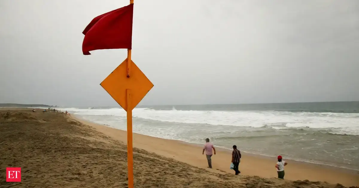
“A coastal hazard warning is also in effect for dangerous surf and erosion risks, communities from Coffs Harbour down to Batemans Bay and including Tenterfield for wind should prepare for severe weather impacts and monitor official warnings.
“This coastal trough is deepening off the North Coast, it is expected to evolve into multiple low pressure systems off the coast tonight.
“One of these low pressure systems will start to dominate and that will actually become then a vigorous coastal low.
“It is a complex system and it is dynamic.
“There is a severe weather warning for this whole vigorous low pressure system.

“There is a marine wind warning today for strong winds for the Byron, Coffs and Macquarie coast.
“Tomorrow, that marine wind warning till Tuesday will move towards gale-force winds for the Macquarie, Hunter, Sydney coast, Illawarra and Batemans Bay. There is a hazardous surf warning right now for the Port Macquarie to Batemans Bay area.
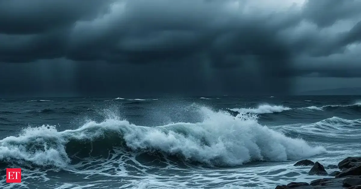
The Bureau of Meteorology’s Daniel Hayes said a “bomb cyclone” – or “bombogenesis” – was a low pressure system that formed “very quickly”, causing pressure to drop significantly within a short period of time.
He said the trough was sitting off NSW and would start bringing rainfall and possible thunderstorms to northern parts of the coast on Monday.
“Pretty much from the Mid-North Coast up towards the Northern Rivers,” Mr Hayes said.
“As we see that continue to deepen and strengthen up, the focus for the rainfall will be on the south side of that low pressure system.
“So around more Central Coast areas through (Tuesday) and potentially further south along the coast, as the low pressure system itself shifts further south through Tuesday and into Wednesday.”

NSW SES Deputy Commissioner Debbie Platz also spoke in Wollongong on Monday afternoon to update the community on the major operation under way to deal with the “significant weather event”.
“As we have mentioned, we have been monitoring this system since Thursday of last week and so our state emergency services, including our partner agency, are all very well prepared and planned for this event,” Ms Platz said.
“We have deployed high clearance vehicles, aerial assets and personnel into the areas which we think will be most impacted by this forecasted weather.”
Sydney could cop more than 200mm of rain in the next week, and parts of the Mid-North Coast could record up to 300mm.
Rainfall is expected to ease by Thursday.
NSW SES has now activated all 11,000 of its volunteers in preparation for the wild weather, and is urging members of the community to get ready.
NSW SES Acting Assistant Commissioner Allison Flaxman said property damage from destructive winds and flash flooding were significant risks amid the “dynamic” weather system.
“People should prepare now by tying down any loose items around their homes so they don’t become projectiles and damage property in the forecast wind,” she said.
“Be alert today so you’re safe tomorrow, by understanding your risk and planning what you will do and where you will go if you are impacted by flash flooding or riverine rises.”
The bureau has issued an initial flood warning for the Hawkesbury-Nepean, Georges, Cooks, Sydney Coast, and Illawarra Coast catchments.

Mr Hayes said flood warnings had been issued to cover “a fairly wide area” at this stage, given uncertainty of the system’s movements.
“We could see some flash flooding as well as river flooding out of this system, depending on just how quickly some of this rainfall falls and how concentrated those falls are in local areas,” he said.
“We do expect to see further warnings issued for NSW today, basically for the developing situation.
“Once the system starts to have some significant impacts, there could be additional, more localised warnings issued … so certainly people (should) keep an eye out for warnings and track the situation.”
Inland areas of NSW and Victoria were tipped to see frost and fog on Monday morning, with frost warnings issued for the Northern Country, North East, and East Gippsland forecast districts.
Melbourne is expected to hit a top of 14C with partly cloudy conditions and the chance of a shower.
Those in Brisbane are likely in for a rainy day with a top of 17C, while Adelaide residents can expect a mostly sunny day with a maximum of 15C.
Temperatures are tipped to reach 13C in Canberra after a freezing start, with a similarly chilly 12C forecast for Hobart.
Monday is likely to be warm and sunny for those in Darwin with a high of 31C.
Perth is expected to reach 23C with a mostly sunny morning before a high chance of showers in the afternoon and evening.