Louisville, Ky., bracing for one of the worst floods in its history - NewsBreak
April 9 (UPI) -- The Ohio River is poised to crest Wednesday evening and could cause one of the 10 worst floods in the city's history after several days of torrential rains.

The National Weather Service Prediction Center estimates the river will crest at 37 feet above the McAlpine Locks and Dam will crest at 68.4 feet below the dam, the Louisville Courier Journal reported.
Kentucky Gov. Andy Beshear declared a state of emergency ahead of storm activity on April 2 as weather forecasters predicted several days of torrential rains that would saturate the ground and overwhelm storm drainage systems.
The storms caused local flooding that shut down several roads and poses a serious flood risk for the greater Louisville area and the nearly 1.4 million people who live there.
"Four days of severe storms have brought devastation to communities across the commonwealth," Beshear said Tuesday in a news release .

"I want to thank all of our first responders and volunteers, both locally and from out of state, who have dedicated time to help our people," Beshear said.
"While the threat of severe storms has ended, several rivers and creeks remain at or above flood stage and roadways remain underwater in several areas," he added. "So we need folks to remain cautious."

Beshear said at least five have died due to the local flooding and safety risks will continue for at least a few more days before the Ohio River and local floodwaters recede.
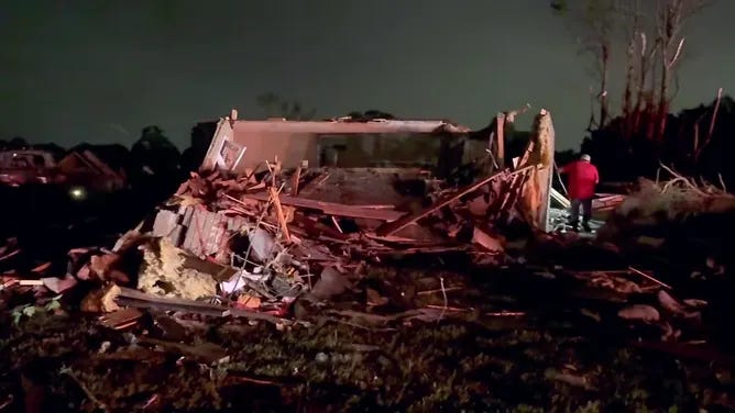
An EF-3 tornado with 145 mph winds also struck Jeffersontown in the southeastern portion of the greater Louisville area early Thursday morning, WDRB reported.

The tornado damaged many businesses and homes, which are threatened with potential flooding from the Ohio River.
Federal Emergency Management Agency personnel are in the area to assist those affected by the storms.