Isolated Saturday afternoon showers, possible storms in the Philadelphia area. Here's the forecast. - CBS Philadelphia
/ CBS Philadelphia
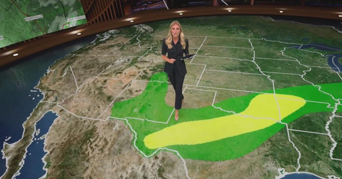
Chances of Saturday afternoon showers in the Philadelphia region
The weekend is upon us and so is a bit of a break from the daily dose of widespread showers and storms.
An onshore wind out of the southeast will help usher in some low cloud cover and fog overnight Friday into early Saturday morning.
This is while temperatures settle into the low-middle 70s to start the weekend. Areas of dense fog will be possible early, but any low clouds and fog will quickly begin to mix out through the first half of the morning and give way to mostly sunny skies.
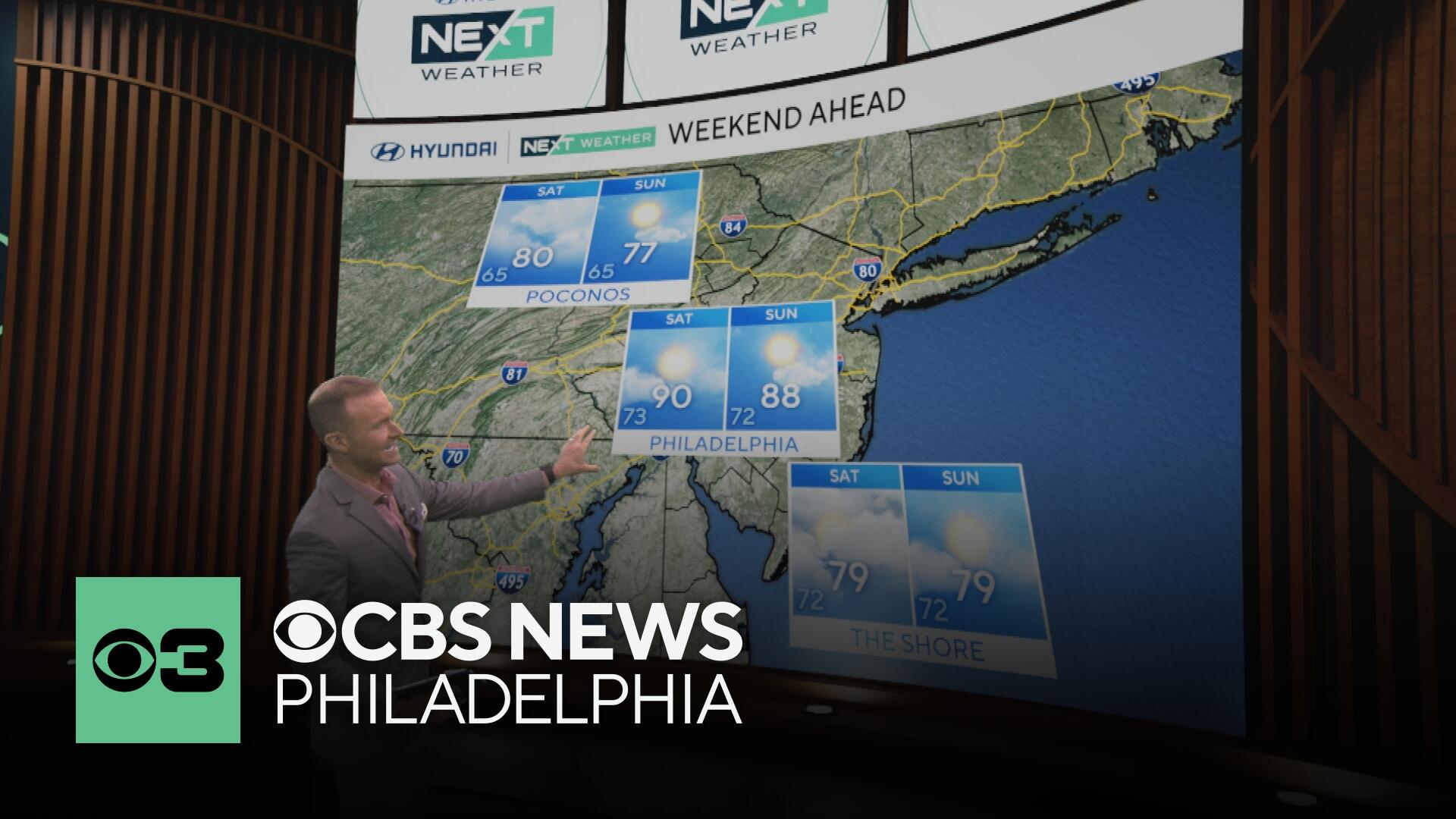
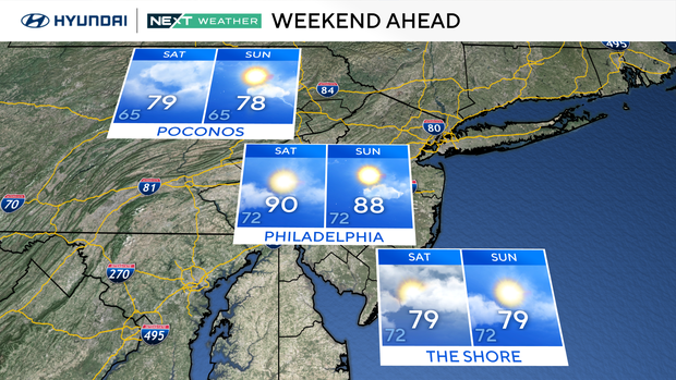
As temperatures warm into the upper 80s Saturday afternoon, a small chance for a few isolated showers will develop, but mainly north and west of the I-95 corridor. Meanwhile, down the shore, the onshore wind will keep temperatures comfortable with highs near 80 degrees with mostly sunny skies.
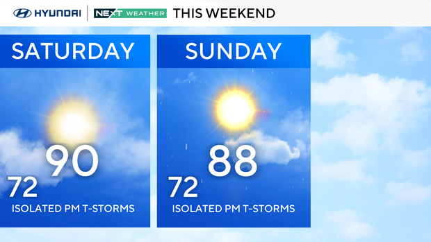
Sunday will be similar to Saturday with areas of fog to start the day before clearing out to a nice mix of sun and clouds with only a few stray afternoon showers and storms to the west.
By Monday, a cold front will approach from the west as moisture builds out ahead of it out of the southwest. Widespread showers and storms look likely Monday afternoon and evening with areas of heavy rain and potentially gusty winds. Otherwise, conditions will be mostly cloudy, warm, and humid Monday with high temperatures in the mid-upper 80s.
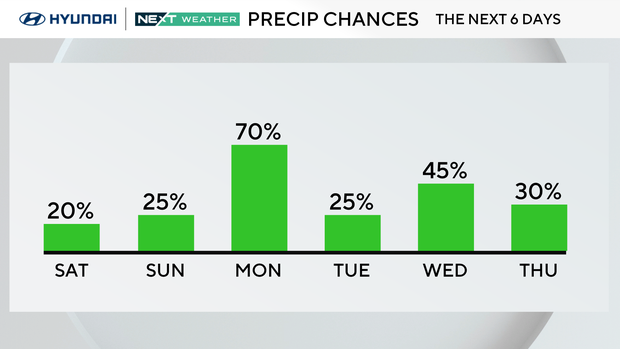
The rest of next week will continue to feature a small chance for a few afternoon showers and thunderstorms with high temperatures turned up a notch closer to 90 degrees.
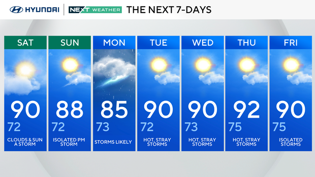
Clouds & sun a storm. High 90, Low 72
Isolated PM storms. High 88, Low 72
Storms likely. High 85, Low 73
Hot, stray storms. High 90, Low 72
Hot, stray storms. High 90, Low 73
Hot, stray storms. High 92, low 75.
Isolated storms. High 90, Low 75