5 Confirmed Tornadoes from Thursday night's severe storms
WEST MICHIGAN — National Weather Service officials have confirmed five tornadoes touched down across West Michigan with the powerful storms Thursday night.

FOX 17
The two strongest tornadoes touched down in Allegan County and are classified as EF-1, with estimated top wind speeds of 95 mph. One of those tornadoes touched down near the Sandy Pines Resort Park, and was on the ground for 5.4 miles into Dorr. The second touched down near Martin, and was on the ground for 8.3 miles, crossing Schnable Lake to near the Barry County line.

FOX 17
In Kent County, an EF-1 tornado with estimated top winds speeds of 90 mph touched down in Caledonia and was on the ground for 14.5 miles to Saranac (Ionia County)

FOX 17
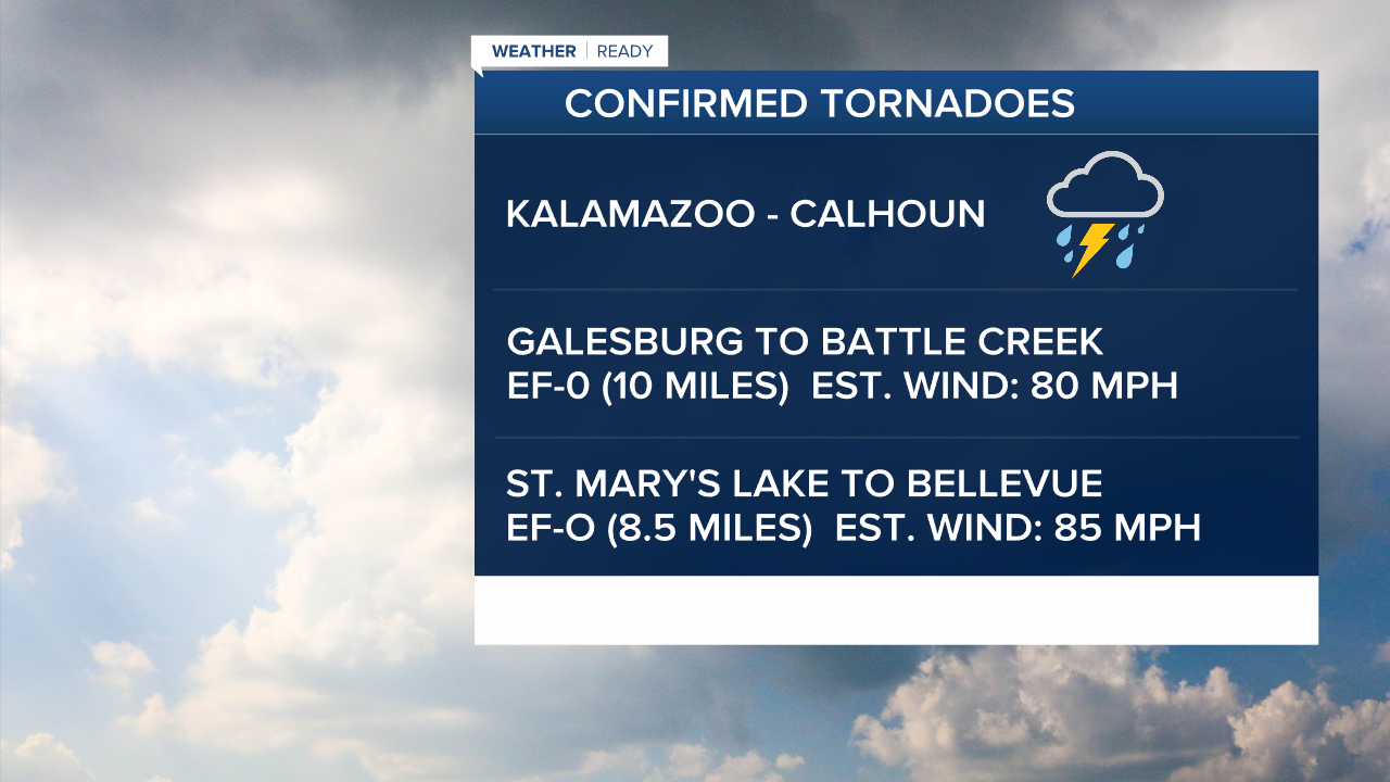
Two EF-0 tornadoes were confirmed in the Kalamazoo-Battle Creek areas. The first touched down in Galesburg and was on the ground for 10-miles to Battle Creek, with estimated top wind speeds of 80 mph. The second touched down near St. Mary's Lake and was on the ground for 8.5 miles to Bellevue, with estimated top wind speeds of 85 mph.
FOX 17
For the latest details on the weather in West Michigan, head to the FOX 17 Weather page.
Follow FOX 17: Facebook - X (formerly Twitter) - Instagram - YouTube
Copyright 2025 Scripps Media, Inc. All rights reserved. This material may not be published, broadcast, rewritten, or redistributed.