The latest on ex-Cyclone Alfred: where and when it will hit, and what to expect this weekend
Cyclone Alfred has been downgraded to a tropical low and is expected to cross the mainland coast between Maroochydore and Bribie Island on Saturday morning. It currently lies off Bribie Island and is moving slowly north.
As of Saturday morning, the ex-tropical cyclone was bringing wind gusts up to 85 kilometres an hour. It was located 65 kilometres north northeast of Brisbane and 40 kilometres south southeast of Maroochydore, and moving at 9 kilometres an hour.
Winds are expected to ease as the low moves inland. Heavy rainfall is expected over southeast Queensland and northeast New South Wales during the weekend.
Heavy to locally intense rain may lead to flash flooding in coastal and adjacent inland areas. Tides are expected to be higher than normal over the weekend. Damaging surf may continue, bringing significant beach erosion between Noosa and Ballina.
In Brisbane, some 20,000 properties have been warned of impacts ranging from minor inundation in yards to significant flooding inside homes. Areas most at risk include Nudgee Beach, Brighton, Windsor, Ashgrove, Morningside and Rocklea.
Northern NSW has already been hit by devastating flooding in recent years, most recently in February 2022. Many of its settlements, including Lismore, are along or close to major river courses. Residents are understandably anxious about what the next few days of rain may bring.
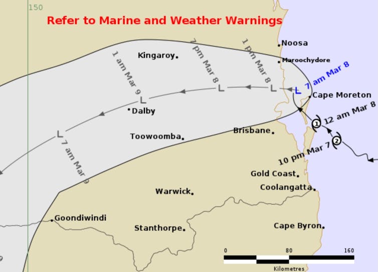
The bureau released the below map on Saturday. It shows the bureau’s best estimate of the ex-cyclone’s future movement and intensity. The grey zone indicates the range of tracks the ex-cyclone centre may follow.
Ex-Cyclone Alfred meandered off Queensland’s coast for two weeks. It maintained its cyclonic structure and intensity much further south than is typical.
Unique atmospheric and oceanic conditions have allowed Cyclone Alfred to intensify.
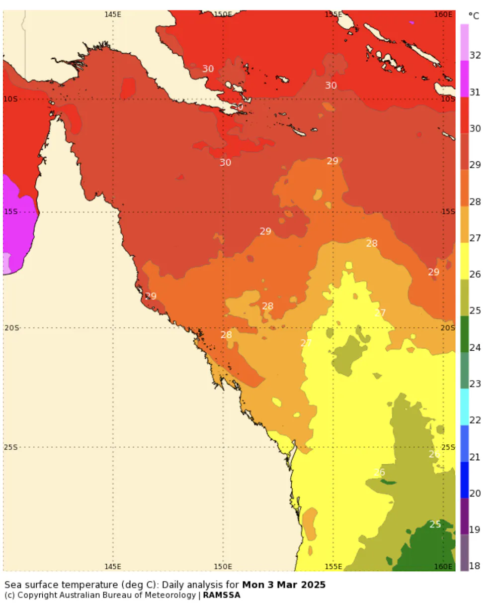
It moved towards an area of warmer coastal water (around 27°C), which caused it to strengthen. It also moved into an area of reduced “vertical wind shear” – a variation in wind speed running at right angles to prevailing winds, which often acts to weaken a cyclone.
Usually, cyclones in this part of Australian waters may brush the coast, but are soon pulled south or east by an upper trough of cold air and then flicked away into the cooler waters of the Tasman Sea – to an area known as the “cyclone graveyard”.
The current situation is unusual because that upper trough is absent. At the same time, a high pressure system in the Tasman Sea is steering the cyclone towards the coast.
For emergency assistance call the State Emergency Service (SES) in NSW or Queensland on 132 500.