Showers and storms across Colorado heading into Fourth of July Weekend - CBS Colorado
/ CBS Colorado
Hot and mostly dry for Denver with storm chances this Fourth of July weekend
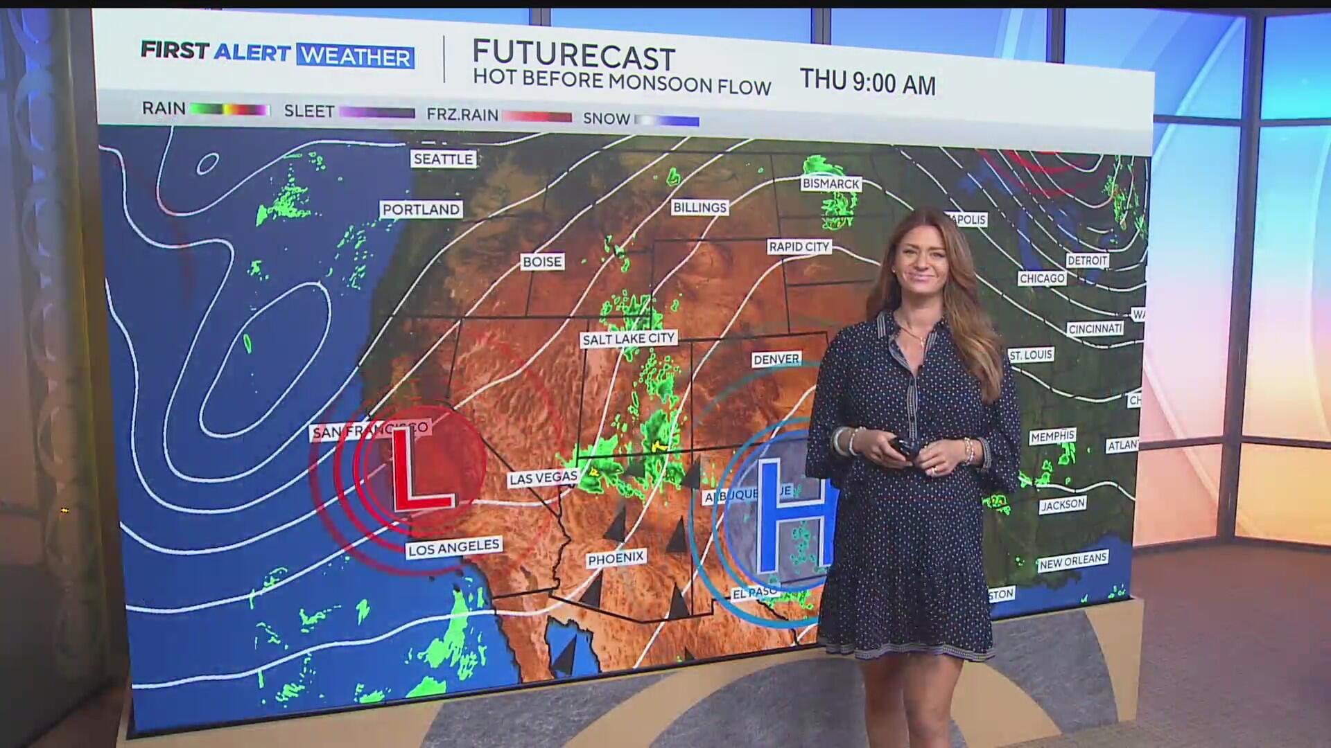
Thursday is Indy Eve and rain and storm chances are moving into the forecast, but like Wednesday, activity will be primarily over the mountains on Thursday.
An incoming upper-level trough will help pull monsoonal moisture in from the south. That will increase the chances of thunderstorms in the mountains, with a stray shower and storm possible for the lower elevations later Thursday.
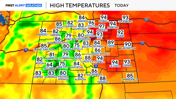
Thursday will be another hot day across the Denver metro area and Eastern Colorado with afternoon highs climbing into the 90s.
Highs in the mountains will drop a couple of degrees as compared to Wednesday, reaching the 70s and 80s.
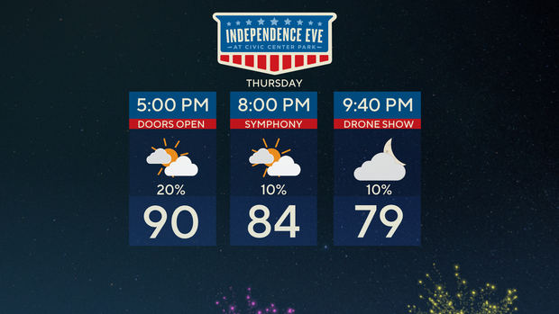
It will still be quite hot as the doors open at Center Park in Denver for Independence Eve on Thursday night.
There will be a 20% chance of showers and storms around 5 p.m., but the rain chances drop going into the rest of the evening.
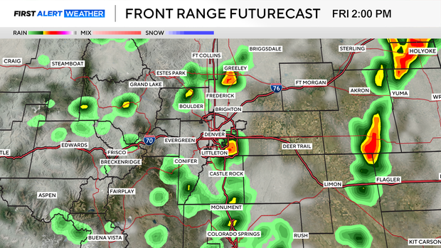
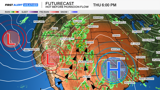
That upper-level trough will move across the area as Friday approaches, which could bring a few early showers, but there is a better chance of rain and storms later in the afternoon.
Scattered storms are forecast to roll across the I-25 corridor, moving East after 12 p.m. Friday will not be a washout, as the storms will be isolated, and are likely to wrap up after 5 p.m.
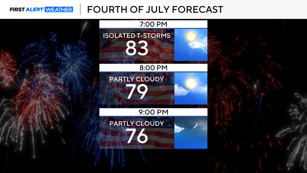
The evening firework forecast looks relatively quiet, with comfortable temperatures for the evening.
First Alert Meteorologist Alex Lehnert provides the weather forecast on CBS Colorado Mornings. Catch her latest First Alert Weather updates on TV and on our free streaming service, CBS News Colorado. Check out her bio and send her an email.


:max_bytes(150000):strip_icc()/Parents-FamilyWatch74-4cd556527fd847649fe8cb23836ab45a.jpg)