More wet weather with chance for storms moves into Colorado this week - CBS Colorado
/ CBS Colorado
Another active weather week with severe weather chances on Monday
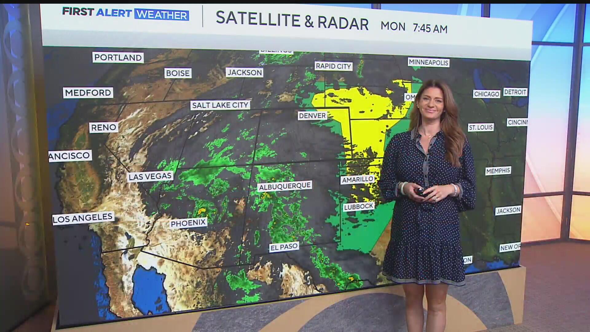
Another week, another round of rain and storms that will move into Colorado. We will start the work week on a quiet note, at least for the first half of the day on Monday, before the chances of rain and storm increase in the afternoon.
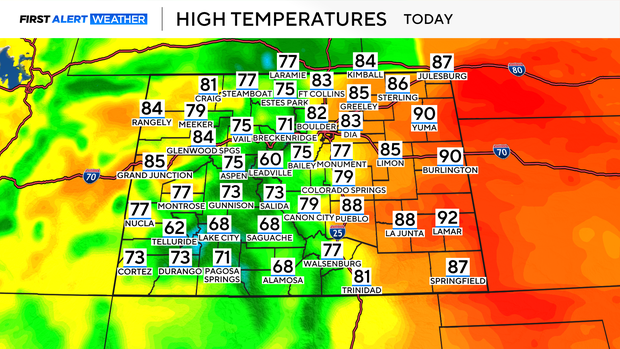
High temperatures on Monday afternoon will manage to climb into the low to mid-80s across the Denver metro area.
Heading out into Eastern Colorado, we could see some low 90s today. That is where instability in the atmosphere will be greater, and the risk for severe weather is higher.
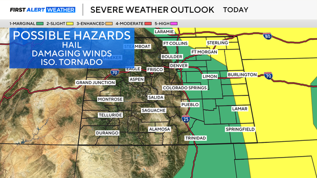
The Denver area, parts of Northern Colorado, and the I-25 corridor are under a Level 1 – Marginal Risk for severe weather Monday afternoon, with the threat increasing to a Level 2 – Slight Risk in Eastern Colorado.
These storms will begin firing up after 2 p.m. on Monday and continue into the evening.
The greatest risks with these storms will be hail and wind for the Denver area, with the threat of possible tornadoes mainly in Eastern Colorado today.
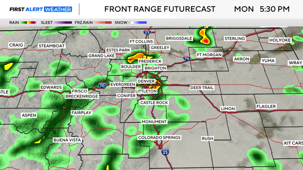
Shower and storm chances continue throughout the evening on Monday before transitioning over into more steady rainfall.
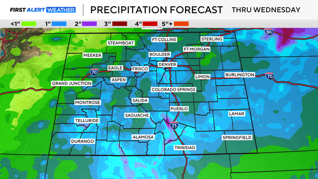
Overnight, into early Tuesday morning, rain will continue to fall and could leave .50" to 1" of rain in the Denver area, with more rainfall totals in the foothills and south metro neighborhoods.
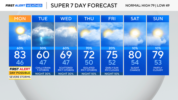
This week will be accompanied by wet weather throughout the week. Each day comes with a chance of rain and storms, with temperatures on Tuesday being the coolest of the next 7 days.
First Alert Meteorologist Alex Lehnert provides the weather forecast on CBS Colorado Mornings. Catch her latest First Alert Weather updates on TV and on our free streaming service, CBS News Colorado. Check out her bio and send her an email.