Monday in Philadelphia region will be cool, cloudy with scattered storms. Here's the weather forecast. - CBS Philadelphia
/ CBS Philadelphia
Dreary start to the week in Philadelphia area, summer arrives Friday
We're kicking off Monday just like the weekend — more clouds, scattered showers and temps stuck in the 60s in the Philadelphia region. Same story, different day.
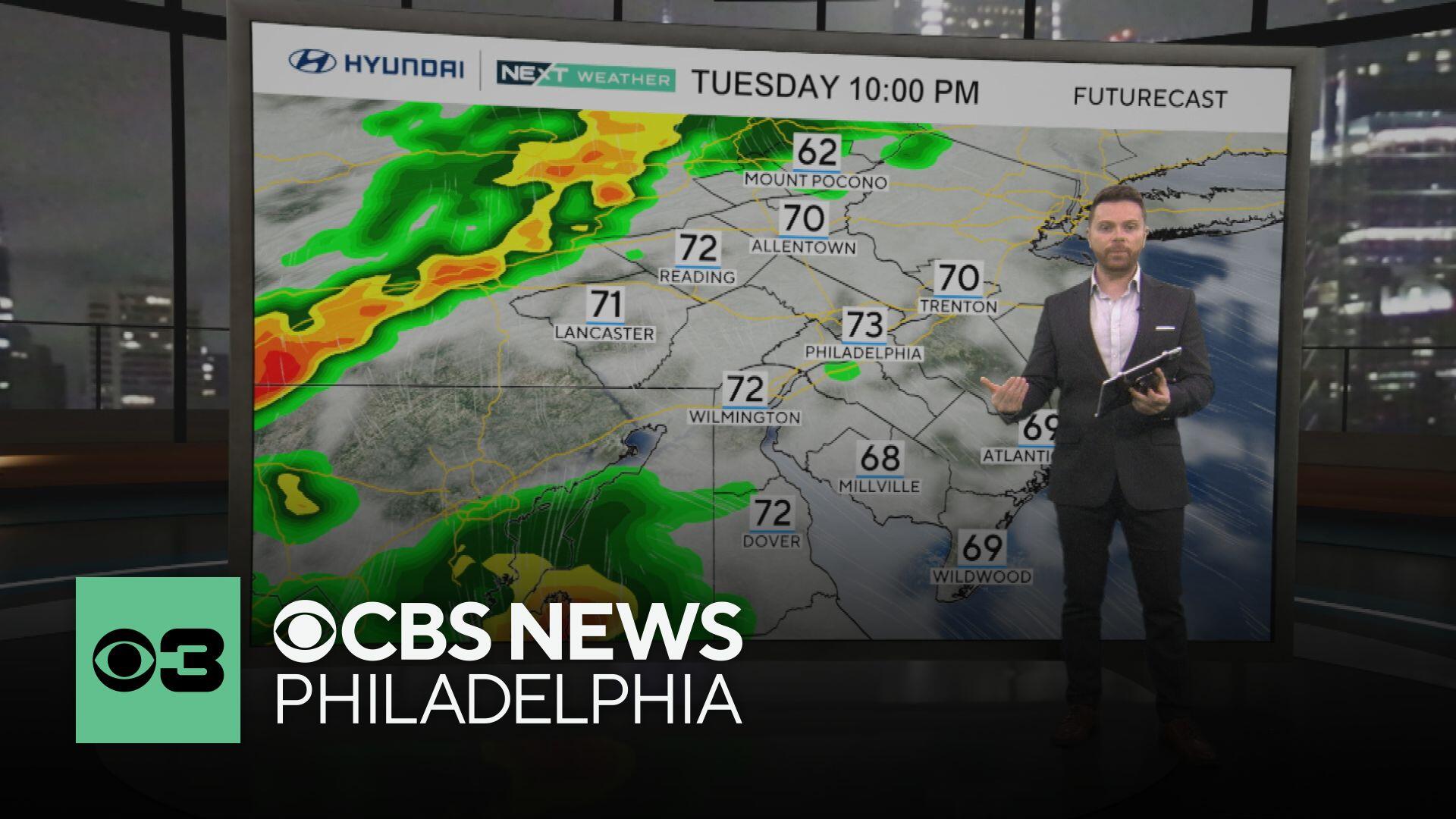
Things start to look up a bit on Tuesday. We'll still have mostly cloudy skies, but highs will creep into the mid-70s, with only a few isolated showers popping up here and there.
By Wednesday, it starts feeling like summer again. Expect upper 80s, some scattered showers, and even a few storms, especially in the afternoon. Skies will be partly to mostly cloudy.

Thursday is the official end of spring, and we're going out with a bang. Highs will be near 90, and there is a chance of those classic afternoon storms — definitely starting to feel like summer.
And speaking of summer, Friday delivers. We're looking at sunshine and highs in the upper 80s — just about perfect.
Get ready — starting next Saturday, we could be entering our first heat wave of the year. That means three or more days in a row hitting 90 degrees or higher, and this stretch could keep going into the following week.

For some context:

Scattered showers. High 70. Low 61.
Shower or rumble. High 76. Low 64.
Afternoon storms. High 88. Low 69.
Hot, a storm? High 91. Low 73.
Mostly sunny. High 87. Low 67.
Heat builds. High 89. Low 67.
Sunny and hot. High 93. Low 71.