May 24, 2025 Saturday Weather Update
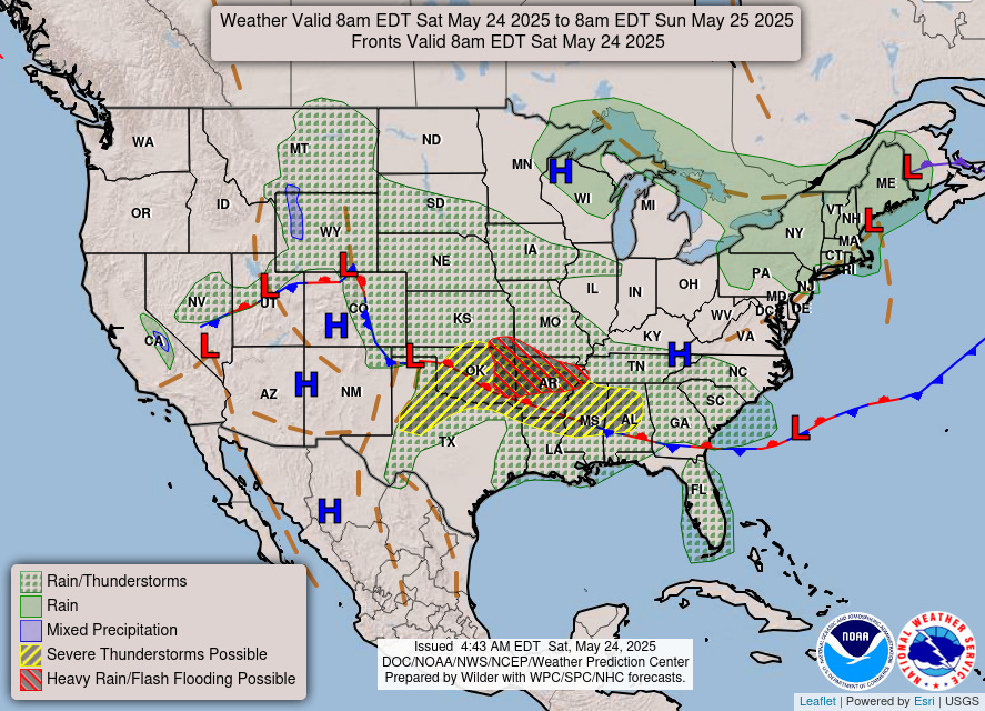
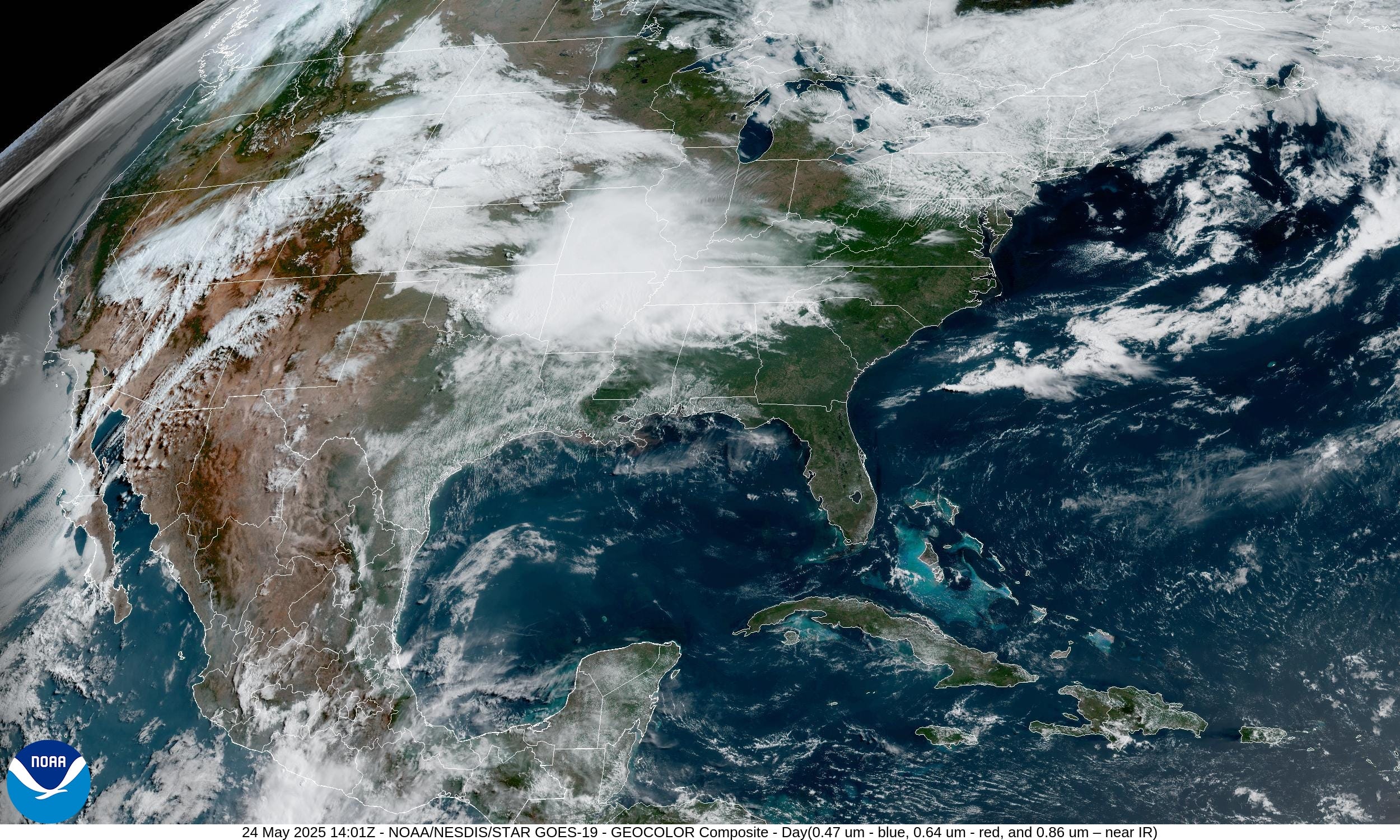
Still clouds from the lingering Nor’easter but eroding in the Great Lakes. Huge convective blowup with a complex of storms rolling ESE out of Oklahoma and Missouri into Arkansas into the Southeast.
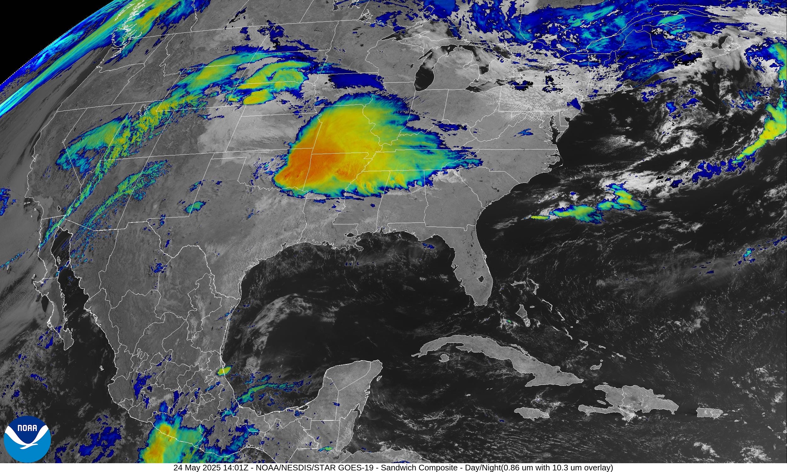
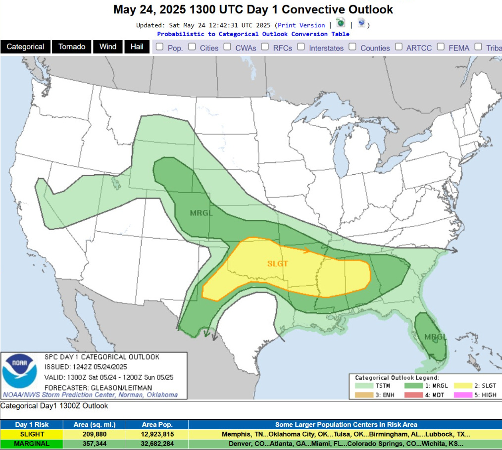
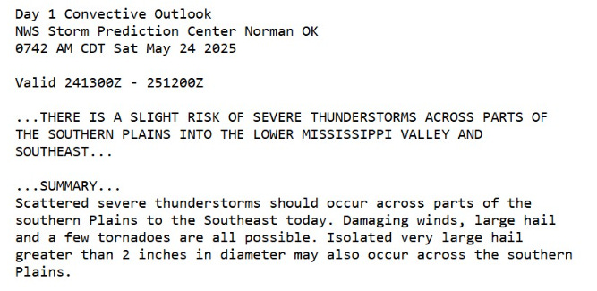
Storms in SE Oklahoma have some history of severe wind gusts. Otherwise, drenching rain across a large area that does not need any more.
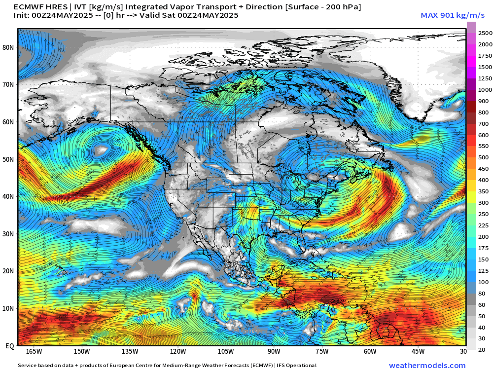
Caribbean and Gulf of Mexico are the primary source regions for the heavy rain across TX/OK and Mississippi River Valley. Tropical easterly flow across Central America will consolidate and circulate into Tropical Storm (or Hurricane) Alvin by Wednesday.
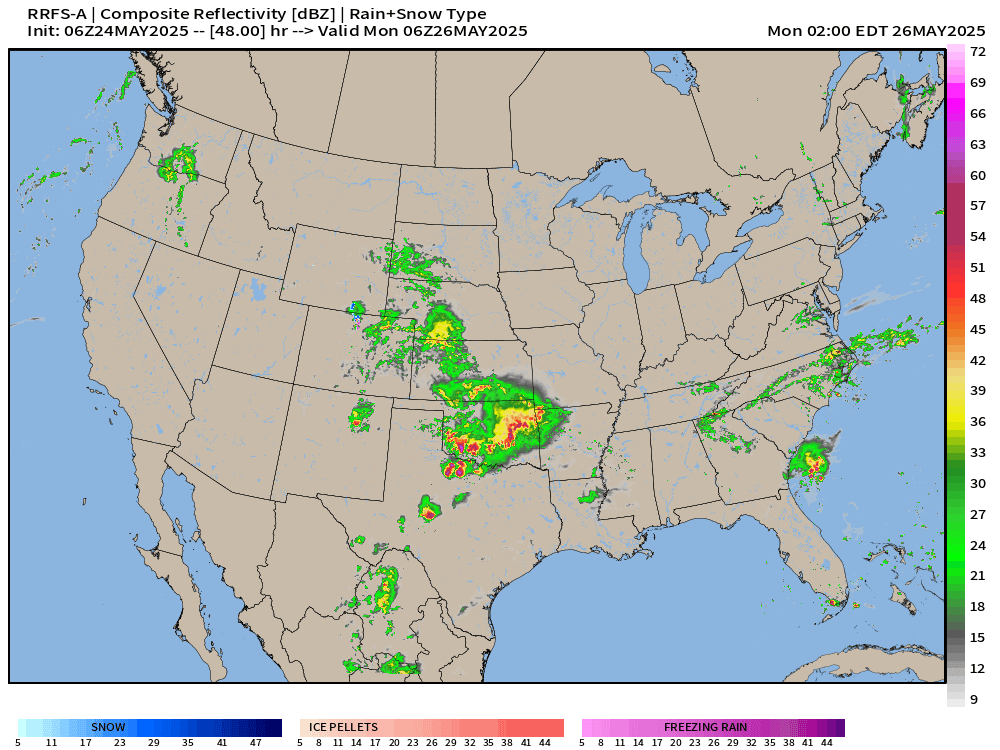
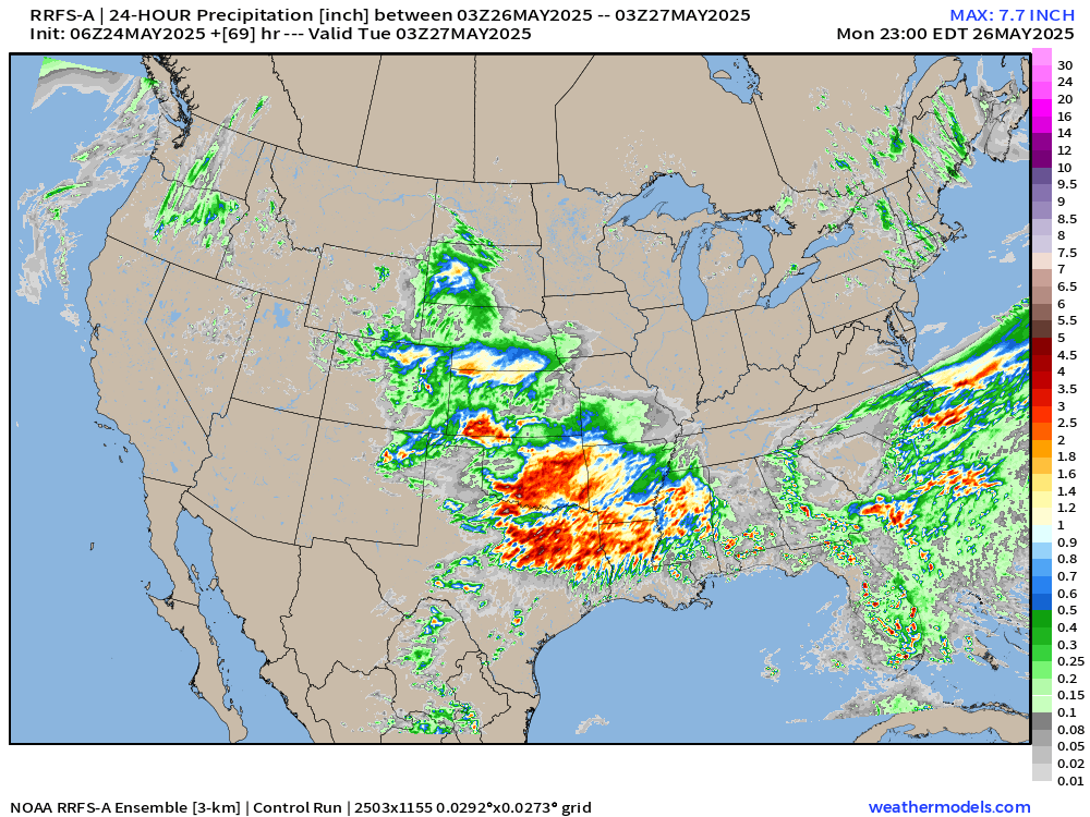
Experimental model (RRFS-A) extended for Monday (48-72 hours) shows the widespread storms from OK/TX and then moving SE along the stalled frontal boundary.
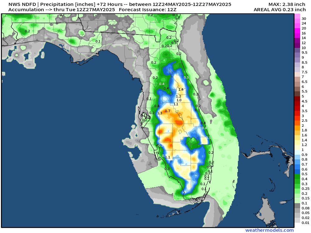
Showers and storms during the day in Florida. Great Lakes, Mid-Atlantic, and Northeast look mainly dry and comfortable
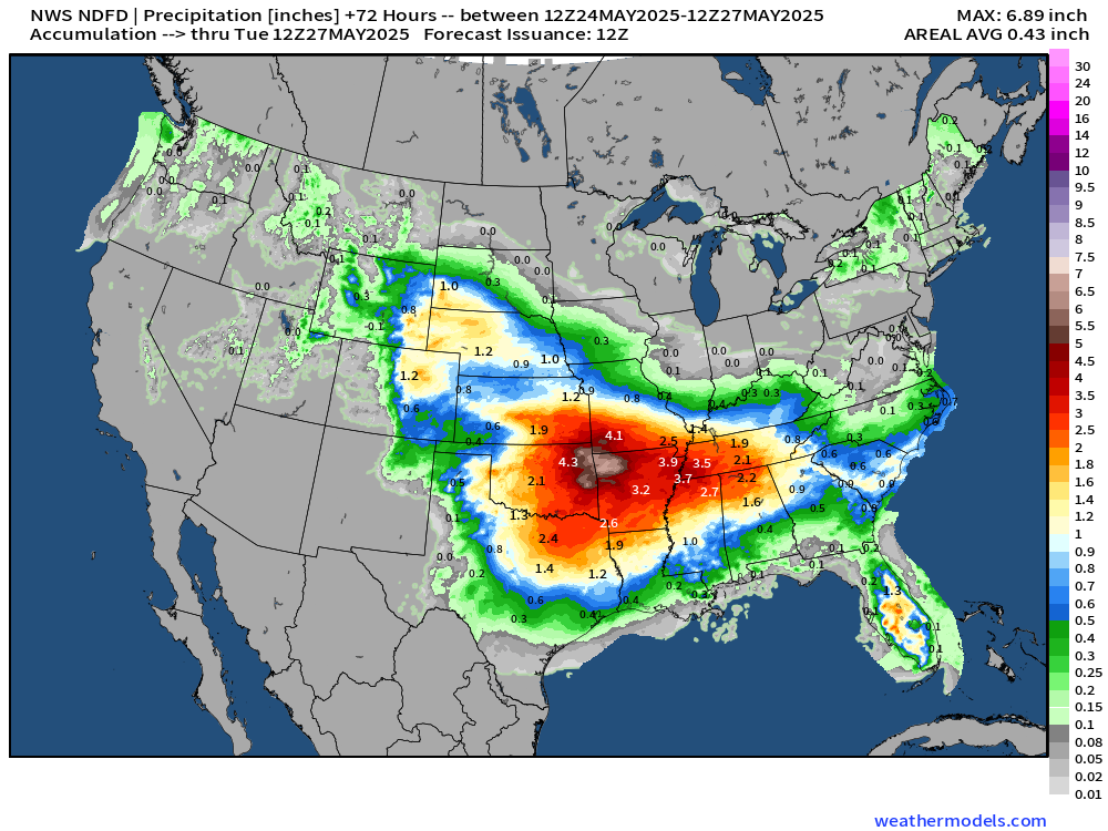
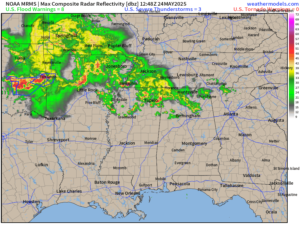
Large area of 2”+ from DFW to OKC and over to Nashville. Highest amounts of > 6” across NW Arkansas.
1-2” would be quite welcome to break up the intense heat from the strong subtropical ridge.
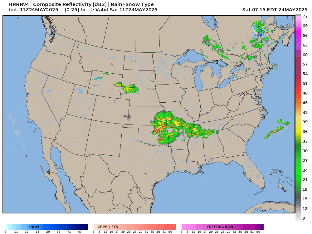
Radar through the rest of today (Saturday) shows more storms/rain in the central Plains on a general ESE trajectory into the Mississippi River Valley … maybe these storms hold together into evening for Atlanta.