May 21, 2025 Wednesday Weather Update
Integrated Vapor Transport (IVT) shows the massive circulations with the monsoonal flow breaking down into two tropical cyclones. Invest 93A is currently designated off the Gujarat coast of India and should slowly gain strength. The next name is Shakhti.
ECMWF 00z HRES has 970 mb at Day 6 with the western tropical cyclone in the Arabian Sea. The Bay of Bengal system might remain as a large tropical storm but still be impactful with extremely heavy rainfall along any coastline it reaches.


Central pressure in the 960s mb should be a major hurricane assuming wind shear and dry air does not knock down the system prior to reaching peak intensity.


We’ll watch the next several days — and see how the A.I. driven systems forecast these tropical cyclones and provide clues for the Atlantic season ahead.
Will read and discuss this in the coming days …
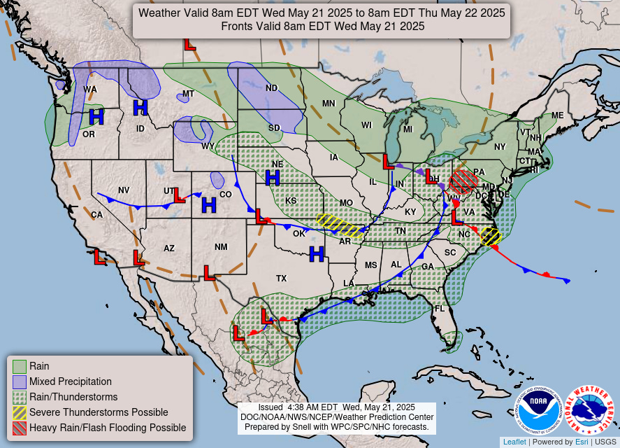
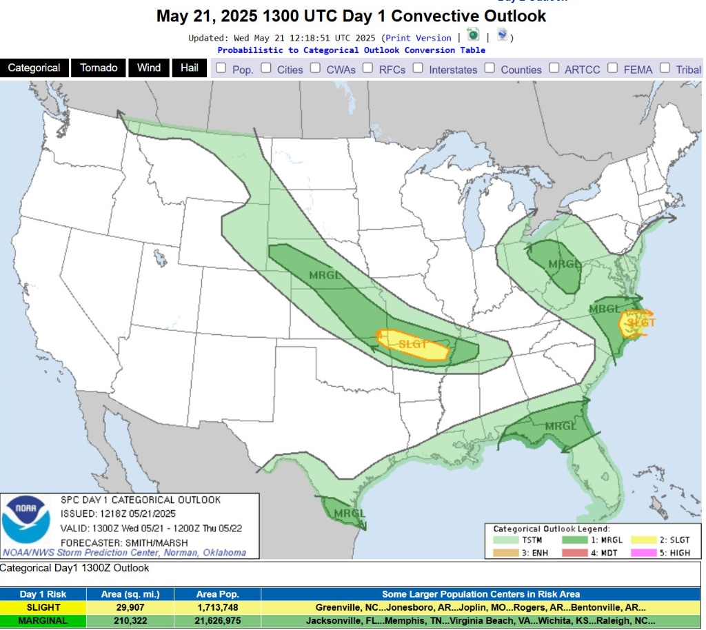
Finally taking a break from severe weather with only slight chances in a couple locations including northern Arkansas and coastal North Carolina. Otherwise, just garden variety thunderstorms.
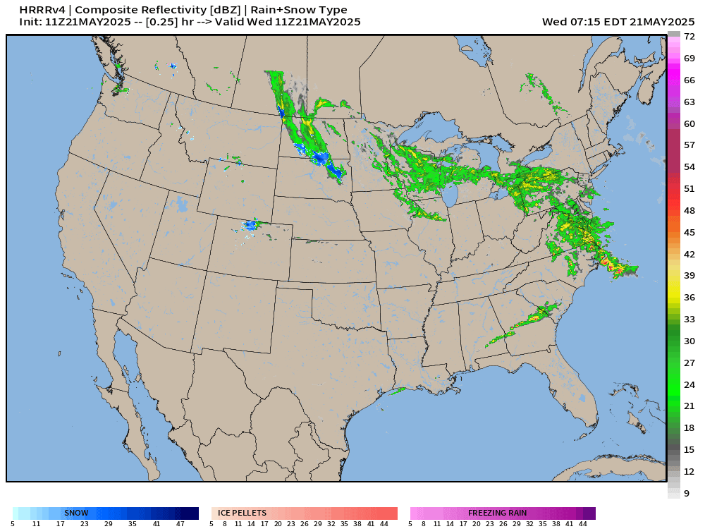
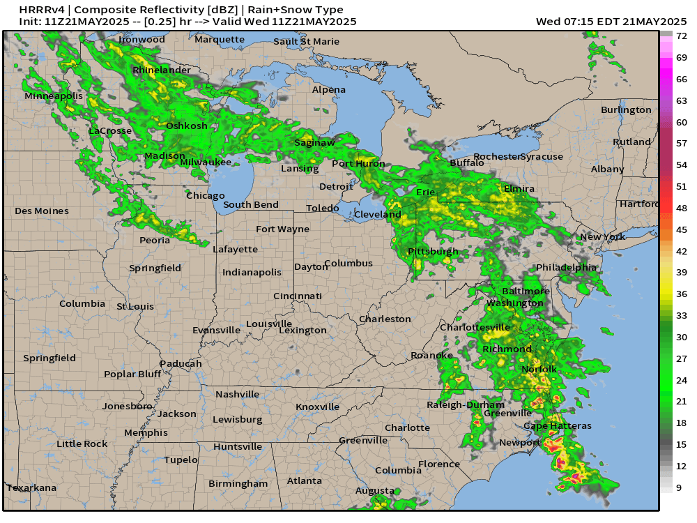
Widespread drenching rainfall continues for the Great Lakes and Mid-Atlantic into the Northeast as a storm system develops — rare mid-May Nor’easter.
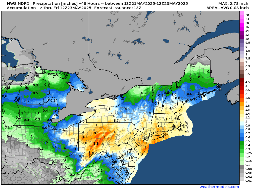
1-inch (yellow) over a wide area including NYC and Boston, maybe closer to 2-inches.
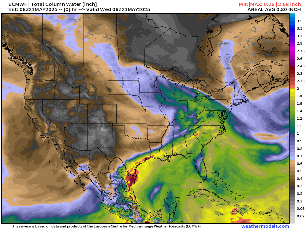
My favorite atmospheric variable (PWAT) — The Nor’easter drags a cold front through the Southeast to clear out and dry the eastern U.S. briefly.
But, moisture quickly returns out of the Gulf of Mexico flowing into Texas and the mid-Mississippi River Valley for heavy rainfall this weekend into Memorial Day.