May 19, 2025 Monday Weather Update
Sadly, another regional severe weather outbreak will fire this afternoon across the central Plains into the middle Mississippi River Valley with the risk of long-track supercells with intense tornadoes.
This is more like an early spring weather pattern instead of mid-May due to the cold air continuously invading the Lower 48 from Canada.
A storm system spinning over the Dakotas has plenty of lift and upper-level wind support to easily fire supercells in the warm sector later this afternoon.
Convective init along a line from Tulsa to Dallas / Fort Worth around 4-5 PM CT will evolve into a massive blob of storms clusters and complex that could linger into the early morning hours across the southern Great Lakes.
= OKC, Tulsa, Springfield, Missouri —> Tornado (Significant > 10%) for a large population > 17 million
Highest tornado risk is centered on eastern Oklahoma, but could see some from DFW to just west of St. Louis.
The ITCZ is along a southerly latitude of 2°N as a continuous band of clouds and showers. To the north, dust from a strong Saharan Air Layer (SAL) outbreak bursting off the African continent.
There are a few major source regions of dust / sand particles that can be pulled up into the lower atmosphere by the strong winds over the extremely hot desert. Libya, Algeria, Chad, and western Africa continuously see hazy, dusty skies. Next 7-days shows the majority of the dust remains bottled up over the Continent. But this amount of dust/sand could easily eject into the Atlantic if the mid and upper-level winds were more favorable.
The Gulf of Mexico and Caribbean are completely clear.
We still have 3 ensembles with storms in the Gulf of Mexico, which is a minimal probability or chance of a tropical storm < 6%. Please don’t worry about anything for the next 7-days
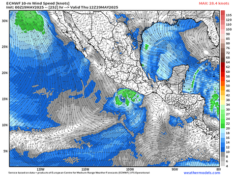
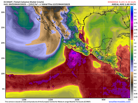
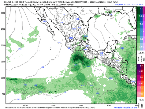
Here in the Eastern Pacific, a majority of ensembles including the main HRES (control) show a storm developing by Day 9-11 just before the end of the month. The system would parallel the coast of Mexico — maybe impact the coast — can’t rule that out, but at tropical storm intensity, but who knows.
Large, sprawling storm system with extensive cloud cover with the low centered on South Dakota.

