'Major' eastern Ontario ice storm expected to start Friday evening
Environment Canada says to prepare for widespread power outages and dangerous travel this weekend because of freezing rain hitting communities ranging from Bancroft to Belleville to Brockville.
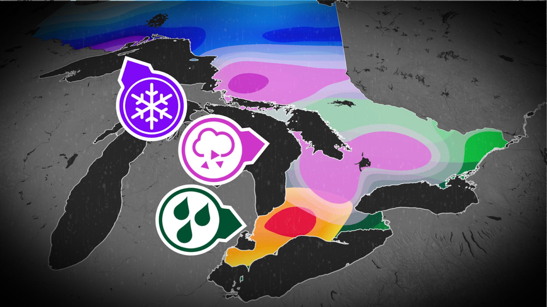
What it's calling a major ice storm south of Ottawa-Gatineau is expected to begin Friday evening, be at its most severe Friday night and end late Sunday.
Freezing rain warnings advertise at least one to two centimetres of ice could build up on communities roughly south of Bancroft, Brockville and Sharbot Lake.
Areas just north of that could get five to 15 millimetres.
The freezing rain may ease for a time on Saturday, according to Environment Canada. It should change to rain Sunday afternoon or evening.
There is a snowfall warning just north of the freezing rain warning. It covers places such as Barry's Bay, Perth and rural south Ottawa and forecasts 10 to 20 centimetres of snow Friday night and Saturday.
Up to a centimetre of freezing rain is then expected on Sunday.
North of that in Cornwall, Pembroke and northern Ottawa, the special weather statement is a mix of those warnings: 10 to 15 centimetres of snow Friday night and Saturday and then up to a centimetre of freezing rain on Sunday.
Freezing rain warnings are likely going to spread to these places, Environment Canada says.
Western Quebec's statement is about five centimetres of snow Friday night, then freezing rain early Sunday.
Forecasters say it should get slippery outside and tree branches could break as ice builds up, putting utilities such as electricity at risk.
Organizations such as Emergency Management Ontario have advice on how to prepare for and manage power outages. CBC Lite is a low-bandwidth version of this website to help stay informed.
Environment Canada also recommends postponing non-essential travel under the freezing rain warnings.