Likely low pressure area may trigger more rain in state: IMD | Bhubaneswar News - Times of India
Bhubaneswar: A low pressure area is likely to form over the Bay of Bengal on May 27 and is likely to intensify further triggering chances of increase in rainfall in the state for three-four days, the IMD forecast on Friday." The possible system, expected over west-central and adjoining north Bay of Bengal, has chances of intensifying further and cause widespread rainfall at many places in the state, covering parts of south, interior and coastal pockets," said Manorama Mohanty, head of the regional IMD centre here.Mohanty said light to moderate rain or thunderstorm would also continue in several districts for five-six days along with low pressure-induced rainfall.
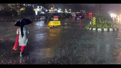
She said thunderstorm accompanied by lightning and gusty surface wind may continue in some districts during the period.On Saturday, thunderstorm accompanied by lightning and gusty surface wind would continue in 12 districts — Mayurbhanj, Keonjhar, Rayagada, Koraput, Malkangiri, Nabarangapur, Kalahandi, Nuapada, Kandhamal, Balangir, Sundargarh and Jharsuguda.Light to moderate rain or thunderstorm occurred at many places in the past 24 hours under influence of a trough line.
There was also heavy rainfall at some places during the period.Gumma in Gajapati district recorded the highest 130 mm of rainfall during the past 24 hours. Champua, Similiguda and Komna in Keonjhar, Koraput and Nuapada districts, respectively, also recorded 100 mm of rainfall or above, the IMD report said.Some places, however, witnessed no relief from hot and humid conditions. Boudh recorded the highest temperature of 37.8 degrees Celsius. The city recorded a maximum of 35.7C.