June 9, 2025 Monday Evening Edition - by Dr. Ryan Maue
Another area of disturbed weather will likely form into a tropical depression by this weekend and become the 4th named storm of the EPAC season. The Atlantic has been quiet — and should remain so for the next 10-14 days.
The next system is Dalila and I’d expect it to fare better than Barbara and Cosme with a higher intensity ceiling over the warm waters south of Mexico.
12z updated ECMWF EPS ensembles are blank for the Atlantic basin through June 24.
A frontal boundary is draped from west Texas into the Southeast and through western NY and PA with rain and storms continuing this evening.
Some scattered storms with heavy rain — may be briefly severe with gusty winds. However, these should die down into the later evening leaving rain as the primary threat.
A storm complex will coalesce out of New Mexico and dip ESE into central Texas sweeping through Austin by early morning.
Rain across the Northeast will continue through the morning.
Heaviest rain in west Texas through the morning … and then along the frontal boundary stalled out across the southern U.S.
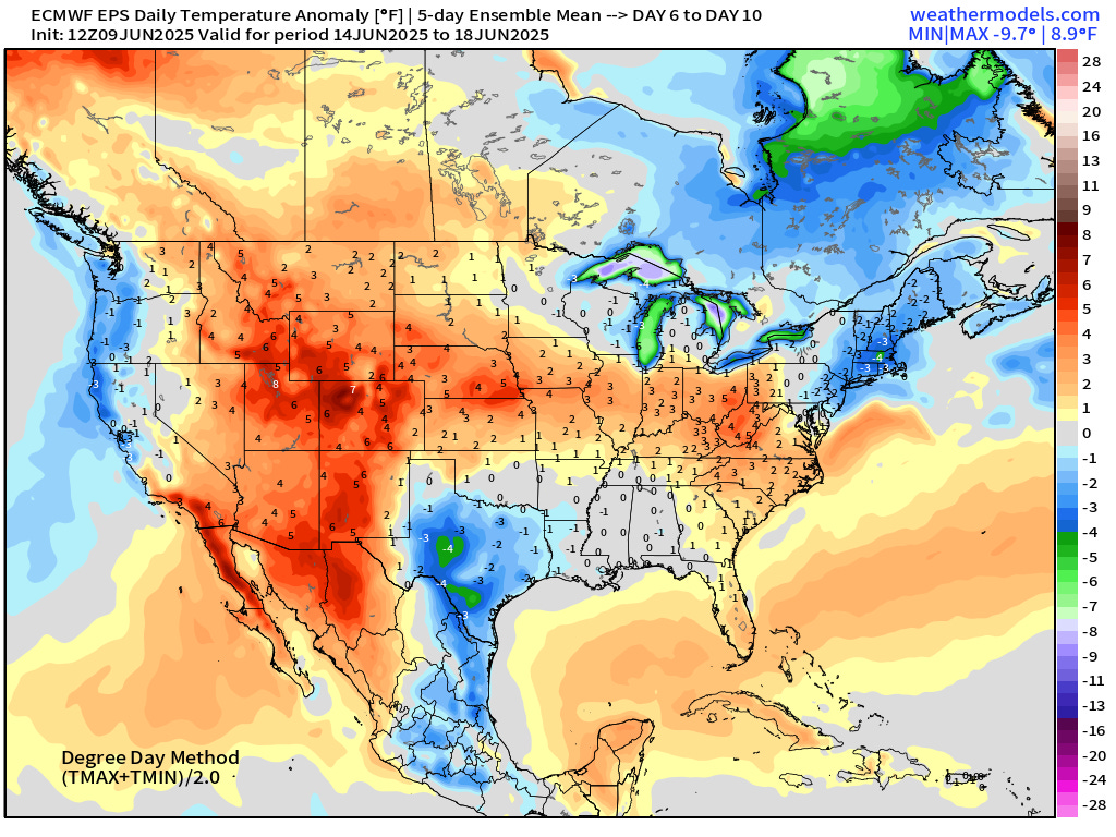
HOT across southeast Washington > 100°F.
Overall the [1991-2020] with considerable heat across the Pacific Northwest > 20°F above normal.
with 217 million at least 80°F, and 64 million above 90°F.
Extreme heat across the Southwest intensifies with Phoenix to 112°F by Sunday.
Wet pattern continues … large area of 1” or more across the Eastern U.S.
Highest totals in Texas, 3 to 5” or more around Austin/San Antonio.
Moisture continues to flow out of the Gulf of Mexico — beaten back by Canadian troughs — then surge northward again on a 3-5 day repeat cycle.
2” PWAT into the Midwest by this weekend = potential for heavy rain.
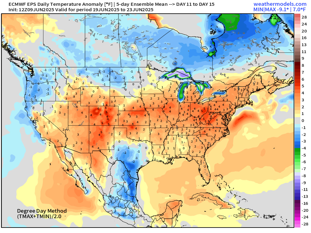
Not seeing a large heat dome across the Lower 48 — except for maybe the U.S. Southwest. However, troughs in Canada easily beat back any high pressure cells + moisture from the south = unsettled conditions for the next 7-10 days+
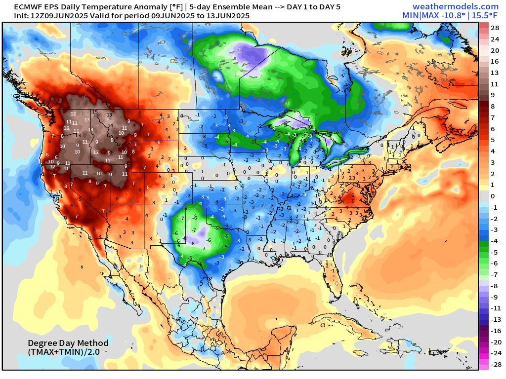
Heat across Pacific Northwest.