Chantal's remnants could fuel storms in Boston amid heat advisory, weather maps show - CBS Boston
/ CBS Boston
Meteorologists discuss heat advisory and potential upcoming storms
The WBZ Weather Team is highlighting today and Tuesday as NEXT Weather Alert days in Massachusetts. This alert is for a combination of heat and humidity as well as a threat for scattered storms fueled by the remnants of Tropical Storm Chantal in the Boston area.
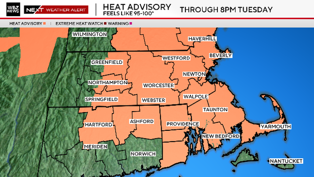
The National Weather Service has posted a heat advisory for most of Southern New England (away from the South Coast) until 8 p.m. Tuesday.
If you are feeling a little déjà vu, the timing of this heat is very similar to that boiling heatwave we had a few weeks ago. That one also started on a Sunday and now, once again, many areas will reach an official heatwave this week (Sunday-Tuesday).
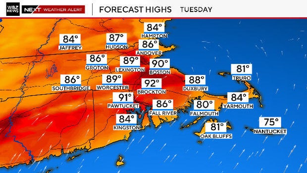
Boston hit a scorching 94 degrees on Sunday and 90 on the nose on Monday. Expect the same on Tuesday with highs right around 90 degrees again. Add in some very "juicy" dewpoints and it will feel close to 100 degrees at times this afternoon as well as Tuesday afternoon.
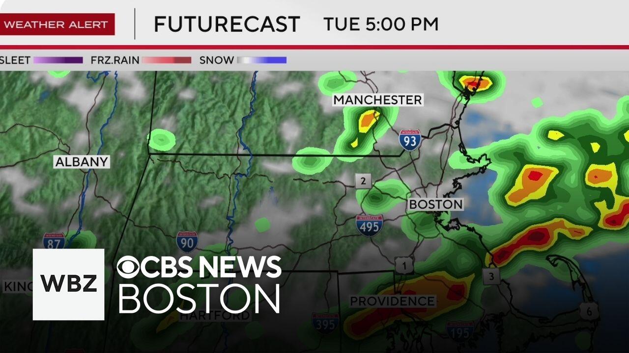
Monday's storm threat is fairly low. There will just be a few isolated downpours here and there through this evening, not expecting any organized severe weather.
The threat is a tad higher on Tuesday and the Storm Prediction Center has placed parts of southern New England in a "marginal" risk for severe weather.
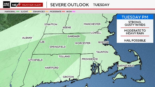
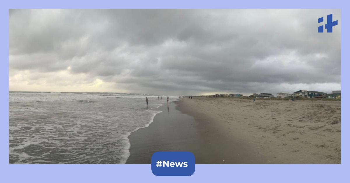
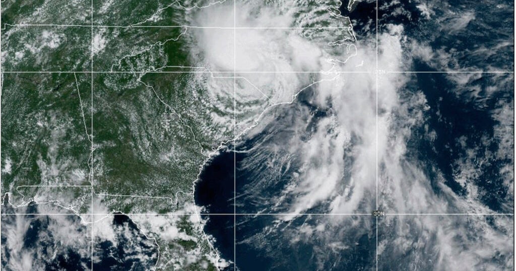
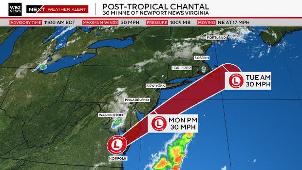
Tuesday's threat is partially due to an approaching cold front and also may be influenced by the departing remnants of Tropical Storm Chantal.
While there isn't much left to Chantal at this point, it could infuse some atmospheric energy into the developing storms on Tuesday afternoon and evening.
As is typical, we will have to watch the skies from mid-afternoon through the evening on Tuesday.
Any storms that do develop could contain some very heavy downpours, frequent lightning and some pockets of wind damage.
Temperatures will tumble on Wednesday and remain largely in the 70s for the remainder of the week.
Each day will feature a mix of sun and clouds as well as a threat for some scattered showers.
Terry Eliasen, Exec. Weather Producer
Terry Eliasen is a meteorologist and executive producer of the WBZ-TV Weather Team. He has worked at WBZ for more than 20 years.


_1751880097.jpeg)