WPC MPD 599
Published 12 hours ago• 3 minute read
WPC Met Watch
Mesoscale Precipitation Discussion: #0599 (Issued at 203 AM EDT Sun Jul 06 2025 )
MPD Selection

Last Updated: 203 AM EDT Sun Jul 06 2025
Mesoscale Precipitation Discussion: #0599 (Issued at 203 AM EDT Sun Jul 06 2025 )
MPD Selection
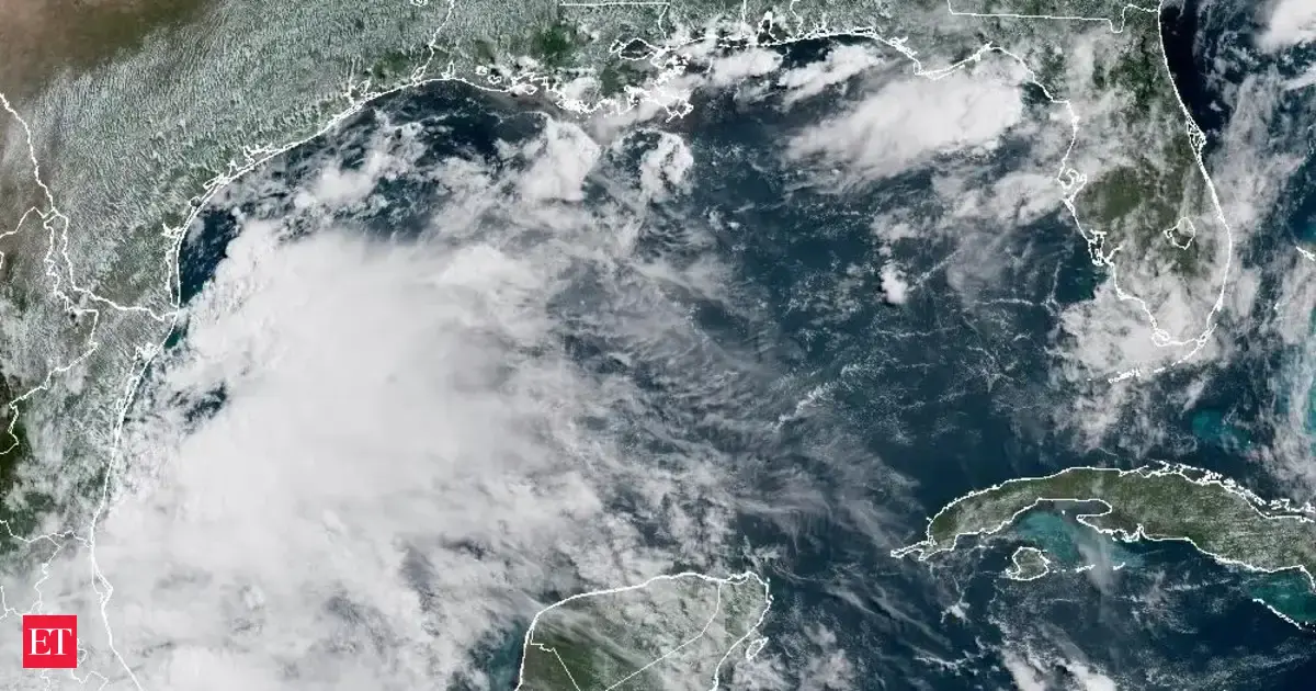
Mesoscale Precipitation Discussion 0599 NWS Weather Prediction Center College Park MD 203 AM EDT Sun Jul 06 2025 Areas affected...coast of northern SC/southern NC Concerning...Heavy rainfall...Flash flooding possible Valid 060602Z - 061200Z SUMMARY...Heavy rain and localized flash flooding will be possible across coastal locations of the Carolinas as T.S. Chantal approaches the northern SC coast tonight. Rainfall rates from 1 to 3 in/hr will be possible along with localized 2-4 inch totals through 12Z. DISCUSSION...T.S. Chantal was located about 35 miles SSE of Myrtle Beach, SC via the latest NHC advisory from 06Z and was moving toward the NNW at 7 kt. Recent GOES East infrared satellite imagery showed the bulk of convection located in its front-right quadrant due to a combination of southerly shear and dry air south of the surface circulation as noted on layered PW imagery. After a burst in colder cloud tops contained within the CDO from late Saturday evening into the early overnight, there has been some minor warming of cloud tops since 05Z from the center of the CDO but recent cooling to the northeast. Local radar imagery from KTLX showed outer bands moving across the northern SC and southern NC coast along with a core of slower moving heavy rain about 25 miles southeast of Myrtle Beach. A curved rain band was becoming better defined to the south of Cape Fear as Chantal's CDO edges closer to the coast, tied to the recent cloud top cooling northeast of the CDO. Increasing rounds of steady heavy rain associated with Chantal are expected to begin moving onshore near the SC/NC border over the next 1-3 hours with increasing potential for 1-2 inches of rain in 30-60 minutes. Rain rates, perhaps as high as 2-3 in/hr, will be possible with slow movement of Chantal's inner core and/or with training from spiral banding to the northeast of the CDO as banding interacts with the coast. While only a small section of southern NC has received above average rainfall over the past week, the rest of the region has been relatively dry and therefore, much of the Coastal Plain of northern SC/southern NC has relatively high flash flood guidance values of 3+ inches in 3 hours. Given antecedent conditions, flash flood potential due to incoming rounds of heavy rainfall appears most likely across urban locations within the Coastal Plain from Myrtle Beach to Wilmington, where potential for 2 to 4 inches of rain will exist through ~12Z. Otto ATTN...WFO...ILM...MHX...RAH... ATTN...RFC...ALR...NWC... LAT...LON 34927824 34927783 34667737 34407730 34097742 33727777 33317850 33097903 33177936 33757957 34297935 34777874Download in GIS format: Shapefile | KML
Loading...
Loading...
You may also like...


Loading...