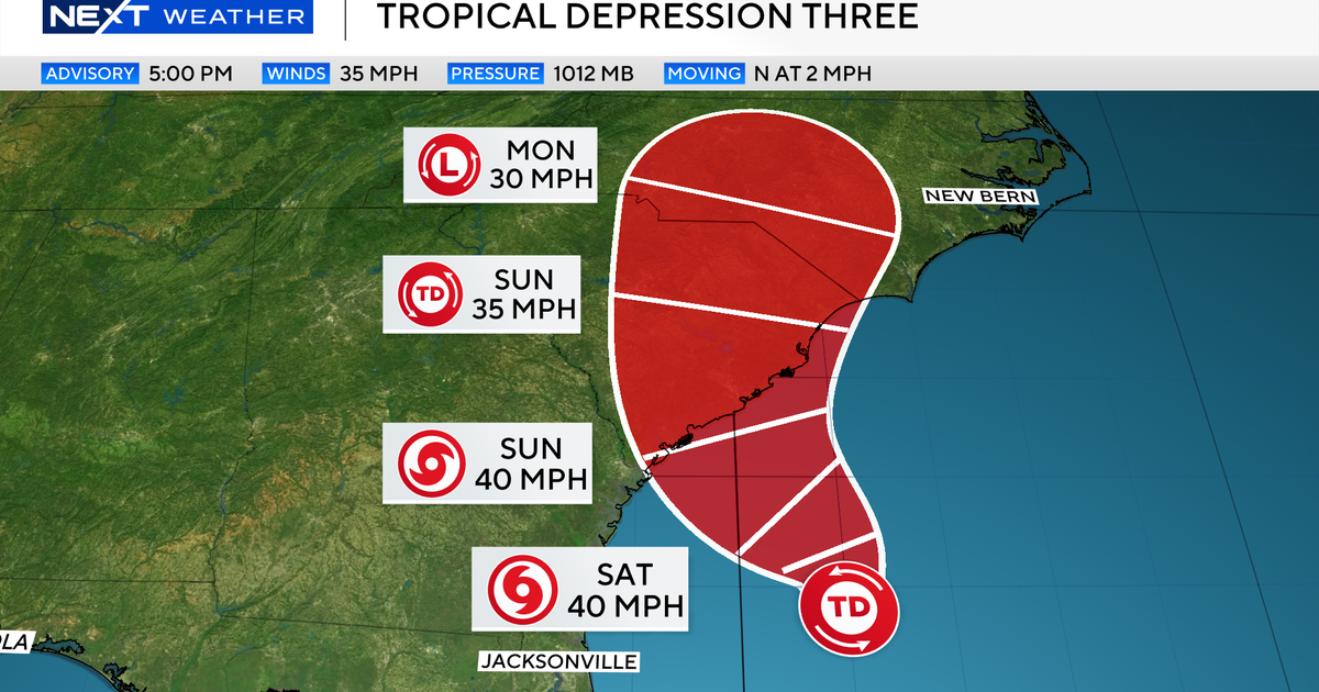
has formed off the Southeast US coast, the
National Hurricane Center (NHC) confirmed on Friday, July 4. A
tropical storm watch is now in effect for parts of South Carolina’s coast. If it strengthens, the depression will become
Tropical Storm Chantal, the third named storm of the 2025 Atlantic hurricane season.The NHC has issued a tropical storm watch from Edisto Beach to Little River Inlet in South Carolina.
Why Florida should be worried as 2025 Hurricane season has an unusual startAs of Friday, 5 p.m. ET, the storm's center was located about 150 miles south-southeast of Charleston, South Carolina. It was moving north at two mph with maximum sustained winds of 35 mph. Tropical storm status begins at 39 mph.
An Air Force Reserve Hurricane Hunter aircraft was en route to investigate the storm and provide more data.
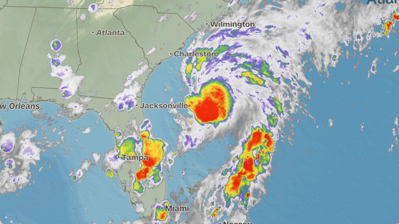
Even if it doesn't become Chantal, the system is expected to bring stormy weather to areas from Florida to the Carolinas, according to Weather dot com.
The National Weather Service in Jacksonville, Florida, warned of slick roads, heavy downpours, and possible flooding in low-lying areas.
Michael Lowry, a hurricane specialist at WPLG 10 in Miami, said heavy rainfall will be the biggest risk along the Georgia and Carolina coasts this weekend.
Lowry said the storm is expected to pick up speed by Tuesday or Wednesday and move northward along the Eastern Seaboard. After that, forecasters say the Atlantic should remain quiet for the rest of the week.
If it is named, Chantal would follow Tropical Storms Andrea and Barry earlier this year.
NOAA has predicted a busier-than-normal hurricane season in 2025. Up to 19 named storms are possible, compared to the average of 14 per season, based on data from 1991 to 2020.