Tropical storm warnings extended up to North Carolina as Chantal approaches - ABC News
This is the third named storm of the Atlantic season.
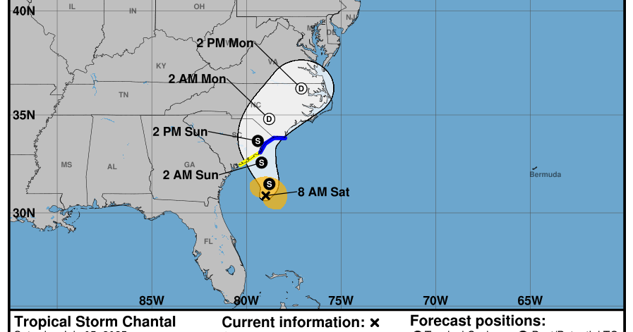
Tropical storm warnings have been extended up to Surf City, North Carolina, as Tropical Storm Chantal is offshore from the southeastern U.S. on Saturday, according to the National Hurricane Center.
The storm has maximum sustained winds of up to 45 mph and is moving north at just 7 mph.
The center of the storm is located about 95 miles southeast of Charleston, South Carolina.
Scattered showers and thunderstorms from Chantal's outer bands are impacting portions of the South and North Carolina coastline Saturday afternoon along with increasing rough surf and dangerous rip currents.

ABC News
Chantal is forecast to continue tracking north toward South Carolina later Saturday.
Chantal could strengthen a bit more before making landfall, likely somewhere along the South Carolina coast during the early morning hours on Sunday.
The storm will continue to pick up forward speed as it approaches the coast and will rapidly weaken after landfall.
Tropical storm conditions are expected to begin Saturday evening for portions of the Carolina coastline from South Santee River to Surf City, where the Tropical Storm Warning is in effect.
Tropical storm conditions are possible beginning later Saturday south of the South Santee River to Edisto Beach in South Carolina where the Tropical Storm Watch is in effect.

ABC News

ABC News
Heavy rainfall across the coastal Carolinas will cause some flash flooding through Monday, with storm total rainfall of 2 to 4 inches and local amounts up to 6 inches expected for the Carolinas.
Chantal will bring minor storm surge for parts of the Carolina coastline, with between 1 to 3 feet of storm surge possible for coastal areas under the Tropical Storm Warning.
The system is also expected to bring life-threatening surf and rip currents along parts of the East Coast from northeastern Florida to the Mid-Atlantic states over the next couple of days.

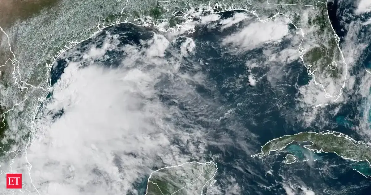
This image provided by NOAA shows Tropical Storm Chantal forming off the coast of the Carolinas on July 5, 2025.
NOAA via AP
The third named storm of the Atlantic hurricane season forms on average around Aug. 3, according to the National Hurricane Center.