Showers linger over North Texas, keeping temperatures in the low 90s - CBS Texas
/ CBS Texas
Some isolated showers, clouds linger as temperatures hit mid-90s in North Texas
Welcome to July, North Texans!
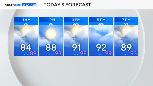
Showers and some non-severe storms moved south from Oklahoma Monday evening and lingered into Tuesday morning for areas west of I-35.
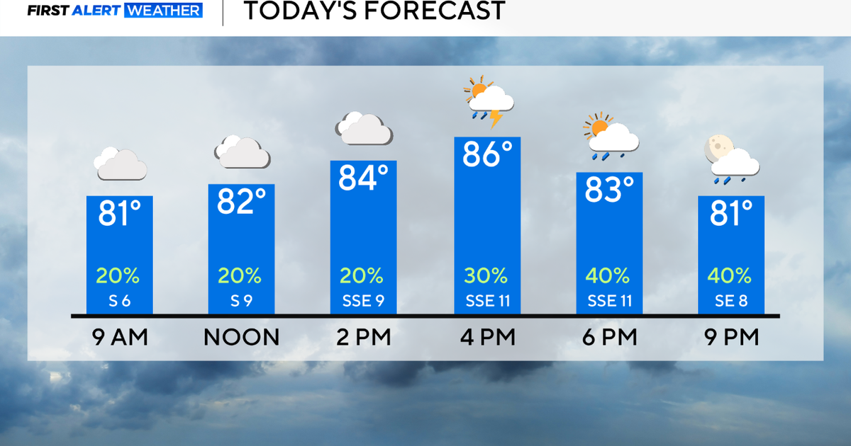
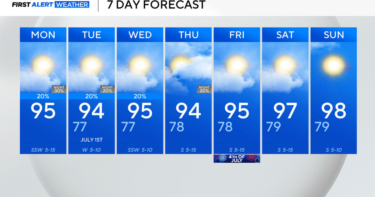
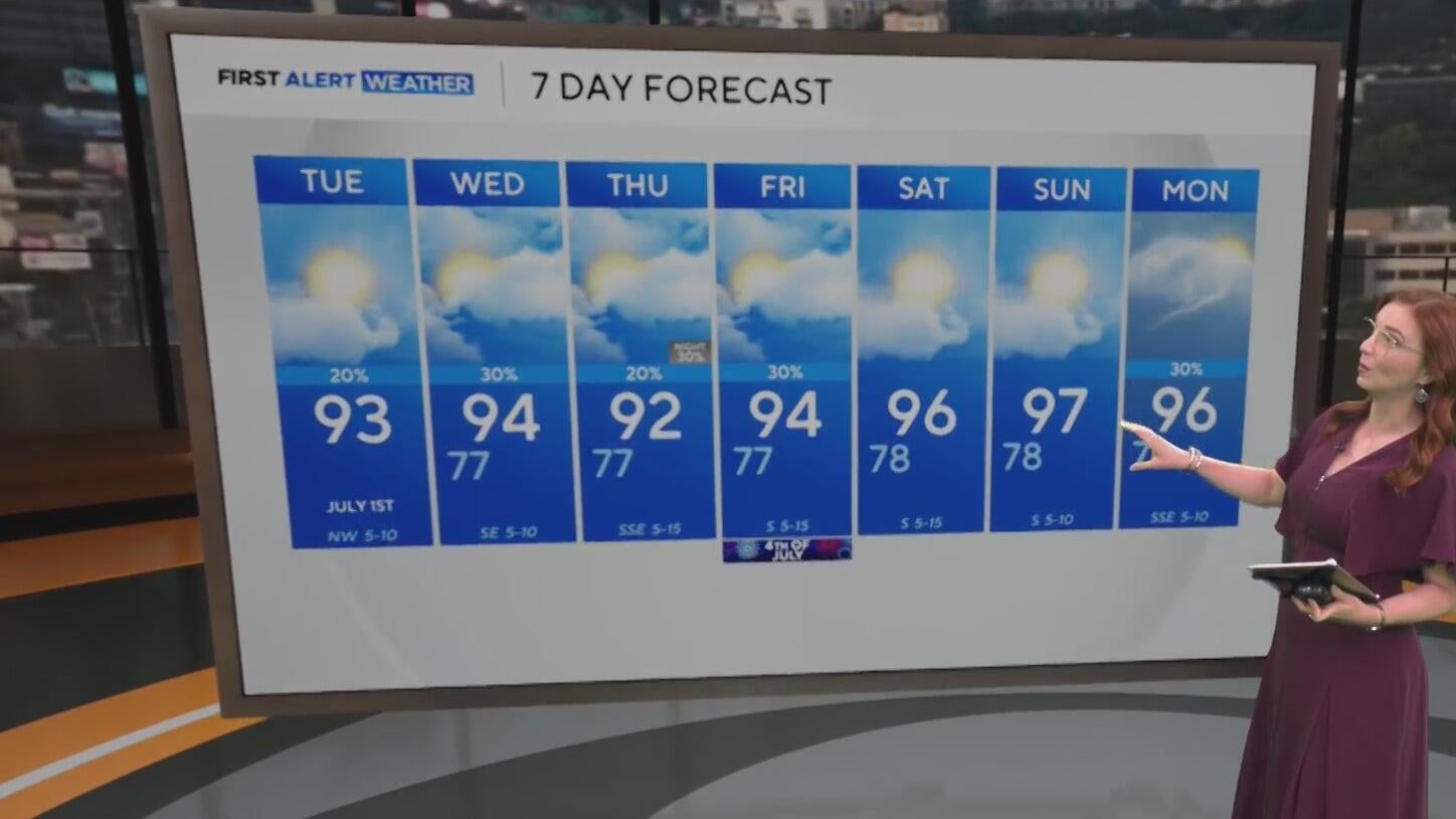
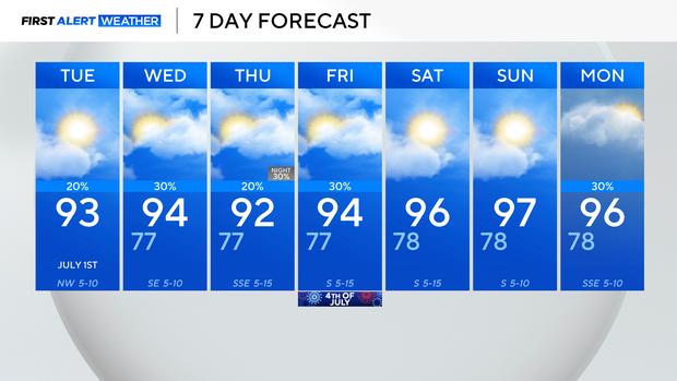
As a weak frontal boundary lingers over the area, spotty showers will continue through Wednesday. The best rain chances are for areas west of I-35, and only about 20%-30%.
The additional cloud cover will keep temperatures seasonal in the lower 90s on Tuesday afternoon.
We will be watching for more moisture to move up from the south Thursday evening into Friday morning, keeping the low-end rain chances in the forecast.
It looks like cloud cover will greet us Friday morning, with a few showers on First Alert radar, and then give way to afternoon sunshine.
High pressure strengthens on Saturday and Sunday, boosting temperatures a few degrees and keeping skies brighter.
Brittany fell in love with weather at a young age watching the sea breeze storms develop every afternoon in Tampa, Florida. She knew her career needed to entail weather and decided becoming a broadcast meteorologist was the path for her.