Shelf clouds and wall clouds | Hey Ray - CBS Pittsburgh
/ CBS Pittsburgh
Hey Ray: Shelf clouds and wall clouds
We have another question to answer!
Jim asks: "Hey, Ray, I recently heard about shelf clouds. They are an eerie sight indeed! Can you give a brief synopsis of how these fronts form?"
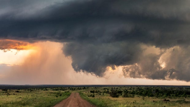
Shelf clouds do look scary, especially knowing they are attached to a thunderstorm. Thunderstorms are essentially systems that move heat and moisture. Big updrafts feed that heat and moisture into a storm to fuel it. As the moisture cools and condenses high up in the storm, rain and even hail form.
When the rain and hail are too heavy for the updrafts to keep them suspended, they fall.
I know we have been sort of talking about a dramatic version of the water cycle so far, but this falling of precipitation is what sets up the shelf cloud!
Precipitation isn't the only thing moving from high up in the storm to the ground. That precipitation drags down cooler air from higher in the atmosphere.
That cold air races out ahead of the storm, essentially creating what we would call a gust front.

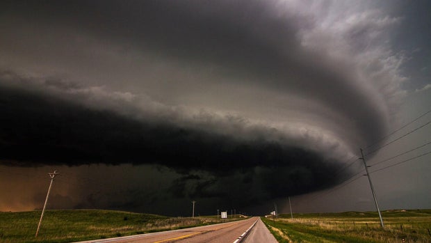
As this cold air races ahead of the storm, it forces air that is warmer and has a higher moisture content upward. This movement causes the air to condense into a cloud that sticks out from the front of the storm. This is the shelf cloud!
If you ever see a shelf cloud, you should expect gusty winds at the very least.
Since they are connected to a thunderstorm, they should act as a warning to get inside and wait out the storm. The gust front can bring strong winds, and the thunderstorm that follows will likely have lightning and thunder.
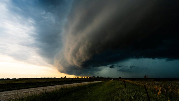
These storms may appear to rotate, too. This rotation sometimes has them confused with wall clouds.
A shelf cloud, according to the National Weather Service, will rotate horizontally. A more dangerous wall cloud will appear to rotate vertically and be at the base of the storm in a rain-free area.
Usually behind the rain. These wall clouds are precursors to tornadoes, but storms with shelf clouds still can spin up a tornado, too.
Great question, Jim! These clouds can look scary and should be taken seriously.
Meteorologist Ray Petelin joined the KDKA Weather Team in October 2018, but is no stranger to the weather in Pittsburgh and Western Pennsylvania. He has been forecasting in Pittsburgh since 2011 and in Western PA since January of 2003.