Hot weather in Pittsburgh remains on Sunday as storm chances loom on Monday - CBS Pittsburgh
/ CBS Pittsburgh
KDKA-TV Morning Forecast (7/6)
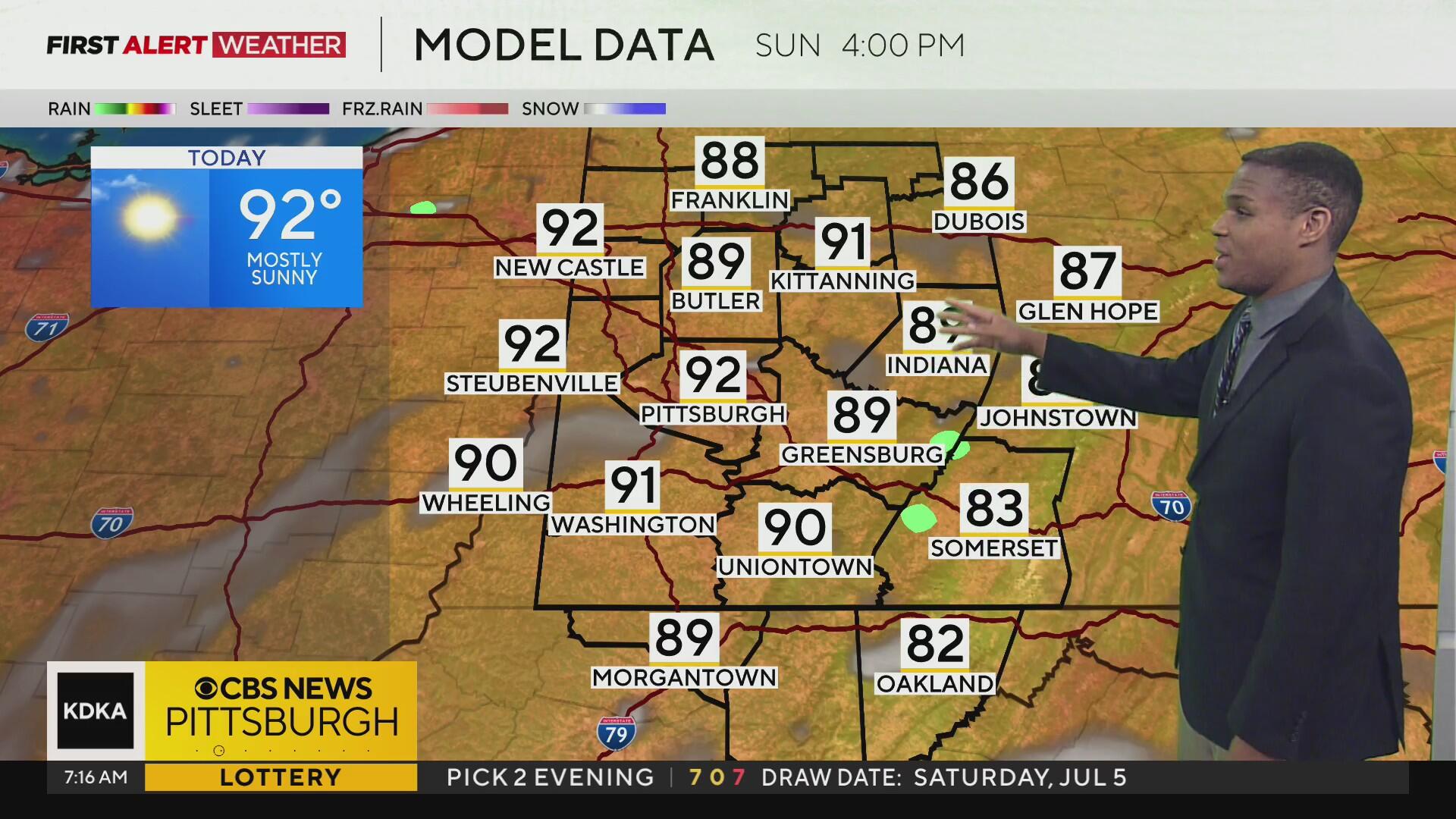
Sunday morning begins with slightly above-normal temperatures across most of Western Pennsylvania and Northern West Virginia, with temperatures that have struggled so far to drop below 70°F in the Pittsburgh metro area overnight.
Current Conditions | School Closings & Delays | Submit Your Weather Photos
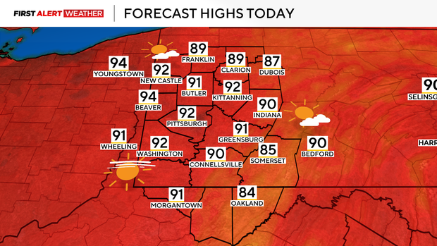
Today will be another hot one with southwest winds aiding our warmup with highs reaching the lower 90s.
Our region will be fixated within a flattening ridge of high pressure and Tropical Storm Chantal moving ashore to the Carolinas, which will amplify sinking air aloft, leaving us with mostly sunny to partly cloudy skies and overall dry conditions.
Despite air temperatures reaching the low 90s today, dew points holding steady and relative humidity dropping as temperatures heat up should keep heat index values out of the danger zone, largely in the mid to upper 90s. Individuals should still stay well hydrated while being outdoors, and those sensitive to the heat should take frequent breaks or avoid being outside during the hottest part of the day.
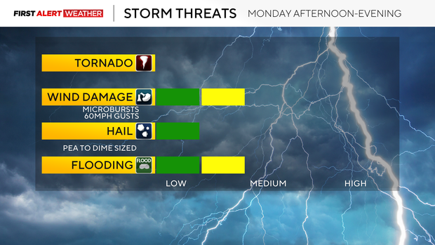
One more hot afternoon is expected Monday ahead of a trough moving in from the northwest by early evening. This trough will be forcing a decaying cold front in our direction, which will lead to scattered showers and storms developing along and ahead of the boundary.
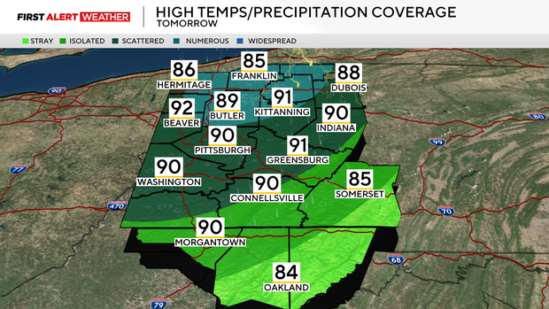
Expect development to occur by 1-2 p.m. in our northwest Pennsylvania counties before activity progresses south and east through the mid-late afternoon and early evening. While widespread severe weather is not expected, storms will be capable of producing microbursts with localized wind gusts up to 60mph, sub-severe or small hail, and very heavy rain. Moisture levels in the atmosphere are projected to be on the upper end to near daily record max levels by early evening, which will support a heavy rain threat with storms. Isolated 1-2" amounts are possible, which could cause flash flooding.
By Monday night into Tuesday, this cold front should move into the Laurel Highlands/Ridges and begin to fall apart over this area by Tuesday morning. The remnant boundary will likely induce some showers and storms Tuesday afternoon and evening, especially from Pittsburgh and points southeast.
Generally, dry conditions are likely from Tuesday evening through Wednesday afternoon, but our next system will approach by Wednesday evening with a low chance of storms.
More scattered storms are expected Wednesday night and Thursday as a slow-moving trough moves across our region. We will likely keep an unsettled pattern going into the end of the week with daily low afternoon storm chances through Saturday, but not all locations will see rain every day.
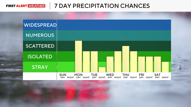
Temperatures will largely remain above normal with highs in the mid to upper 80s and lows in the mid to upper 60s.

Stay up to date with the KDKA Mobile App – which you can download here!