Hot weather in Philadelphia will spark extreme heat warning Sunday-Wednesday as temperatures reach 100 - CBS Philadelphia
/ CBS Philadelphia
Philadelphia region's first heat wave of the year has arrived. Here's what to know.
Our first heat wave of the year is here in the Philadelphia area, and it will continue through Thursday with heat that will at times reach dangerous levels.
As a reminder, three consecutive days at or above 90 is considered a heat wave. Highs Saturday will hover in the low 90s in the city. Plan on plenty of humidity with heat indices feeling like 95.
Temperatures peak in the 80s at the Jersey Shore and Delaware beaches.
This heat is being felt across a large swath of the country and by Sunday, an estimated 140 million Americans will be under the highest level of extreme heat alerts. CBS News shared maps of the heat wave showing how forecast highs are tracking much higher than normal.
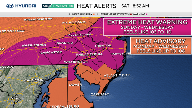
The National Weather Service has issued an extreme heat warning for these counties in the Philadelphia region from 8 a.m. Sunday to 8 p.m. Wednesday:
Sunday, the heat reaches dangerous levels with highs in the upper 90s and overnight lows near 80. The feels-like heat index will range from 102-105.
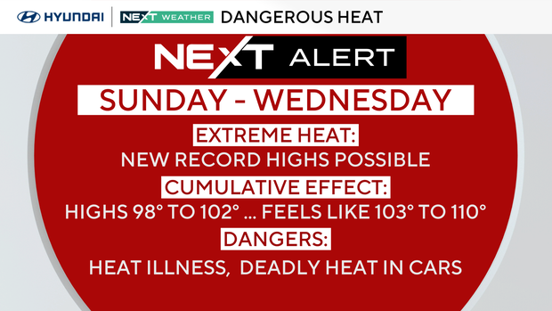
Because of this dangerous heat, a NEXT Weather Alert is in place Sunday through Wednesday.
This dangerous heat will continue through Wednesday with highs Monday, Tuesday, and Wednesday either side of 100 degrees and heat indices that could feel as hot as 110.
We also have a heat advisory in effect in these counties from 8 a.m. Monday to 8 p.m. Tuesday:
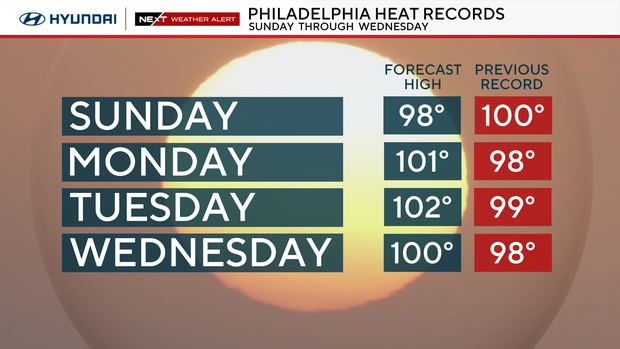
It is likely we will set some new record highs each day and could have potentially record high low temperatures at night.
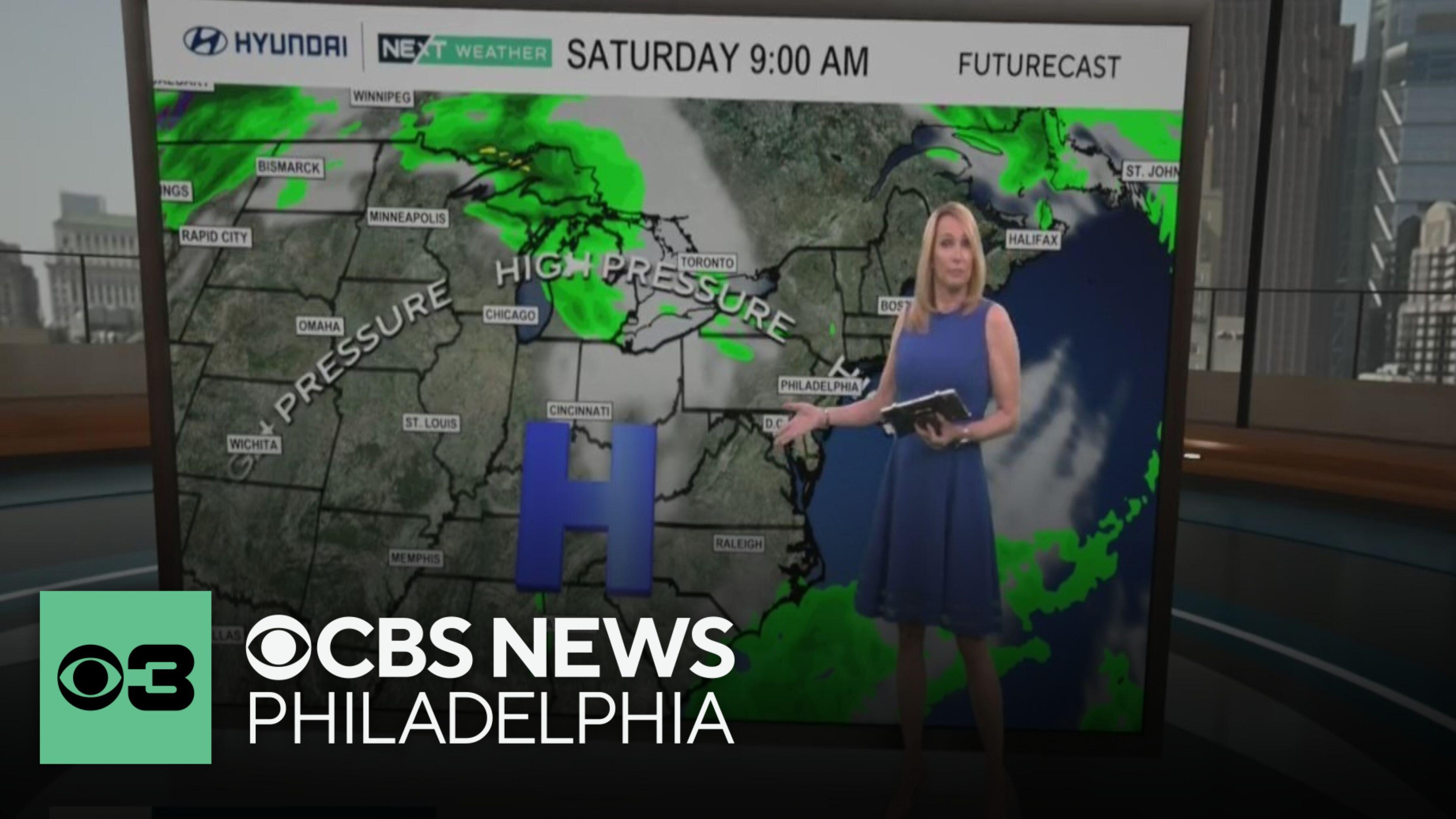
No organized storms are headed our way, and it should be dry through next Thursday. However, there is a chance of pop-up storms each day simply because of the available energy with the heat and humidity.
At these triple-digit temperatures and feels-like temperatures, heatstroke and heat exhaustion are possible. The cumulative effect of the extreme heat over 6 days can lead to additional health problems. Temperatures will not cool much overnight, providing little relief.
Make sure to hydrate with nonalcoholic and non-sugary drinks. Spend time in the air conditioning and if overheated, try a cool shower.
Never leave people or pets in a car, the heat builds quickly, and it can be deadly in minutes. Check on family and friends. Finally, keep pets indoors or in a shaded area with clean, cool water. Don't walk dogs on the hot pavement, their paws can burn.

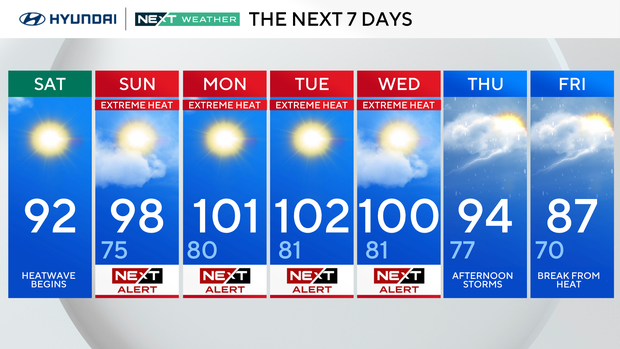
Heat wave begins. High 92
Extreme heat moves in. High 98, Low 75
Potentially record-breaking heat. High 101, Low 80
Day 4 of heat wave. High 102, Low 81
High 100, Low 81
Storms on potential last day of heat wave. HIgh 94, Low 77
Break from the heat. High 87, Low 70