Heavy storms in Philadelphia area on Monday could cause flash flooding | NEXT Weather - CBS Philadelphia
/ CBS Philadelphia
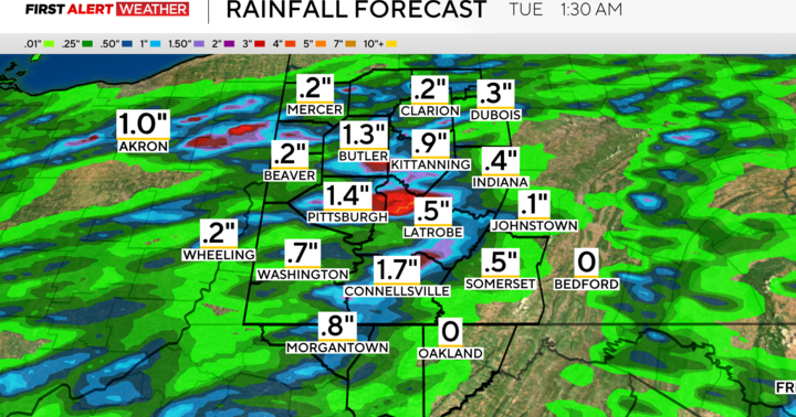
Remnants of Chantal to bring heavy rain with risk of flash flooding | NEXT Weather
Get ready for a bit of an unsettled week ahead in the Philadelphia area. Each day will be humid, with highs in the upper 80s to near 90 degrees, and a chance of showers or thunderstorms. So, consider this your official "Umbrella Alert" for the week.
Monday's rain differs from the rest of the week because it will be the remnants of Tropical Storm Chantal.
A few showers and storms will start to fire up midday, but it's really later this afternoon and evening that storms will become more widespread and heavier, especially to the south.
This system moves across Delaware later tonight, bringing heavy rain and downpours triggered even further north, up toward the city.
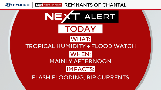
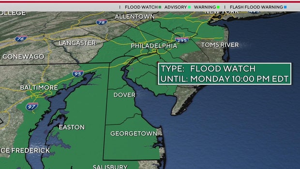
These storms could dump locally heavy rain and pose a threat for localized and even flash flooding. The National Weather Service has issued a Flood Watch for much of the area from 10 a.m. to 10 p.m.
In addition, we will be feeling tropical moisture and humidity today and tomorrow as Chantal moves out and a cold front approaches.
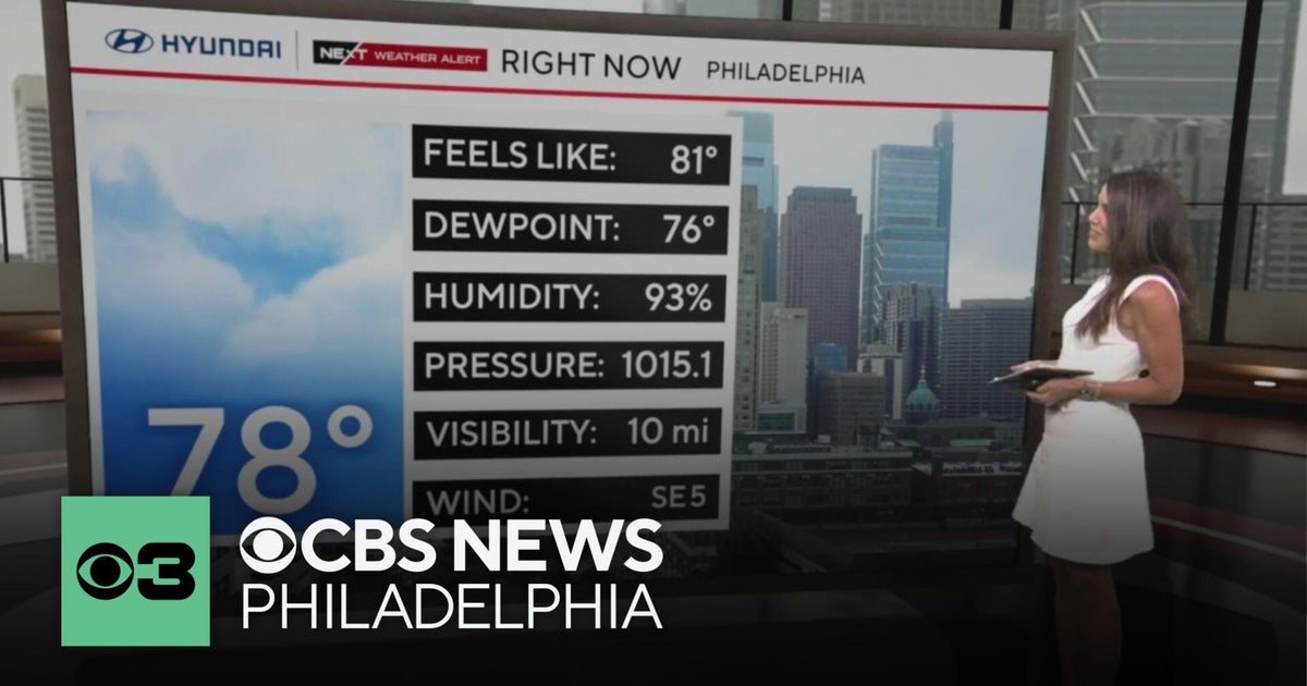
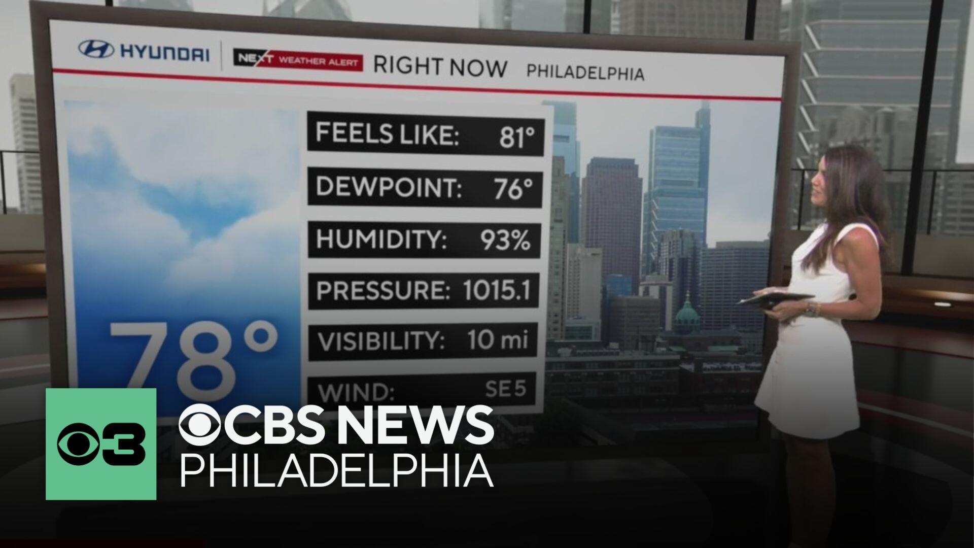
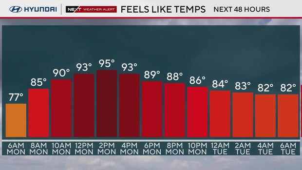
Today's highs are in the mid-80s and will feel like mid-90s. On Tuesday, with more sunshine, the heat index values could reach 103-104, prompting a heat advisory for areas surrounding Philadelphia. Tuesday once again brings the chance for scattered storms in the afternoon and evening, though they will be more widely scattered.
Humidity remains high throughout the workweek, with showers and storm chances present each day.
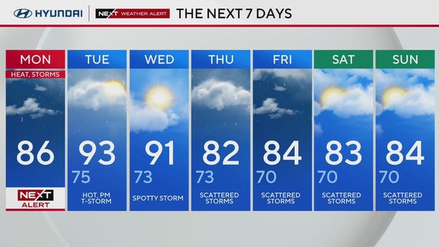
Scattered storms. High 86, Low 75.
Thunderstorms. High 93, Low 75.
Spotty storms. High 91, Low 73.
: Scattered storms. High 82, Low 73.
: Scattered storms, High 84, Low 70.
Scattered storms. High 83, Low 70.
Scattered storms. High 84, Low 70.


_1751880097.jpeg)