First Alert Day: Heavy rains bring possibility of flooding due to Tropical Storm Chantal - NewsBreak
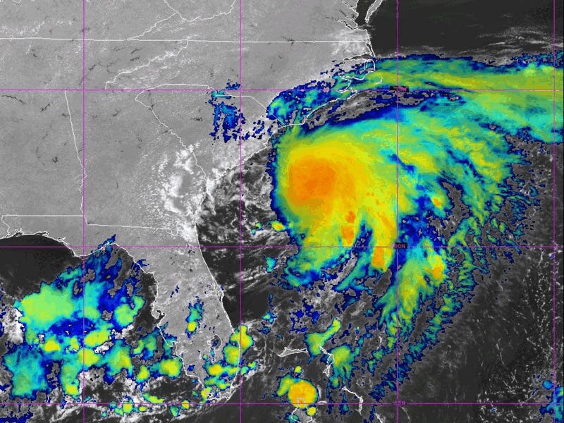
Tropical Storm Chantal made landfall Sunday morning in South Carolina.
In addition to soaking parts of the North Carolina coast, bands of heavy rain are expected to impact as far inland as central NC. The area can expect rounds of heavy rain on Sunday morning and again in the afternoon.

There is a level 1 and a level 2 risk for flooding across the state on Sunday as rain move through. Flash flooding is the greatest threat we need to be on alert for.


Temperatures will reach the mid-80s on Sunday.
A spotty shower Monday, mainly along and east of I-95, then just a stray storm Tuesday and hot too with feels-like temperatures over 100 degrees.
The middle of the work week will feature a very active pattern with afternoon and evening storms possible Wednesday through Friday.
Highs will be in the low 90s each day with humid conditions.