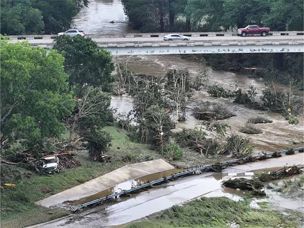
What caused the Texas flooding - and could it happen on LI?
The flooding that killed at least 37 people and left others missing Friday in Texas Hill Country was unexpected and terrifying.
Long Island is not immune to torrential rains and sudden flooding either, although it is rare. Most of Long Island’s significant flooding events have been associated with the remnants of tropical storms, like Ida and Floyd. But two extreme events — one last August on the North Shore, another in August 2014 that dumped 13.57 inches of rain at MacArthur Airport in Ronkonkoma in 24 hours — did not have such tropical connections, just a “stalling pattern” where intense rain bands did not move much, so the same spots got hit very hard.
Meteorologist Rich Von Ohlen explains what happened in Texas and what can happen here.
A small-scale weather feature known as an MCV, or mesoscale convective vortex. It’s basically a swirling, vortex-like circulation that typically spans 30 to 60 miles in diameter and can persist for many hours, even days. MCVs can cause extreme flooding and severe storms, and their impacts are exacerbated by the speed at which they move. The slower the movement, the more time an area sees significant impacts.
This is exactly what just happened in central Texas.
This was northwest of San Antonio. A number of small towns saw anywhere from 8 to 13 inches of rain in less than 48 hours.
The highest total recorded from NOAA (the National Oceanic and Atmospheric Administration) was around 20 inches, near the town of Kerrville, where fatalities from drowning and missing residents were reported. Local river levels rose to unprecedented levels, nearly 6 feet higher than normal.
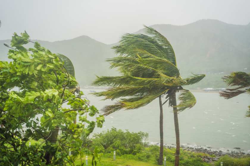
Yes, but likely with a different setup. Long Island extreme flooding is typically more affected by the Atlantic Ocean, and persistent winds from the south that bring in large amounts of moisture, especially during the summer and fall when sea surface temperatures are at their highest (anywhere between 65 and 80 degrees).
Any convergence of winds at different levels of our atmosphere can create those large, tropical-type towering clouds, which are more common in places like Florida. If these clouds don't move much east-west or north-south and stay in one spot, they can dump huge amounts of heavy rain over the same areas, causing massive flooding. It’s happened before and will probably happen again. It’s just a matter of when and where.
Long Island should always be on guard for these potential disasters. The NOAA flooding safety awareness page provides excellent education on how communities can anticipate and prepare ahead of potential significant flooding.
The general warming we’ve experienced could be contributing to these localized yet extreme events. Typically, storms spread out and distribute their energy, and resulting wind and rain, across a broader area. That means a larger amount of real estate “shares” the wealth of the impacts, and you don’t typically see the unprecedented numbers. However, when these meso-storms compact and distribute the same amount of rain/energy over a smaller (and unlucky) area, those local towns and areas get devastated.
Yes! Hurricane Harvey moved inland back in 2017, stalled, and caused massive rainfall, flooding and devastation near the Houston area. Some spots saw over 4 feet of rain in just over 48 hours.
The stalling of any weather systems, combined with more heating in the atmosphere and a persistent wind flow from a moist source (typically the Gulf) is a terrible recipe for devastating storms, rain and deadly flooding.

NewsdayTV's Elisa DiStefano has your guide to Fourth of July fun across Long Island.