Tropical Storm Chantal Has Formed - Where Is It Headed?
Tropical Storm Chantal on the morning of July 5, 2025.
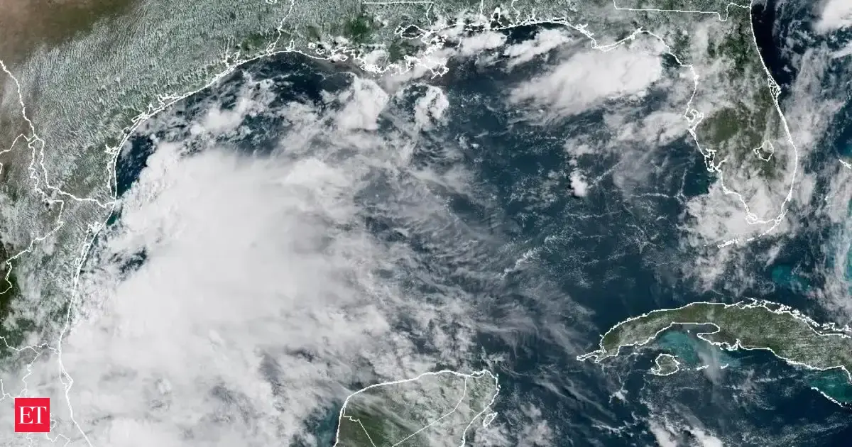
NOAA and Tropical Tidbits websiteTropical Storm Chantal, the third named storm of the Atlantic hurricane season, has formed off the coast of South Carolina. At 8 EDT on July 5, 2025, the storm had maximum sustained winds of 40 mph and was slowly drifting north at 2 mph. Here are the latest details about the storm as we move further into the July 4th weekend.
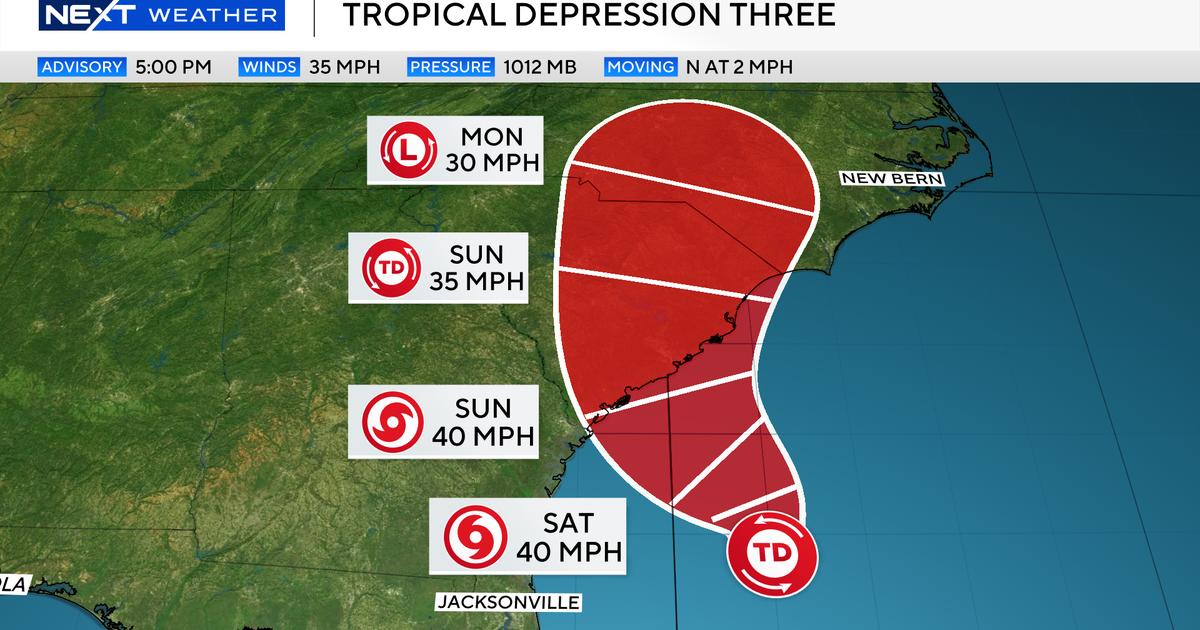
Tropical Storm Chantal formed on July 5, 2025.
NOAAWhile many people vacationing along the Georgia and South Carolina coast may be surprised by Tropical Storm Chantal, we have been signaling all week that this storm would likely form. On Thursday, I wrote in this very platform, “If this low forms and overperforms to reach named status, it would be called Chantal.” Tropical storm watches were issued on the 4th of July, and the system is expected to make landfall Saturday or early Sunday perhaps just south of the border between South Carolina and North Carolina. If there is one surprising aspect, we typically do not expect the third named storm to form in the Atlantic basin until early August.
At the time of writing on Saturday morning, the National Hurricane Center advisory stated, “A Tropical Storm Warning is in effect for…* South Santee River, SC to Cape Fear, NC…. A Tropical Storm Watch is in effect for…* Edisto Beach to South Santee River, SC.” A warning means conditions are expected in the next 12 to 24 hours.
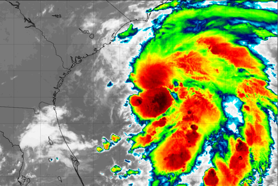
Rainfall potential with Tropical Storm Chantal.
NOAAThe most dangerous aspects of this particularly storm will be rainfall. Between 2 and 6 inches of rainfall could fall from Charleston, South Carolina to Hatteras, North Carolina. Locations near the border of the Carolinas could also deal with flash flooding so be prepared.
Rip current risks with Tropical Storm Chantal.
NOAAI am always concerned about the rip current hazard with these types of storms too. NOAA has placed the portions of coastal Georgia, South Carolina, and North Carolina under a “high” rip current risk. It is also important to remind readers that tropical storm winds or gusts can extend well away from the center of the storm. Once the storm moves inland, it should weaken, but lingering rainfall in the region.
Probability of tropical storm winds.
NOAA