Pittsburgh's temperatures will warm up this week with wildfire smoke likely - CBS Pittsburgh
/ CBS Pittsburgh
KDKA-TV Morning Forecast (6/1)
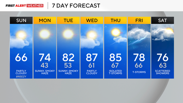
Yesterday's highs struggled to make it out of the 50s for most of Western Pa.
Current Conditions | School Closings & Delays | Submit Your Weather Photos
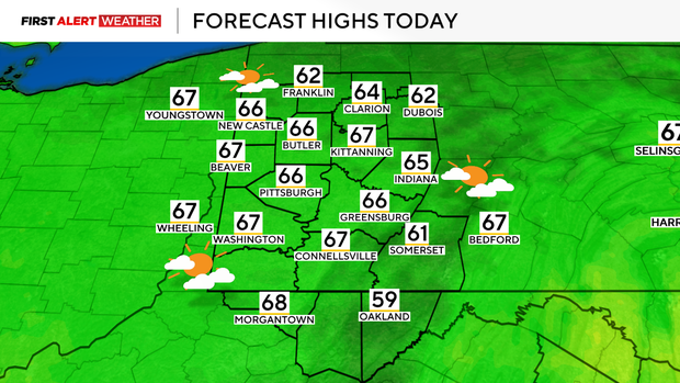
This morning, June begins with an unseasonably chilly air mass across the region, with temperatures hovering in the upper 30s to mid-40s for most locations. The strongest cold air advection following yesterday's frontal passage has weakened. This, along with some more sun, will allow highs to easily reach the low to mid-60s for most today, which is still several degrees below normal.
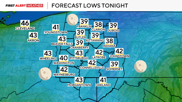
As high pressure settles in tonight, skies will clear and temperatures will once again drop into the low 40s for most, with a few spots possibly in the upper 30s for Monday morning.
There is an increasing potential for the Northern Lights to be viewed in our area after sunset through sunrise tomorrow due to a strong geomagnetic storm and its associated solar wind energizing particles in Earth's thermosphere.
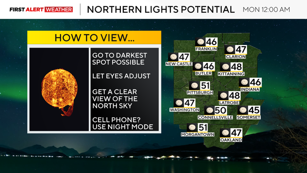
As always, there is high uncertainty in the timing of when the northern lights will be most viewable, but those interested should keep an eye out between sunset tonight and Monday morning, and possibly again Monday night into Tuesday morning if the solar storm continues long enough. Skies should be free of clouds, and wildfire smoke should be out of the air, promoting optimal viewing.
It will be cool as well with temperatures quickly dropping into the 50s and 40s after sunset.
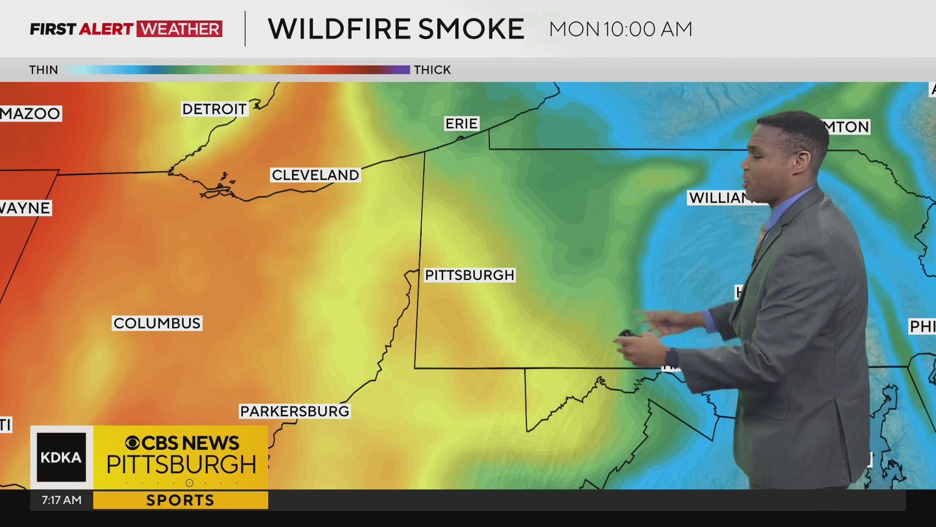
Speaking of wildfire smoke, we will be watching a mass of Canadian wildfire smoke that has been in place across the Upper Midwest to slowly migrate eastward by Monday into Tuesday. This will leave a large part of our area with hazy skies Monday, Tuesday, and possibly Wednesday.
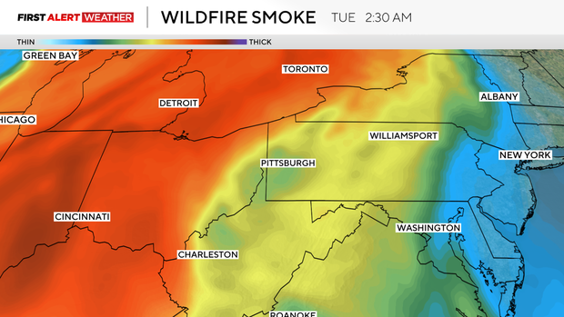
As of now, it appears that the smoke should remain aloft in the atmosphere on Monday, but sinking air Monday night into Tuesday could allow for some smoke to mix down to the surface, creating air quality issues.
Outside of the smoke, temperatures will warm back to well above normal levels through the middle part of the week, although the smoke could mute how high temperatures could theoretically reach. Mid to upper 80s are likely on Wednesday and Thursday.
A series of disturbances and a slow-moving frontal boundary will bring a chance of showers and storms beginning in Northwest Pa., on Thursday.
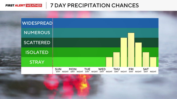
The better chance of rain and storms looks to be on Friday as the front moves across our area. Right now, this doesn't appear to be a classic severe weather setup, but we are in peak season, so this does bear watching.
Stay up to date with the KDKA Mobile App – which you can download here!