Pittsburgh could see isolated thunderstorms before a dry and comfortable 4th of July - CBS Pittsburgh
/ CBS Pittsburgh
KDKA-TV Morning Forecast (7/3)
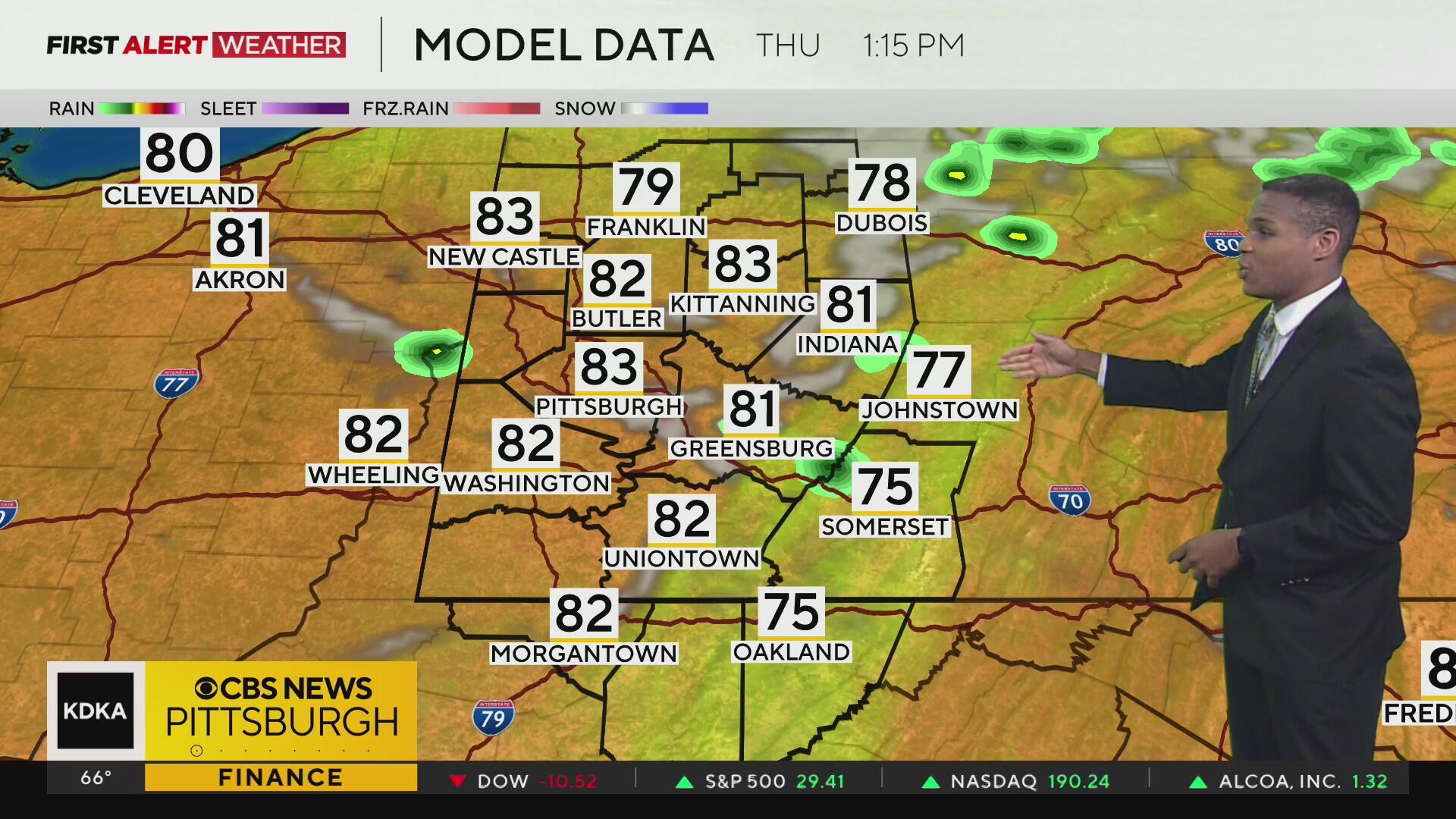
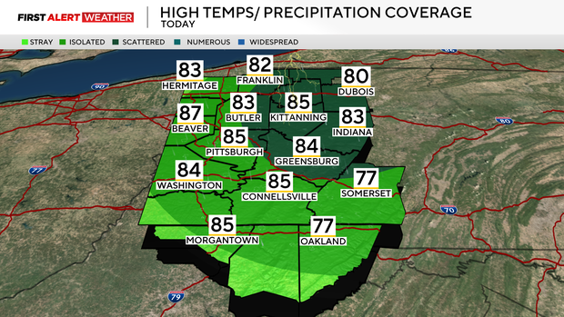
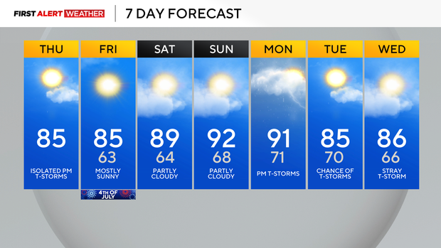
Thursday morning begins on a seasonably mild note across all of Western Pennsylvania and Northern West Virginia. Skies are mostly clear to partly cloudy, with more clouds and even a few isolated showers around our I-80 counties.
Current Conditions | School Closings & Delays | Submit Your Weather Photos
These clouds and showers are part of a weak but fast-moving upper-level disturbance and cold front that will move across our region later today.
The strongest lift and jet stream winds with this system will likely pass northeast of Pittsburgh into Central Pennsylvania, but this will still be close enough to give us a chance for some isolated afternoon and evening thunderstorms. Sufficient instability and some wind shear will support a risk of hail and strong downburst winds with one or two cells that are really able to pulse up.
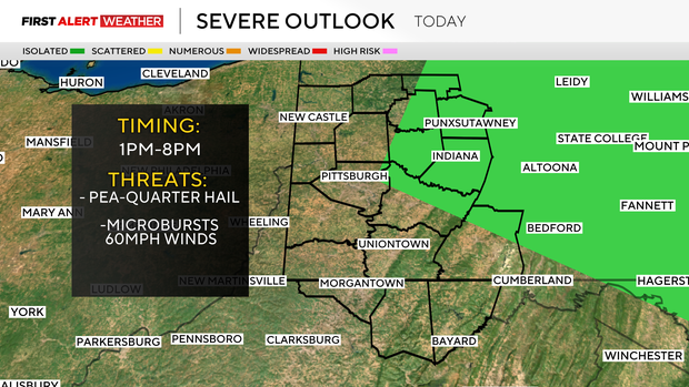
Storm coverage will diminish as the front passes by this evening, and with a loss of daytime heating.
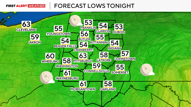
Overnight into Friday, skies will clear out and temperatures will be seasonable for the Fourth. No weather issues are expected for those who are doing outdoor activities or watching fireworks.
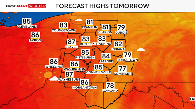
By Saturday, as high pressure moves east and winds shift to the southwest, we expect a warmer and more humid air mass to move in. Highs on Saturday and Sunday will be in the upper 80s to near 90, with the most likely days to see 90+ highs on Sunday and Monday as well.
The heat dome that builds in this weekend will not be as strong or long-lived compared to the one last week, so this stretch of 90s will be brief and eventually capped off with a chance of storms late Monday afternoon into Tuesday.
As always, any summer storms will be capable of producing downburst winds and small hail. Our pattern will remain slightly unsettled with daily low storm chances into the middle of next week.
Stay up to date with the KDKA Mobile App – which you can download here!