May 28, 2025 Wednesday Tropical Update
The ECMWF HRES (control) IVT model simulation for the next 10-days does not show anything spinning w/tropical designation across the Atlantic. However, the interaction between various features could eventually spin up a system in line with June climatology. The surge of moisture into the Caribbean will head into the Gulf of Mexico and be steered by the subtropical ridge to the east of Florida.
The Bermuda high strengthens. This pattern with strong easterly flow is typical for June in the Main Development Region (MDR) from the Lesser Antilles to Africa, but the water temperatures at the surface (SST) are still too chilly for development until July.
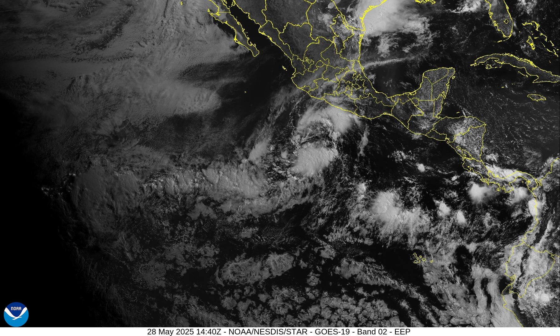
Two tropical waves that failed to develop in the Atlantic will have their chance in the Eastern Pacific.
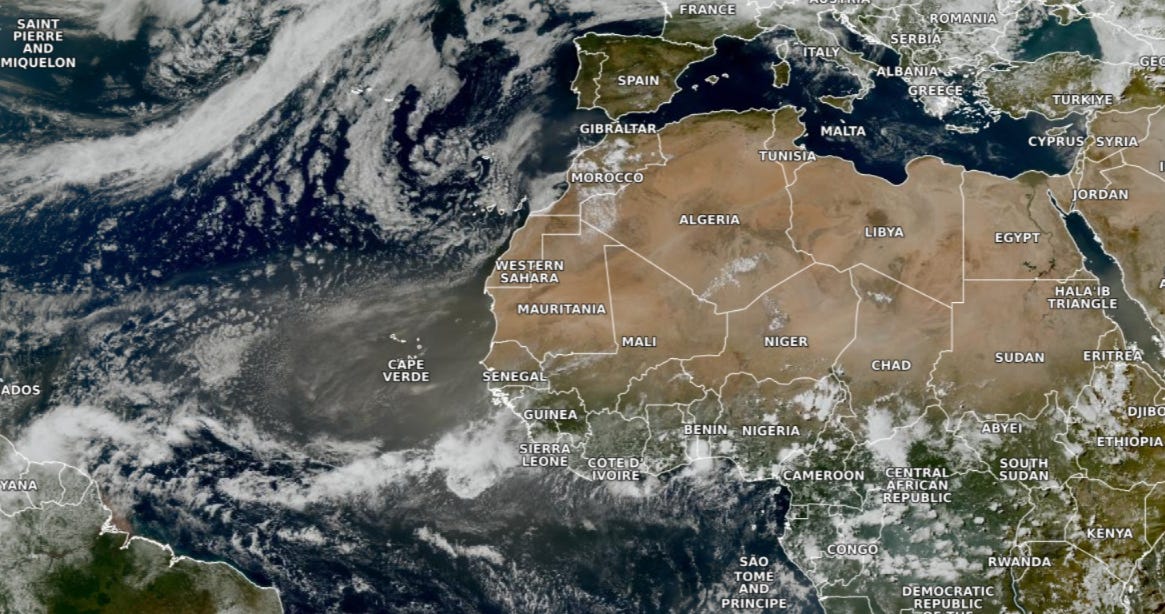

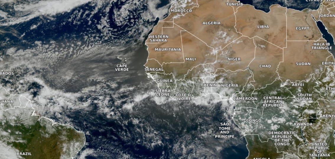
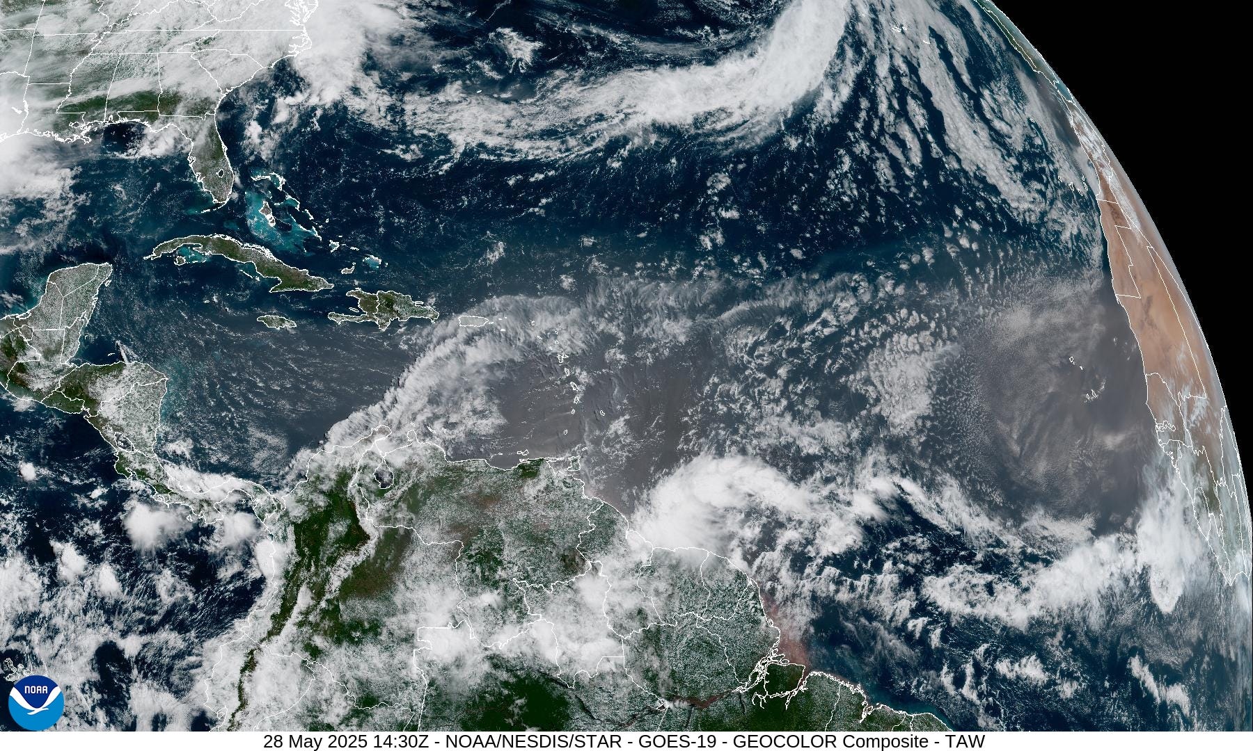
Our dust cloud over Cape Verde Islands is thick and shows well in the “true color” satellite imagery as a brown haze.
The monsoon trough to the south of the dust off Sierra Leone is generating strong convection. Tropical waves over the continent have waned with convective coverage, but will track west over the next several days — African Easterly Wave Train.
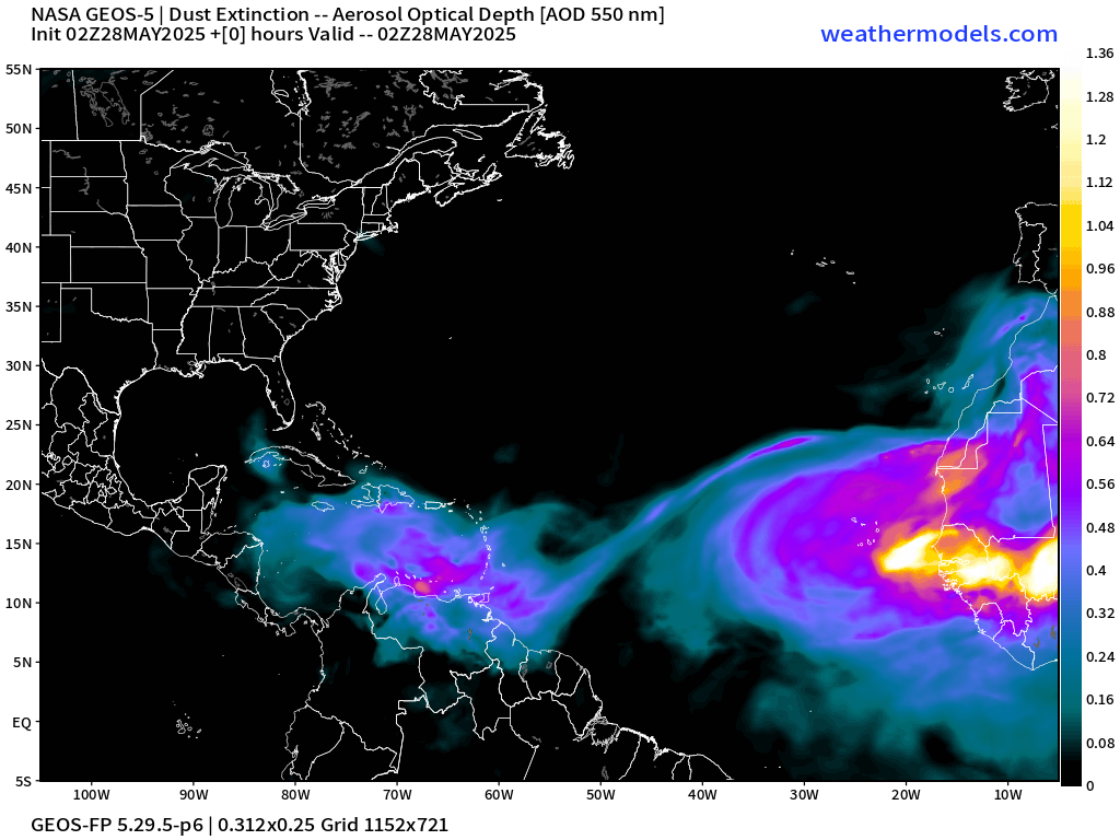
SAL + dust in the Caribbean will enter the Gulf before being diluted — fertilizing the ocean for the critters.
The major SAL spins clockwise (anti-cyclonically) into Cuba and Bahamas by middle of next week. Then, a break in SAL plumes for several days.
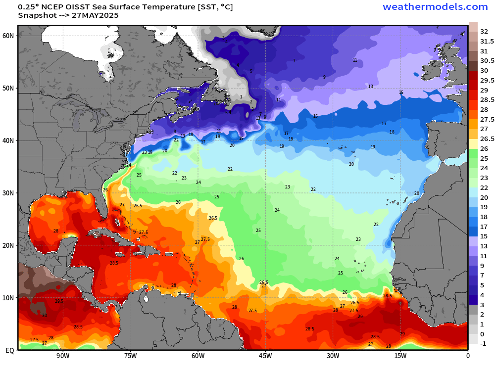
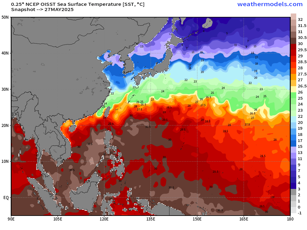
Actual sea-surface temperatures < 26°C won’t support tropical storm genesis through normal convective pathways shutting off the MDR for a while. The Gulf and Caribbean are open for business with 28°C surface water available.
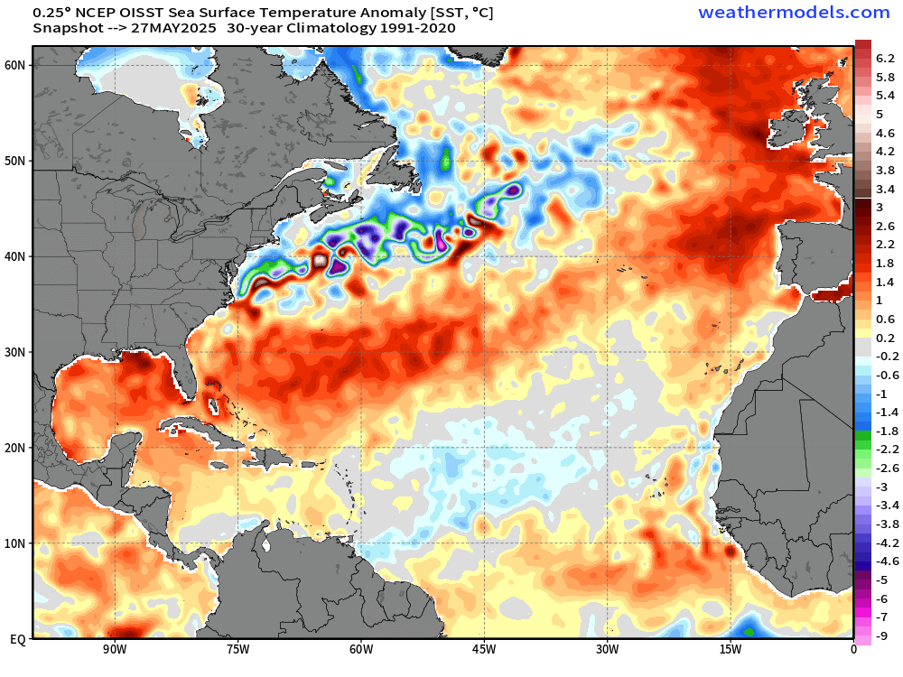
Anomaly (compared to 1991-2020) is 1-2°C above normal across the Gulf and into the Southwest Atlantic off the coast of Florida to Bermuda. However, even if it’s warmer than normal, the actual T is still < 26°C.
actual Sea-Surface Temperatures (SST) help form and intensify tropical storms and hurricanes NOT the anomaly. We need sustained 26°C SST for typical tropical pathway storm development. You can see the green (under 26°C) extends still to 10°N latitude = too chilly for typical MDR development, but that will warm over the next 2-weeks to be viable.
The Caribbean is already (always) warm enough for a major hurricane (28°C). The Gulf is still chilly across the northern half of the basin.
As the boreal summer season comes into view, we see the warming of the Northern Hemisphere tropics and middle latitudes ocean temperatures — usually!
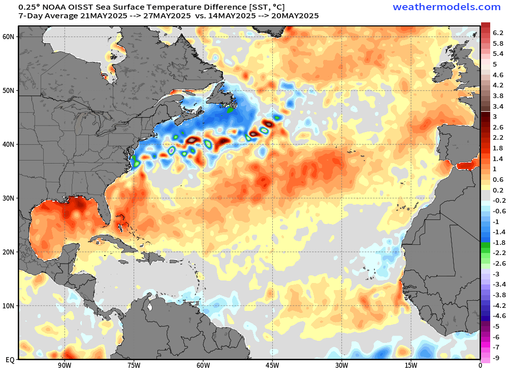
However, in this map which compares the change in ACTUAL temperatures — not anomaly — no climatology is here — we see extensive cooling of SSTs off the East Coast of the U.S. up to off Nova Scotia. Actual SST is 3°C or less — bone chilling cold.
The Gulf of Mexico has warmed significantly over the past week as well as the central subtropical Atlantic. The Caribbean has remained static. We’ll see how the SAL impacts the SST change in the coming days.
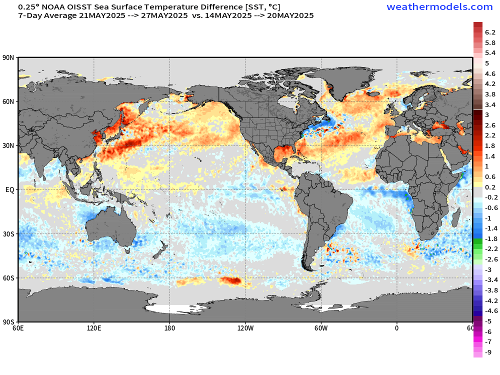
The entire globe shows you the advance of the seasons with the Southern Hemisphere cooler — especially in the tropical Atlantic along the Equator — Atlantic Niña.

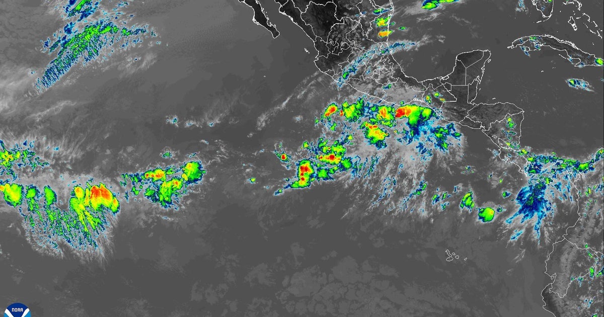
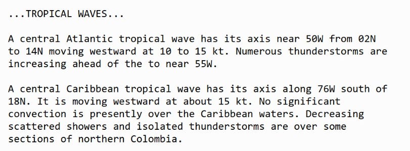
Two tropical waves — one heading through southern Caribbean nearing Panama has lost most of its convection. However, strong convection with tropical wave approaching northern South America still at a low latitude of 5°N. Tropical depression is not going to happen but if the wave holds together over the coming 5-days, it could emerge in the Eastern Pacific more apt to develop right away.
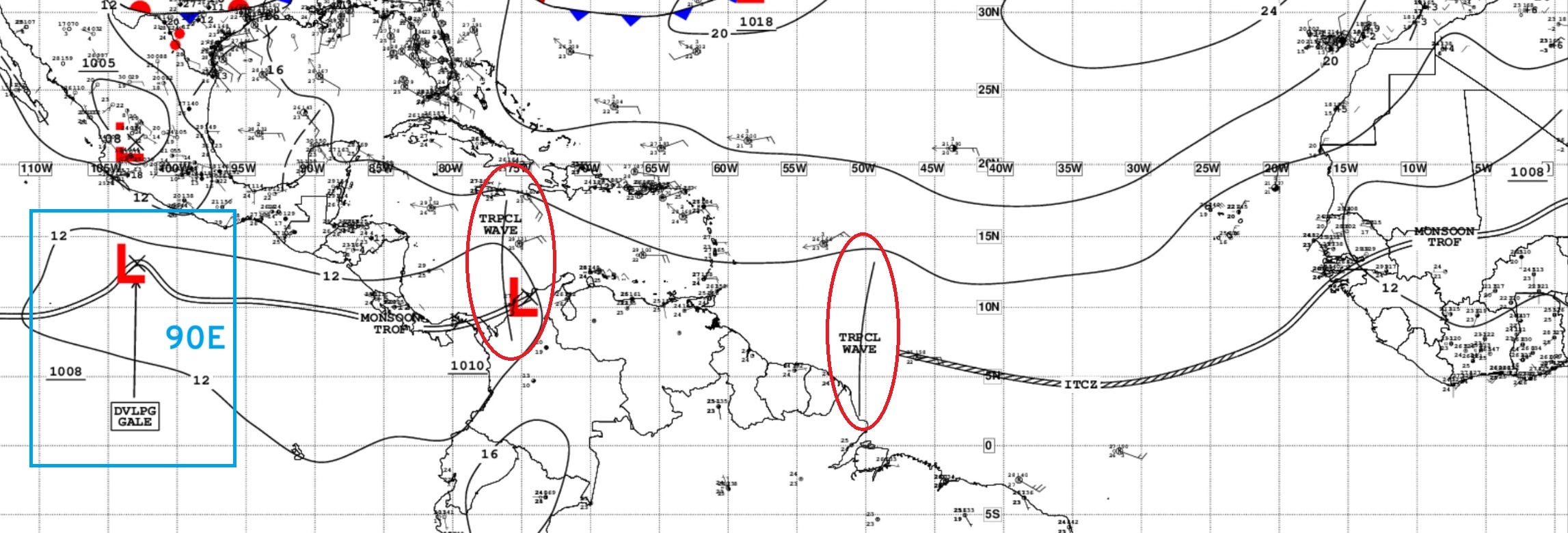
However, no tropical development expected. But these systems can provide the seedlings for Eastern Pacific hurricanes in 10-14 days from their emergence off African coast.
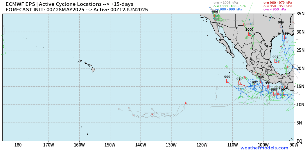
No tropical storm activity on the map
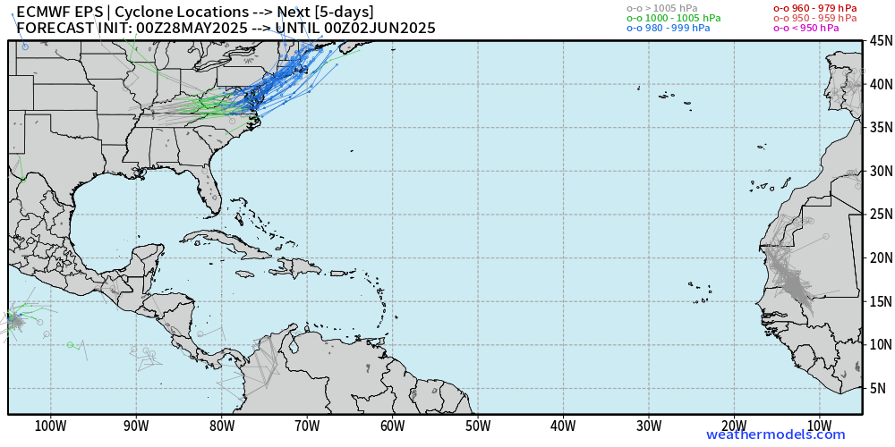
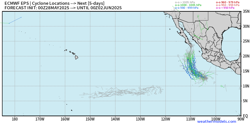
10 or so tracks in the Gulf of Mexico coming out of the Caribbean = 20% chance of development within this model ensemble.
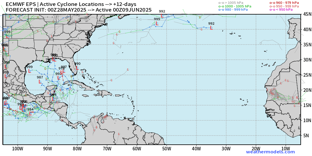
A few more ensembles pop up with low pressure centers surrounding Central America. This is typical for mid-June with a Caribbean / Gyre + favorable sub-seasonal forcing (MJO).
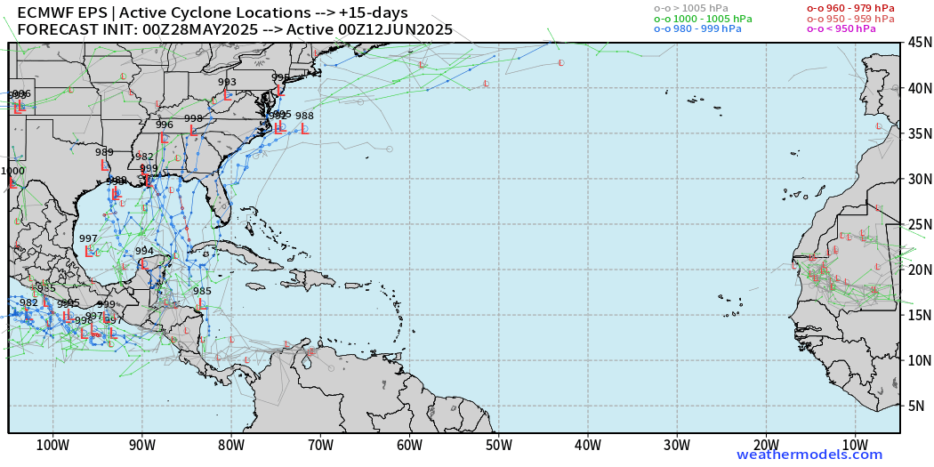
However, nothing imminent for the next 7-days as confirmed by NHC Tropical Outlook
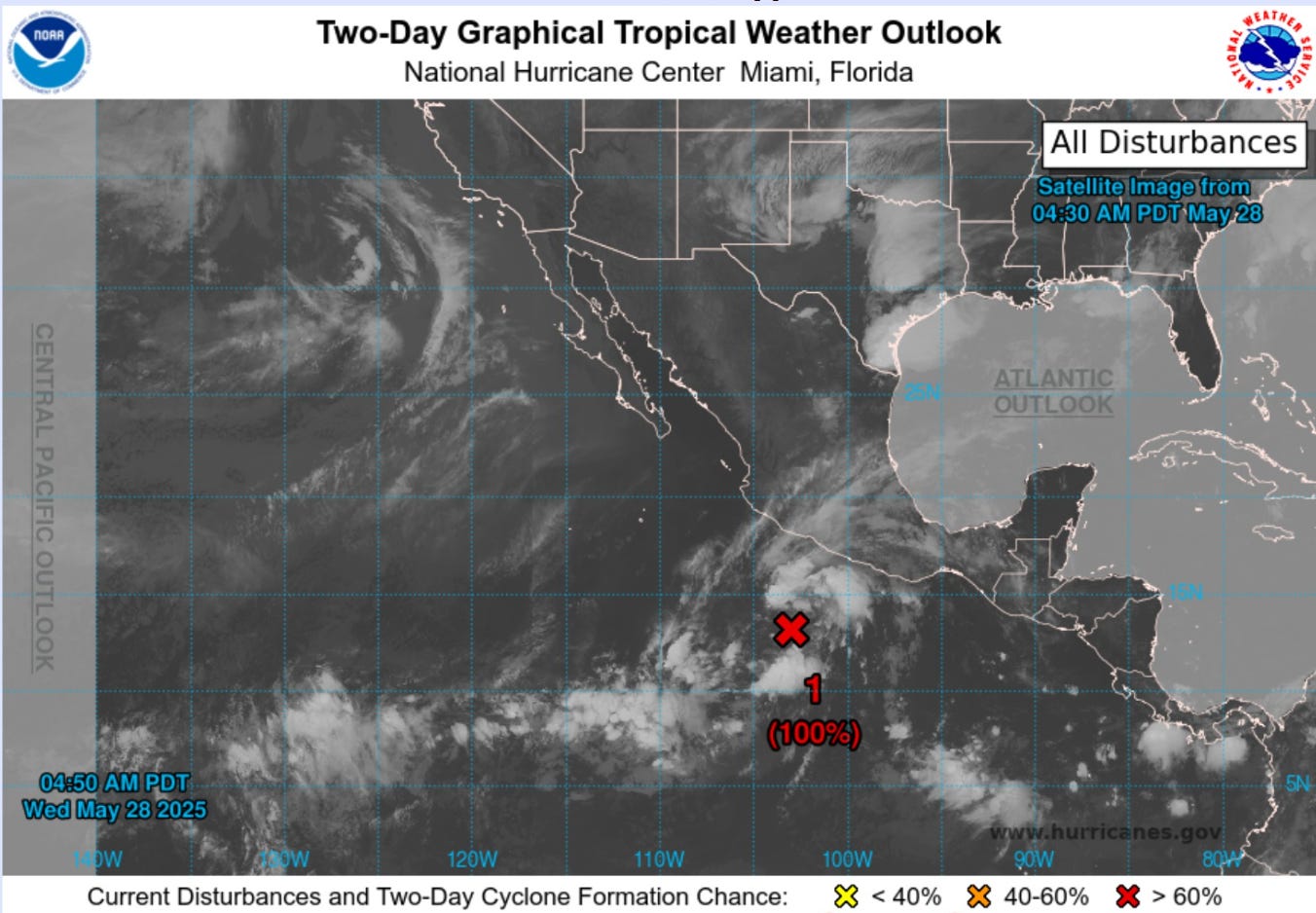
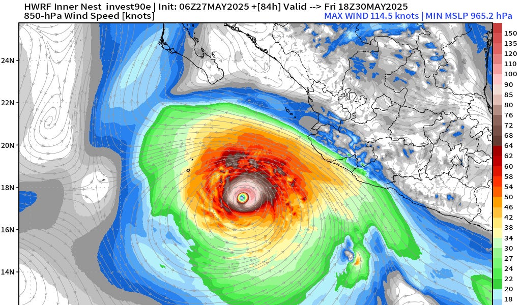
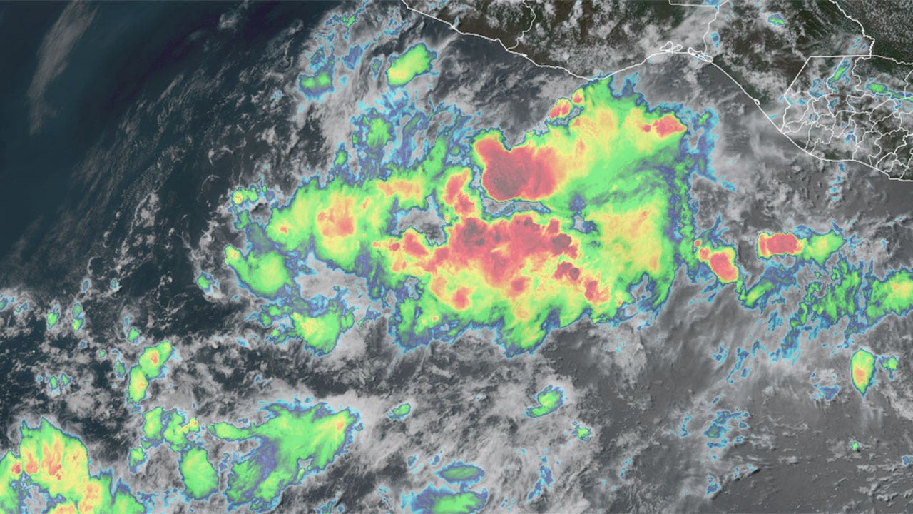
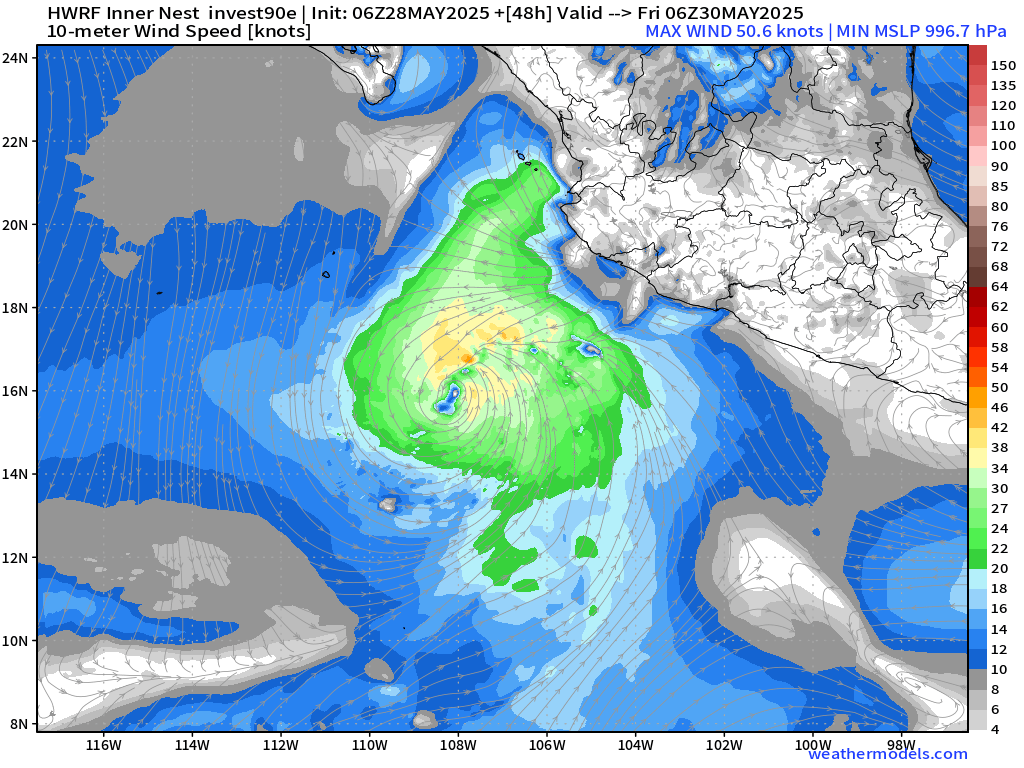
Invest 90E designated by NHC with 100% chance of tropical storm development in the next 48-hours.
Upper-level wind shear is not ideal with a cut-off low dipping off Southern California to help steer Invest 90E (Alvin) quickly to the north and then northeast over colder water into Mexico.
Invest 90E is running out of time to intensify much more than a tropical storm.

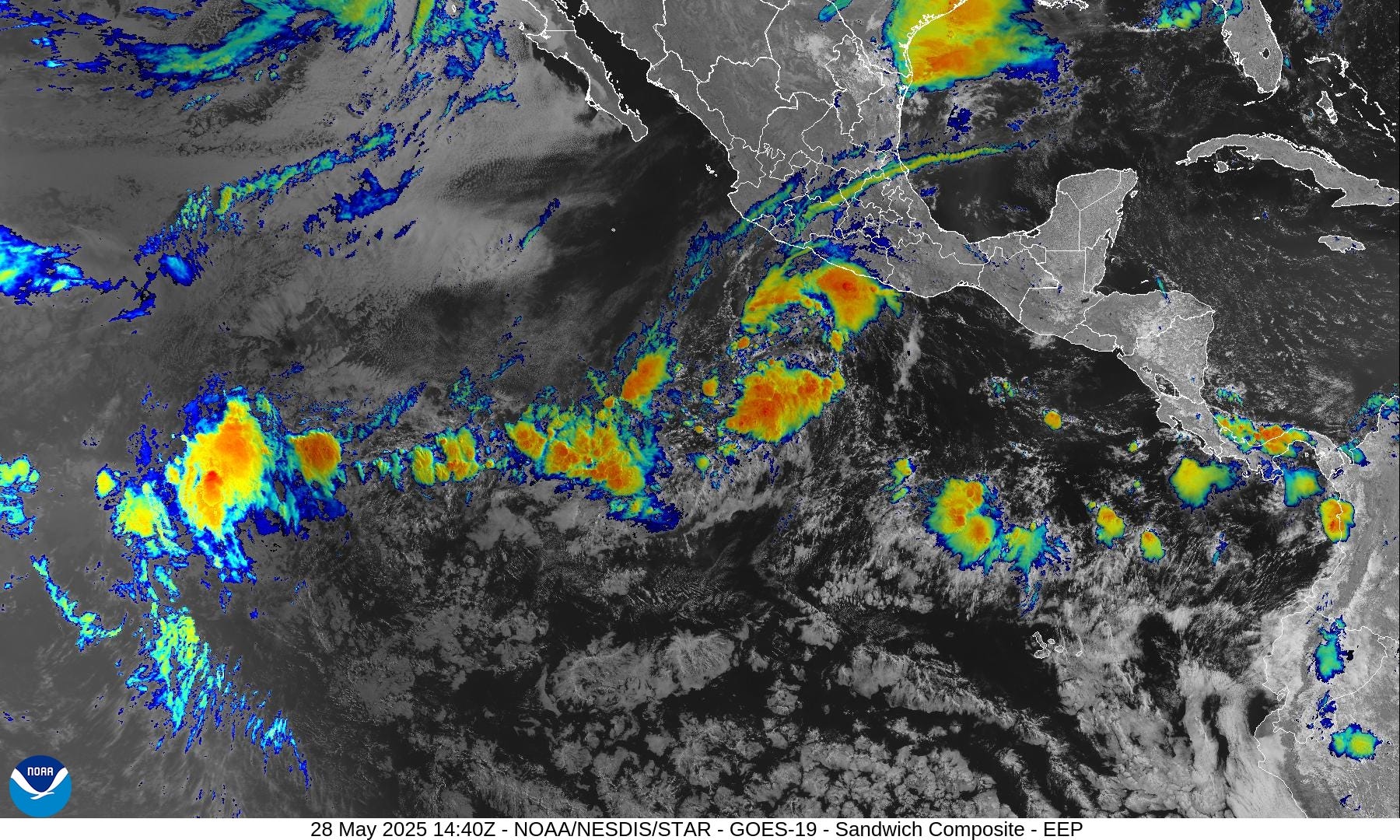
Satellite imagery shows two convective arcs surrounding a largely rain free center. There is a hit of a broad surface circulation but not yet low enough pressure or required organization for classification.
My favorite weather parameter shows Alvin over the next 5-days near the tip of Baja California (Mexico) with moisture enhancement into the U.S. Southwest.
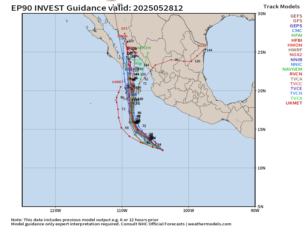
High level of agreement on the track envelope except weirdly for UKMET, which is a western outlier.
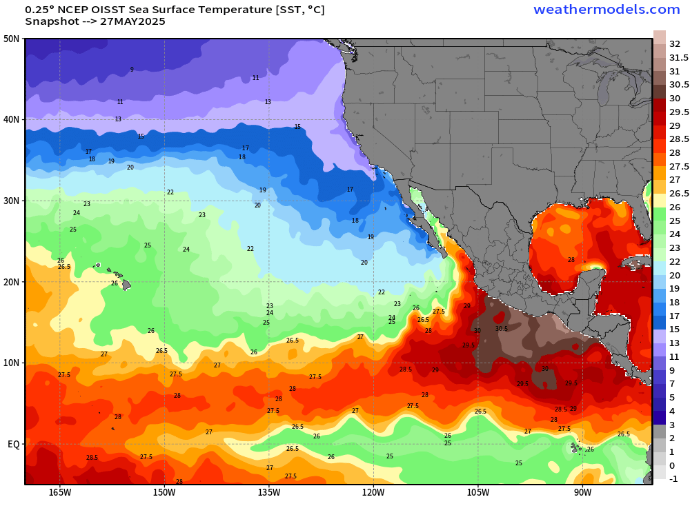
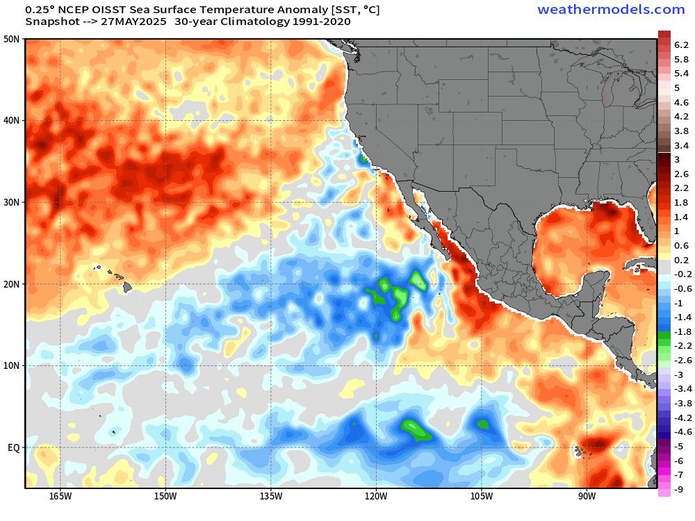
Oddly enough, quite a bit of BLUE = cooler than normal from Hawaii to Mexico at 20°N and then along the equator. Those wave patterns are called Tropical Instability Waves.
has a minimal tropical storm — cancelling previous efforts at making Alvin a major hurricane. Just not enough time and lacking proper organization.
are also weaker with tropical storm strength.


Global models are also not enthusiastic about Invest 90E. GFS musters 995 mb.
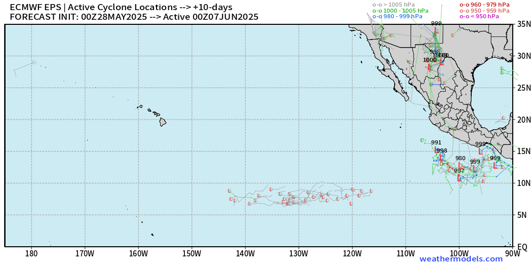
— additional development possible on the heels of Alvin in line with climatology of the Eastern Pacific, but in the 15% range.
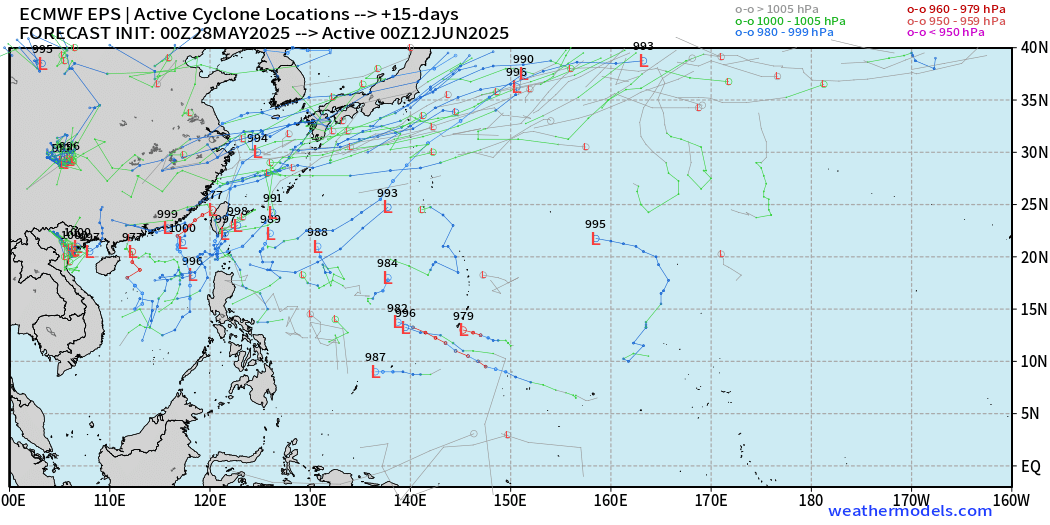
Water temperatures are very warm in the Western Pacific warm pool, but a whole lot of nothing going on out here.
Maybe a random development somewhere in the basin well down the road into June 12th — but not in the short-term.