First Warning Forecast: Warm, muggy, and storm chances this weekend
Meteorologist Myles Henderson’s First Warning Forecast
A very summer-like stretch of days with heat, humidity, and storms.
Hot & humid again today with highs in the upper 80s. With the humidity it will feel more like the low 90s. Expect partly to mostly cloudy skies today with scattered showers/storms developing this afternoon to evening. Watch out of areas of localized flooding with heavy downpours.

WTKR News 3
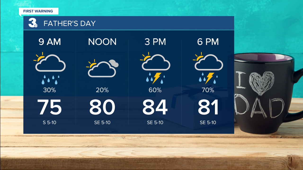
Don’t expect much change in our weather pattern as a stationary front lingers over the Mid-Atlantic. Expect highs in the mid to upper 80s this weekend with afternoon heat index values in the 90s. We will see partly to mostly cloudy skies with scattered showers and storms both days. Most of the storm activity will be in the afternoon to evening hours.
WTKR News 3
We will start off next week soggy, but rain chances should start to drop through midweek. The heat and humidity continue for midweek with highs in the 90s and a heat index near 100.
Today: Afternoon Storms. Highs in the upper 80s. Winds: SW 5-10
Tonight: Showers & Storms. Lows in the low 70s. Winds: SW 5-10
Tomorrow: Afternoon Storms. Highs in the upper 80s. Winds: SW 5-10
Weather & Health
Pollen: Low-Moderate (Grasses)
UV Index: 5 (Moderate)
Air Quality: Moderate (Code Yellow)
Mosquitoes: Extreme
Tropical Update
No tropical activity at this time
Weather updates on social media:
Facebook: MylesHendersonWTKR
Instagram: @MylesHendersonWTKR
Copyright 2025 Scripps Media, Inc. All rights reserved. This material may not be published, broadcast, rewritten, or redistributed.