Feeling like summer in Minnesota with chance for severe storms in afternoon - CBS Minnesota
By
Born and raised in Pittsburgh, Pennsylvania, weather has been a passion for Adam for as long as he can remember! Whether it was thunderstorms or winter storms, Adam has always been geeking out. After earning his meteorology degree from Penn State, he made his way to the Ohio Valley to forecast for WTOV.
/ CBS Minnesota
NEXT Weather: 8 a.m. report for Minnesota on June 28, 2025
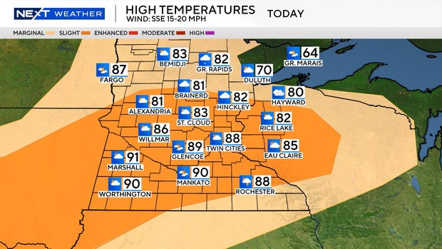
The heat and humidity will be noticeably more intense on Saturday in the Twin Cities, with highs in the upper 80s and heat index values in the 90s.
Storms are moving across Minnesota early Saturday morning, but will continue to weaken and slide east. Another wave of energy will help to develop more storms later in the afternoon, some of which could be severe.
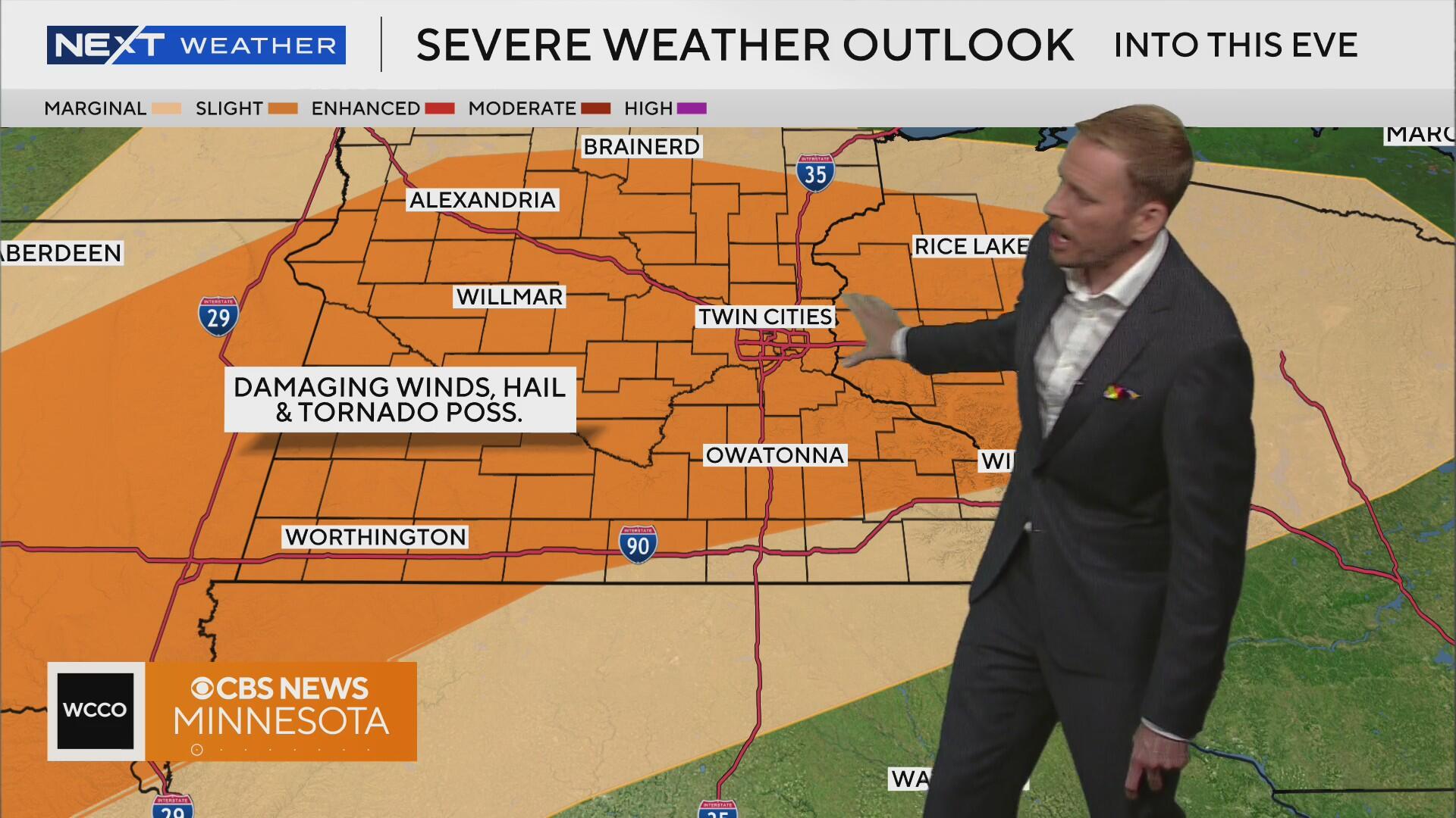
There is a slight risk for severe weather on Saturday with heavy rain, wind and hail being the main threats. Isolated tornadoes are possible, too.
More storms may try to fire again Sunday afternoon, but most of the action is south and east of the metro.
Expect high temps a few degrees cooler Sunday in the mid-80s.
High pressure is back early next week, making for a sunny, seasonable start to the week. It looks like things turn stormy again toward the end of the week, with several chances for storms as we approach the Fourth of July.
Born and raised in Pittsburgh, Pennsylvania, weather has been a passion for Adam for as long as he can remember! Whether it was thunderstorms or winter storms, Adam has always been geeking out. After earning his meteorology degree from Penn State, he made his way to the Ohio Valley to forecast for WTOV.