Chance of showers, storms return to North Texas as temperatures remain in the mid to high 90s - CBS Texas
/ CBS Texas
Chance of rain, storms return to North Texas amid temps in the mid-90s
Another dry, mostly sunny, and hot day is on tap.
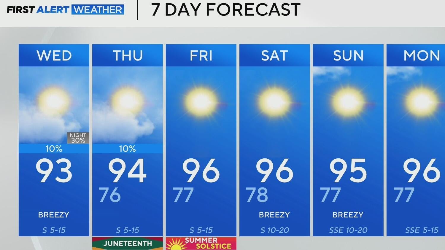
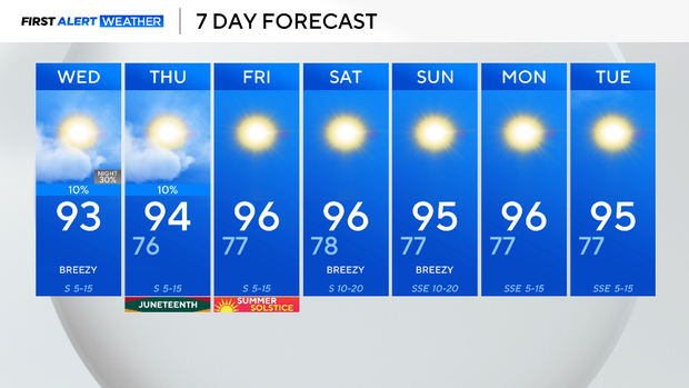
Wednesday morning will start cloudy, but the clouds will dissipate throughout the day. In DFW, winds will gust around 25 mph, and highs will peak around 93 degrees at 5 pm.
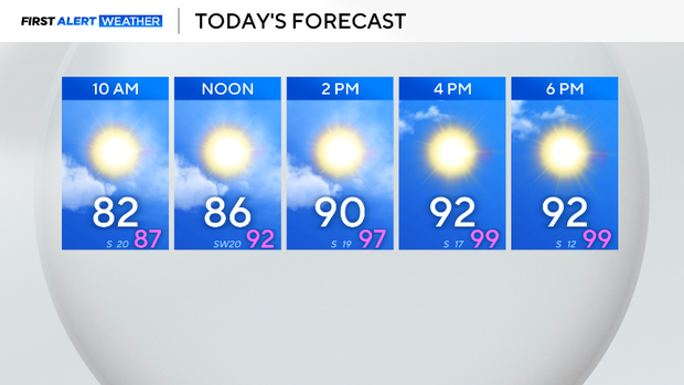
In addition, dew point temperatures are in the 70s, which will make it feel more like the triple digits outside.
During the day, the likelihood of showers and storms is low. However, a cold front will move into North Texas Wednesday night, bringing the risk of severe weather and brief downpours.
The Storm Prediction Center has highlighted a level 2 out of 5 risk for the metroplex and to the north. This means that isolated to scattered severe storms with damaging winds and hail will be possible overnight.
On Juneteenth, there is a potential of a few spotty showers and storms during the day due to the diurnal heat cycle; however, most of us will stay dry. Highs on Juneteenth will reach the mid-90s with winds from the south around 10 to 15 mph.
The longest day of the year and the official start of the Summer Solstice will be hot and sunny. The trend will continue through the weekend and into next week.
Stay tuned for the latest forecast updates!