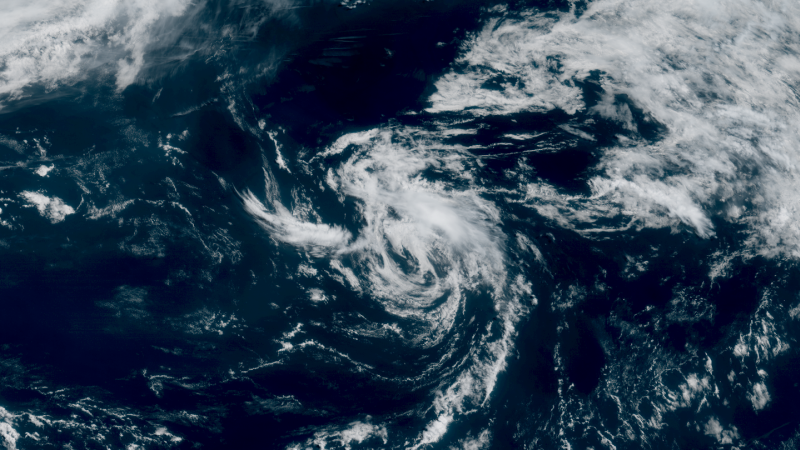
Meteorologists say the storm’s structure is relatively weak, and environmental conditions won’t support long-term development. The NHC expects Andrea to start weakening by Tuesday night and disappear completely by Wednesday evening.
At its latest update, Andrea had maximum sustained winds of about 40 mph. Gusts could be higher, but no further intensification is expected. The storm does not currently meet the criteria to be classified as a hurricane. Its wind speeds are just at the threshold for a tropical storm designation.

The system is traveling over open waters where cooler temperatures and increased wind shear are likely to disrupt its circulation. This is why experts say Andrea will likely be a short-lived storm. While Andrea itself may not bring severe weather to land, it signals that the Atlantic hurricane season is officially underway. The season runs from June 1 to November 30, with the most active period expected between mid-August and mid-October. The season typically peaks around September 10.
According to NOAA and the National Hurricane Center, 97% of all tropical cyclone activity occurs within this official time window. The early formation of Andrea adds to concerns that the 2025 season could see higher-than-average storm activity.
Tropical Storm Andrea's projected path—often referred to through “spaghetti models”—shows the storm drifting away from land into the open Atlantic. These models offer a range of forecast scenarios using various weather prediction systems. However, the National Hurricane Center relies on the top-performing models when issuing its official track and intensity forecasts.It’s important to note that the “cone of uncertainty” shown in these models only tracks the center of the storm. Impacts such as wind and rain can occur well outside this cone, but with Andrea expected to weaken quickly, little impact is expected at all.
While Andrea remains the main story in the Atlantic, meteorologists are also watching a broad area of low pressure in the eastern Pacific Ocean, located a few hundred miles off the southern coast of Mexico. According to the National Hurricane Center, this system is producing disorganized showers and thunderstorms, but environmental conditions look favorable for gradual development.The NHC gives this Pacific system a 70% chance of becoming a tropical depression over the next seven days. It’s expected to move slowly in a west-northwestward direction, staying off the coast of Central America and southern Mexico.
The naming of Tropical Storm Andrea is a reminder that storm season is heating up. With forecasts pointing toward a hyperactive season, residents in hurricane-prone areas should begin preparing early. Even if the first storm of the year doesn’t make landfall, future storms could be stronger and more dangerous.Experts advise keeping an emergency kit ready, staying informed through trusted weather sources, and following guidance from local emergency management officials. As conditions evolve, the National Hurricane Center will continue issuing advisories and updates.
Tropical Storm Andrea is the first named storm of 2025 and is moving away from land in the Atlantic Ocean.
Yes, there's a 70% chance it could become a tropical depression near southern Mexico.
Read More News on
(Catch all the US News, UK News, Canada News, International Breaking News Events, and Latest News Updates on The Economic Times.)
Download The Economic Times News App to get Daily International News Updates.