Temperatures across North Texas remain frigid; Extreme cold warning in effect through 9 a.m. - CBS Texas
By , Julia Falcon
/ CBS Texas
Dangerous cold continues across North Texas with subzero wind chills
Frigid, bitterly cold temperatures and dangerous wind chills continue across North Texas through Thursday morning.
Temperatures will feel in the single digits through the morning hours.
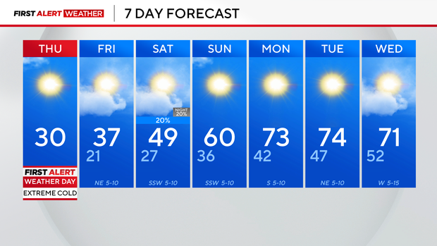
Thursday is another First Alert Weather Day due to wind chills knocking "feels-like" temperatures to dangerous lows. Limit time spent outdoors on Thursday and cover up exposed skin to avoid frostbite.
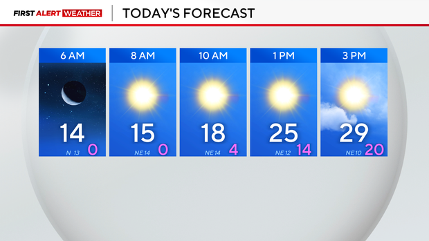
Temperatures Thursday will warm into the high 20s and low 30s.
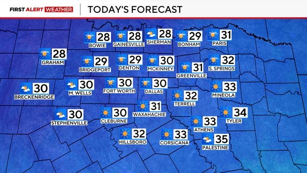
Another likely record-cold day is ahead – today's high is only expected to reach 31 degrees. The current record high is 35 degrees, which was reached on this day in 1904. On Wednesday, the high only reached 28 degrees, setting a new record. The previous record high was 31 degrees on that day in 2006.
Winds won't gust up to 30 mph like on Wednesday. At 5 a.m., winds across North Texas were blowing between 10-15 mph. An isolated flurry is possible but lake effect snow isn't likely.
Temperatures in North Texas will remain below freezing until midday Friday. The high is expected to reach 37 degrees.
Precipitation chances return on Saturday with an isolated, low chance of rain.