Maps show heat wave forecast across U.S. Here's what to know. - CBS News
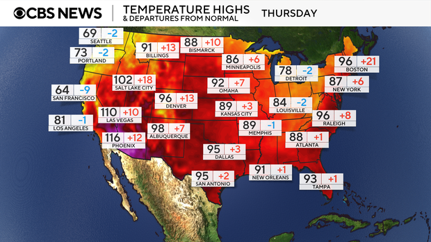
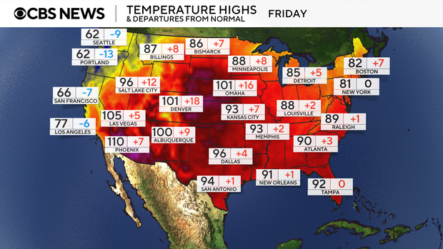
These maps show daily highs across the country and their departures from average temperatures.
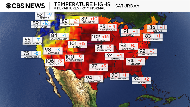
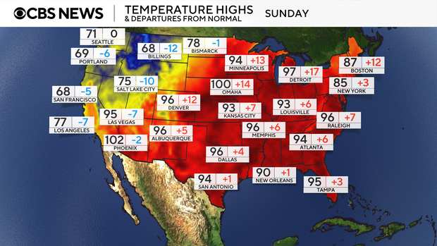
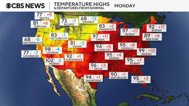
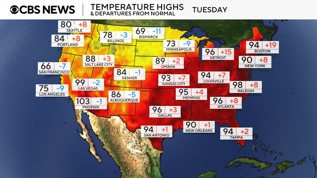
The heat is expected to shift into the Midwest and Ohio Valley by the end of the weekend and arrive in the Northeast and mid-Atlantic on Sunday through the first half of next week.
Parts of the Northeast face a "High Risk" — a greater than 60% chance — of extreme heat through the middle of next week, according to the National Weather Service.
A heat wave is a period of unusually hot weather that lasts more than two days, according to the National Weather Service.
It often, but not always, covers a large area and exposes a large number of the population to hazardous heat, which can be extremely dangerous for vulnerable people, including children and the elderly.
The simplest way to way to avoid heat-related illnesses is to stay out of the sun, experts say.
If strenuous outdoor activities are unavoidable, you should dress for the heat and wear lightweight, loose-fitting and light-colored clothing, the National Weather Service recommended. You should also stay hydrated by drinking plenty of water, even if you're not thirsty.
It's also important to be aware of any symptoms of overheating, which include muscle cramps, unusually heavy sweating, shortness of breath, dizziness, headaches, weakness or nausea, according to the Centers for Disease Control and Prevention. If you experience these symptoms, one major sign to seek care is if the symptoms don't improve after getting into a cooler environment or hydrating, experts say.
Nikki Nolan contributed to this report.
Kiki Intarasuwan is a news editor for CBS News & Stations.