Heat advisory for Boston, most of Massachusetts Thursday. Map shows severe storms risk for hottest day of year. - CBS Boston
/ CBS Boston
Next Weather: WBZ midday forecast for June 18
It will be the hottest day of the year in most of Massachusetts Thursday and the first time Boston has hit the 90 degree mark in 2025.
There is also a thunderstorm threat late in the day, mainly for areas west of Boston.
The National Weather Service has issued a heat advisory for most of southern New England, away from the South Coast, from 11 a.m. to 8 p.m. Thursday.
If you combine high temperatures between 90 and 95 degrees with dew points approaching 70 degrees, the "feels-like" temperatures will top out near 100 in the afternoon.
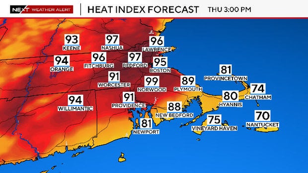
This will be the first time this year that the city of Boston will reach the 90-degree mark, having just missed it last Thursday, when it hit 89.
Last year, Boston didn't reach 90 until June 18th and there were 12 days above 90 in 2024.
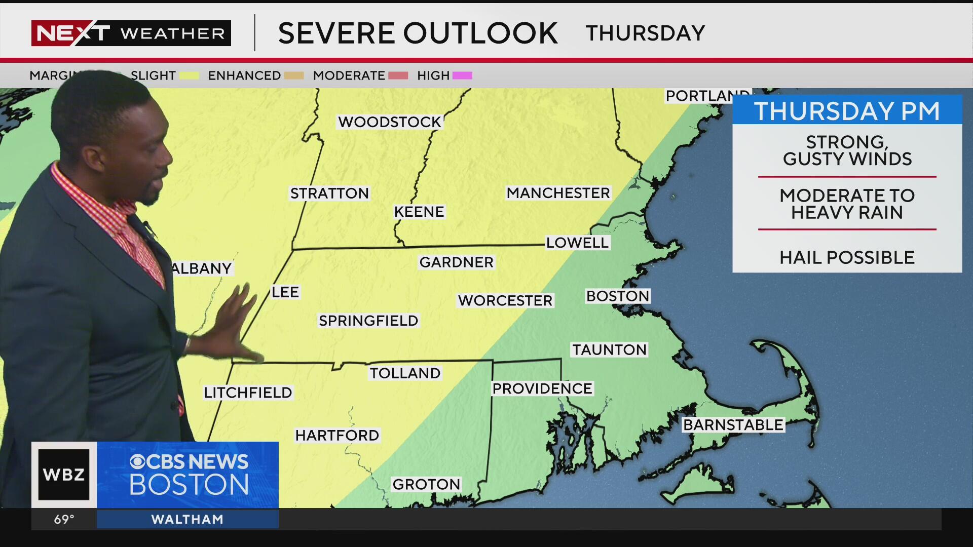
The Storms Prediction Center has placed most of central and western Massachusetts in a "slight" risk for severe weather on Thursday.
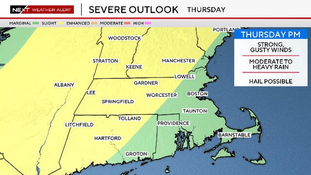
The trigger will be an approaching cold front. The timing may be just a bit too late to maximize the heating of the day with the "lift" from the front to produce any widespread severe weather in eastern Massachusetts.
The time frame to watch would be:
Any storms that do form may contain very heavy downpours, frequent lightning, small hail, damaging winds and there is even a small risk for an isolated tornado.
Again, the highest risk area remains west of Route 495 given the later timing of the cold front but, this is something we will have to watch closely as things unfold on Thursday.
Terry Eliasen, Exec. Weather Producer
Terry Eliasen is a meteorologist and executive producer of the WBZ-TV Weather Team. He has worked at WBZ for more than 20 years.