Freezing rain and wintry mix will reach some on Saturday afternoon | First Alert Weather Day - CBS Pittsburgh
/ CBS Pittsburgh
KDKA-TV Morning Forecast (2/8)
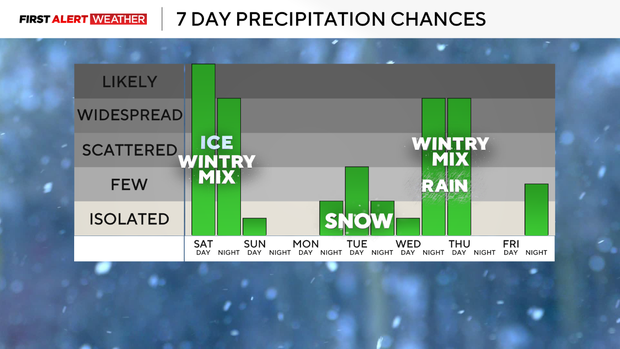
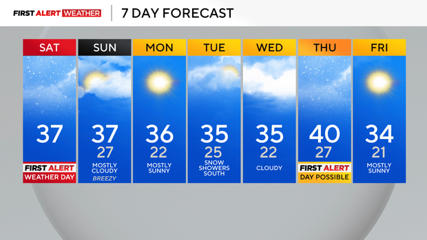
PITTSBURGH (KDKA) - Saturday morning begins overcast and dry with seasonably cold conditions across the region. High pressure is in place to our northeast and is slowly retreating to the east ahead of an approaching area of low pressure from the southwest that will bring widespread precipitation to all of Western Pennsylvania beginning this afternoon and lasting until after midnight. An ice storm warning has been issued for the eastern half of Westmoreland, Fayette, Somerset, and Garrett counties. A winter weather advisory in effect from Pittsburgh, points west and north through the afternoon and into tonight.
Current Conditions | School Closings & Delays | Submit Your Weather Photos
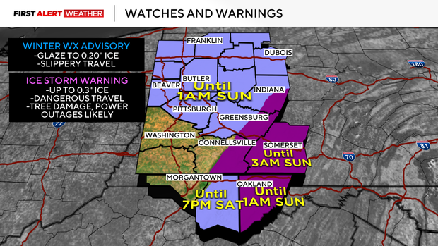
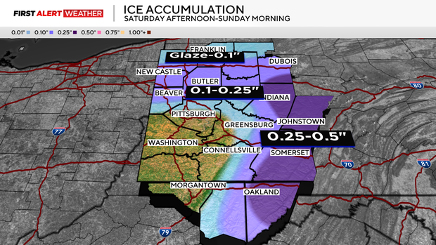
Ice accumulation could be significant in the Laurel Highlands and the Ridges, especially eastern sides and in valleys where shallow cold air tends to linger longest. Between 0.25 inches to 0.5 inches is possible. This ice accumulation, combined with strong winds will lead to the potential of tree damage and power outages, especially in the ice storm warning area. Areas from Route 422 and north to I-80 also have a decent chance of seeing some light ice accumulation Saturday evening, especially if the track of the low pressure continues to hold. Amounts in this area will generally range between 0.1 inches - 0.25 inches.
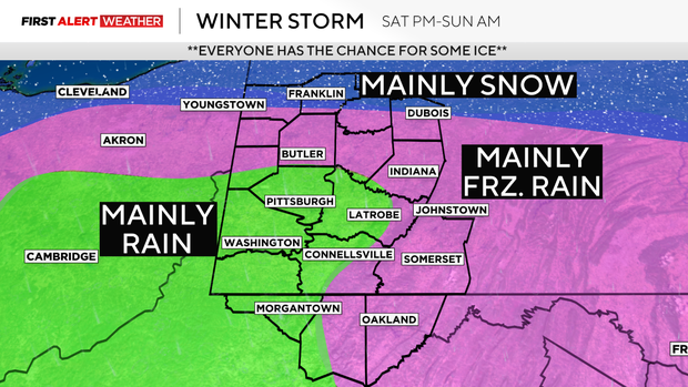
Right now, most of Allegheny County looks to be on the cusp of icing, with a tendency to see all rain generally southwest of Pittsburgh to Northern West Virginia. This could still shift slightly by as much as 30 miles north or south, so folks in the Pittsburgh area should still monitor temperatures and conditions closely this evening. The margin for error will be great as the immediate metro area will be within a very tight north to south temperature gradient. If any icing occurs in Allegheny County and the Pittsburgh metro area, it will be between 3 p.m. - 9 p.m., with northern portions of the metro having a better chance of light icing than southern communities.
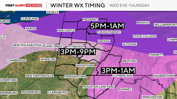
All precipitation will exit before daybreak Sunday. This will be followed by breezy northwest winds, clearing skies, and a brief lull in between systems Sunday night and Monday. A fast-moving disturbance will traverse the Ohio Valley to Mid-Atlantic States next Tuesday into Wednesday. This will bring another chance for some snow to our region, with the higher probabilities generally across far Southwest Pennsylvania into Northern West Virginia at the present moment. On the heels of this system will be another wave of low pressure that will abruptly approach from the southwest Wednesday night into Thursday. This could bring a mixed bag of wintry precipitation to all of the region that will gradually transition over to rain as warmer air briefly moves in. Following that, yet another wave of low pressure will move in toward the following weekend, so get ready for an unsettled pattern for at least the next week and a half.
Stay up to date with the KDKA Mobile App – which you can download here!