Boston weather maps, radar show when nor'easter will be at its worst today with flooding rain and strong winds - CBS Boston
/ CBS Boston
Nor'easter slams Boston: Meteorologists discuss latest weather forecast and flood risk
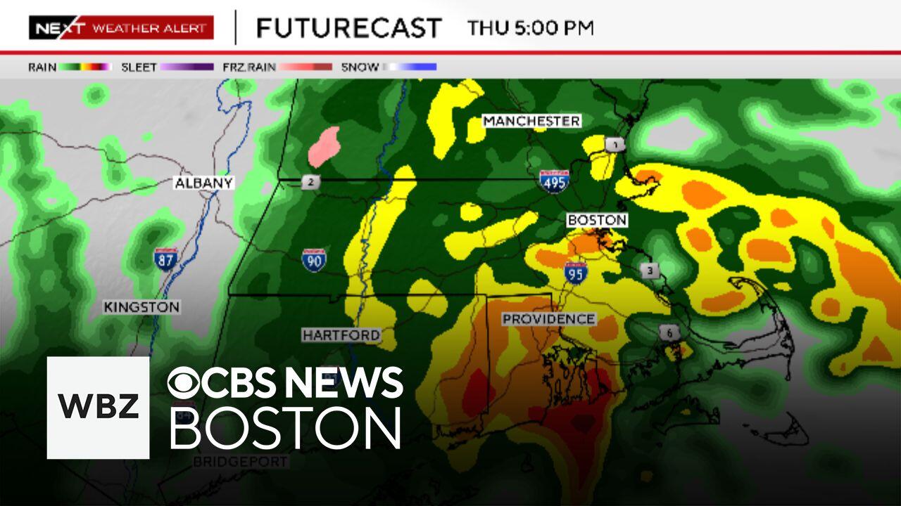
The nor'easter is underway in Boston, the weather radar shows, and today will be one of the nastiest days Massachusetts has seen so far this spring.
The storm will ramp up quickly and the worst conditions will be present Thursday afternoon through about midnight.
The afternoon commute will coincide with some of the strongest winds and heaviest rainfall.
We anticipate widespread, localized flooding, poor drainage flooding and a high hydroplaning risk on roadways.
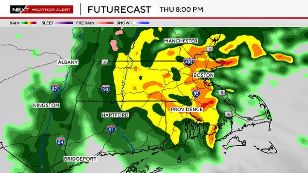
The storm's center will be crossing over southeast Massachusetts later tonight and could be the focus for one final burst of rain between 7 p.m. and midnight.
After midnight, the heavy rain will lift north of our area and the precipitation will become lighter and more scattered.
There will still be some leftover showers Friday morning, but the worst of the storm will be long gone.
Rainfall totals will average between 1.5 and 2 inches. There is a chance for some localized, higher amounts up to 3 inches.
This will cause some minor small river and stream flooding but we do not expect any major rivers to reach their banks.
Strong, northeast winds will persist for much of the afternoon and evening, peaking between 30-50 mph along the coastline.
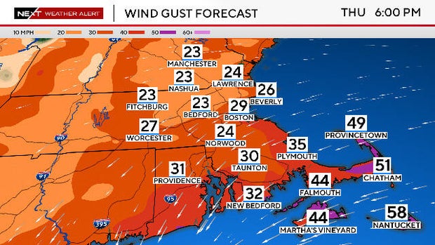
Inland, gusts may reach as high as 20-40 mph.
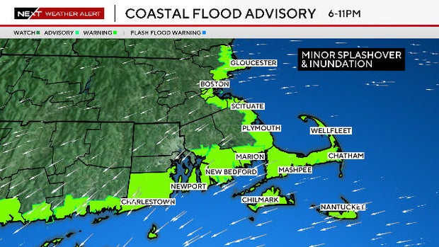
We do expect some minor coastal flooding/inundation during Thursday night's high tide cycle.
Timeframe of concern is between 4-7 p.m. along the South Coast and between 6-11 p.m. along the East Coast.
Friday will be a transition day as the storm slowly moves away from southern New England.
There will be lingering showers in the morning and clouds will likely remain for the entire afternoon and evening.
Saturday will show some improvement. We expect some patches of sunshine, but also a few pop-up showers.
The second half of the holiday weekend will be the better half with increasing amounts of sunshine and milder temperatures.
Terry Eliasen, Exec. Weather Producer
Terry Eliasen is a meteorologist and executive producer of the WBZ-TV Weather Team. He has worked at WBZ for more than 20 years.