Atlantic hurricane season forecast: 2025 predicted to be 'above average' - BBC Weather
Published 9 hours ago• 3 minute read
- an intensity usually seen during peak season.
It brought death and destruction to parts of the Caribbean, areas of Mexico and the Gulf coast of the US.
Whilst concern grew about what might be to come, the season then became unusually quiet midway through with the the most prolonged lull in hurricane numbers for around 50 years.
It wasn't until late September and into October that the big ones returned.
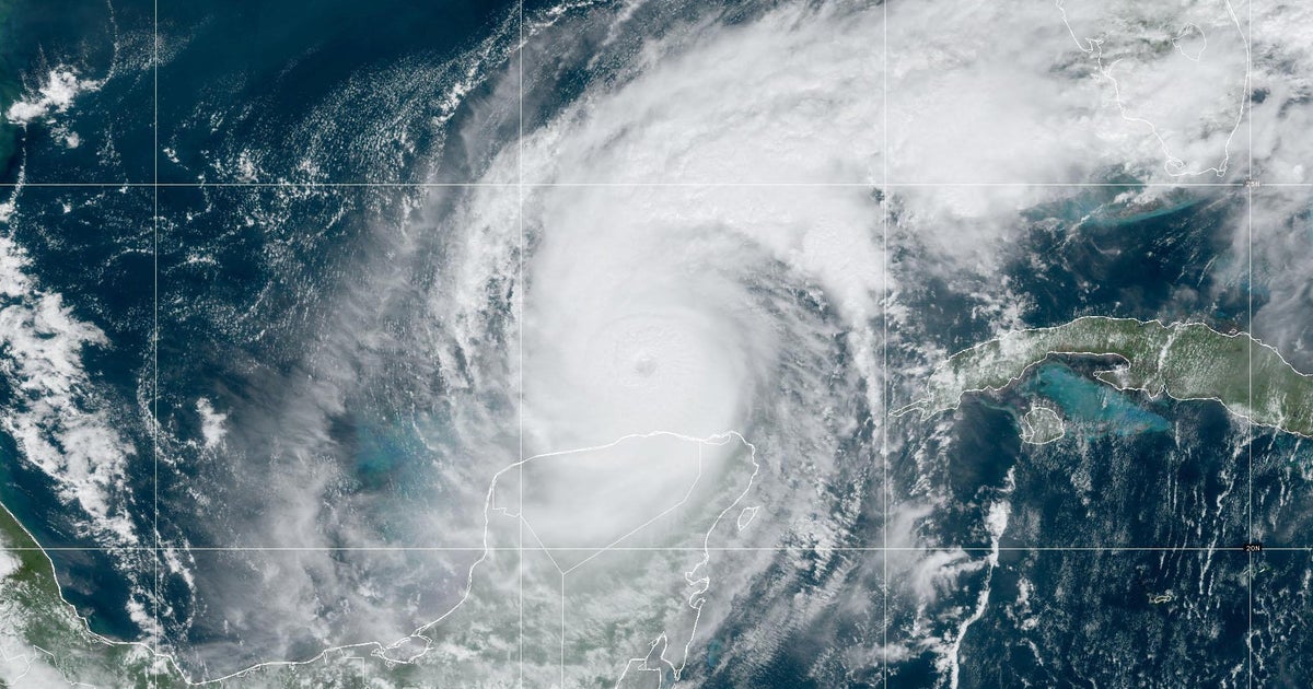
Hurricane Milton, which reached Category 5 strength near the Yucatán Peninsula, struck Florida as a Category 3, driving hurricane-force winds far inland.
In terms of the physical damage, estimates varied widely depending on the scope of impacts considered, but according to NOAA direct physical damage from Helene cost $78.7bn and Milton $34.3bn, external.
Image source, Reuters
Image caption,
A drone view shows a flooded and damaged area following Hurricane Helene in Florida, in September 2024
Each year the areas just north and south of the Tropic of Cancer and Capricorn spawn storms that vary in the paths they take and the force with which they strike land in the Caribbean, Central America or the US.
Hurricanes draw energy from the tropical Atlantic, so forecasters monitor the sea surface temperatures well ahead of the season.
In 2024, early signs of above-average warmth in that area suggested a higher risk of frequent and intense storms.
This year, while many areas remain warmer than average, there are also large regions where the temperature is slightly cooler - or even below normal. It could be an early sign that there may be less energy available for hurricane development.
However, forecasting an entire hurricane season is a complex challenge, as it involves many interconnected factors, one significant one is the West African monsoon.
These rains that bring powerful thunderstorms to Nigeria, the Ivory Coast and Sierra Leone can sometimes develop into hurricanes once they move across the Atlantic.
If the West African monsoon behaves differently to usual, it can significantly influence how and when hurricanes form.
In addition, complex wind patterns that stretch from Africa to the Gulf of Mexico can either support or hinder hurricanes.
The ideal environment for a hurricane to develop is a moist atmosphere with steady winds.
Any sudden shifts in wind direction and speed - known as wind shear - can tear developing tropical storms apart before they can fully form into hurricanes.
Forecasting wind shear for an entire season is extremely difficult, but forecasters had expected optimal conditions for hurricanes in 2024.
In reality there were periods when wind sheer hindered hurricane formations across parts of the Atlantic and Gulf of Mexico and this may have contributed to the mid-season lull.
The infamous El Niño, and its opposite La Niña weather patterns, strongly influence wind patterns over the Atlantic despite occurring many thousands of miles away.
Powerful rainstorms that develop over the warm waters of the eastern Pacific during El Niño often lead to increased wind shear over the Gulf of Mexico, Caribbean, and tropical Atlantic.
The opposite tends to occur during La Niña, when wind shear is typically reduced.
Since wind shear is one of the most effective forces for tearing hurricanes apart, understanding conditions in the eastern Pacific is crucial for forecasting.
Projections for 2025 suggest a neutral pattern - neither El Niño nor La Niña - which makes predicting wind patterns more challenging and uncertain.